
Magnitude |
:2.7 |
| Date & Time (UTC) | 2015-08-16 03:36:52.1 |
| Date & Time (Local) | 1394/5/25 08:06:52.1 |
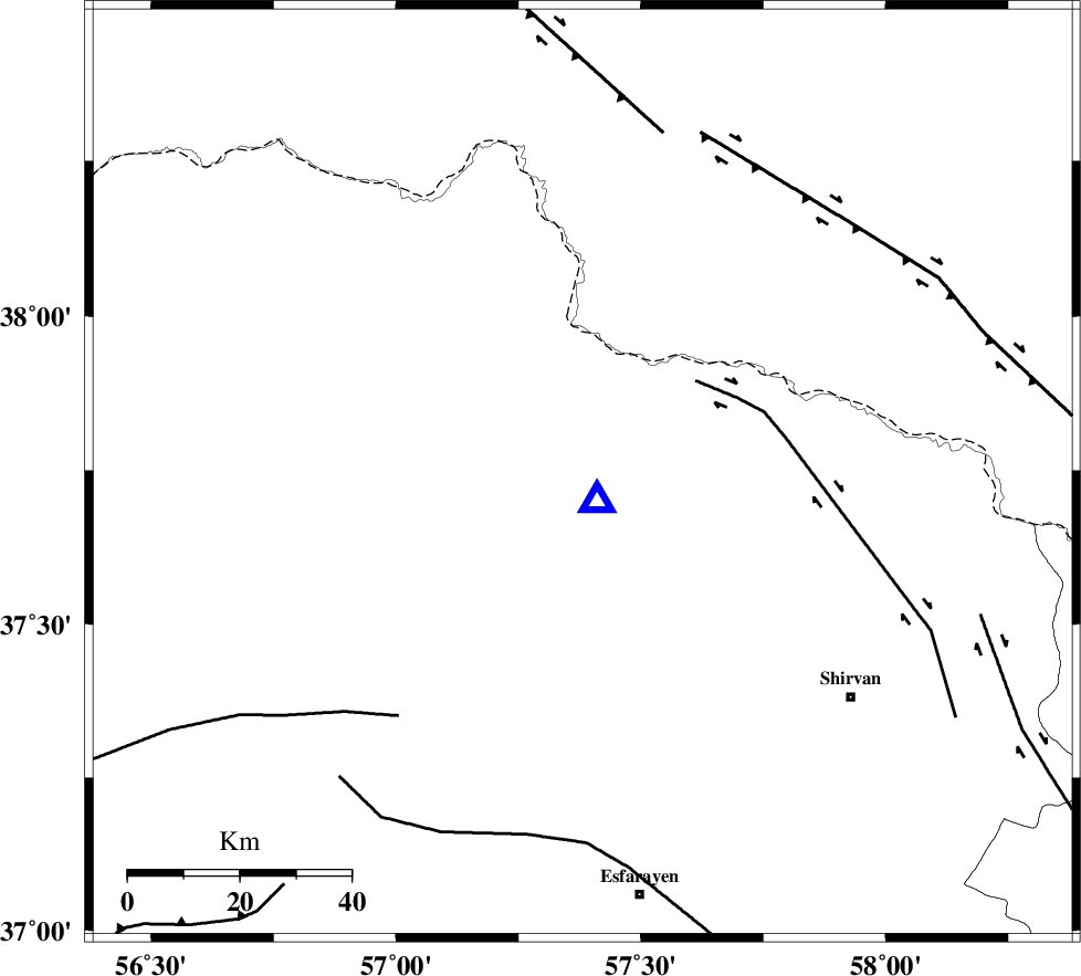
| Location | Lat:37.745 Lon: 57.381 |
| Region | Khorasan(north) Province, 31 km North of Bojnurd |
Nearest Cities |
|
| 19 km South West of Gifan olia, Khorasan(north) Province | |
| 27 km North West of Hesar-egarmkhanh, Khorasan(north) Province | |
| 31 km North of Void, Khorasan(north) Province | |
| 31 km North of Bojnurd, Khorasan(north) Province | |
| 31 km South East of Raz, Khorasan(north) Province | |
| Depth | 14 km |
| Agency | |
Faults within 150 km: |
|
| BAGHAN_GERMAB_F (Length: 79 km) , Distance to epicenter: 26 km | |
| ROBATE_QARABIL_F (Length: 168 km) , Distance to epicenter: 55 km | |
| MAIN_KOPEHDAGH_F2 (Length: 131 km) , Distance to epicenter: 63 km | |
| Number of Phases | 6 |
| RMS | 0.2 |
| Number of Stations | 4 |
| Error in Latitude | >3.4 km |
| Error in Longitude | 5.9 km |
| Error in Depth | 9.5 km |
Download waveform in seisan format
to download seisan software Click here
to access information about IIEES stations Click here
Amplitude | ||||||||
| UID | Agency | Station | Component | Amplitude | Period | Arrival Time | Proccessing Time | Signal Clip |
| 100354 | IIEES | MRVT | N | 211.6 | 0.27 | 2015-08-16 03:37:31 | 2015-08-16 06:22:00 | n |
| 100355 | IIEES | MRVT | E | 187.1 | 0.27 | 2015-08-16 03:37:33 | 2015-08-16 06:22:00 | n |
| 100356 | IIEES | SHRO | E | 58.6 | 0.6 | 2015-08-16 03:37:58 | 2015-08-16 06:22:00 | n |
Phase | ||||||||||||
| Agency | Station | Component | Phase Type | Phase Quality | First Motion | Observed Arrival Time | Time Residual | Loc. Flag | Input Weight | Distance | Azimuth | |
| IIEES | MRVT | Z | Pg | E | 2015-08-16 03:37:11 | -0.29 | y | 114 | 266 | |||
| IIEES | MRVT | N | Sg | E | 2015-08-16 03:37:25 | 0.18 | y | 114 | 266 | |||
| IIEES | SHRO | Z | Pn | E | 2015-08-16 03:37:28 | 0.21 | y | 228 | 213 | |||
| IIEES | SHRO | N | Sg | E | 2015-08-16 03:37:56 | -0.07 | y | 228 | 213 | |||
| IIEES | TABS | Z | Pn | E | 2015-08-16 03:37:56 | -0.19 | y | 455 | 183 | |||
| IIEES | SHRT | Z | Pn | E | 2015-08-16 03:38:05 | 0.16 | y | 525 | 149 | |||