
Magnitude |
:2.7 |
| Date & Time (UTC) | 2015-08-15 00:35:31.7 |
| Date & Time (Local) | 1394/5/24 05:05:31.7 |
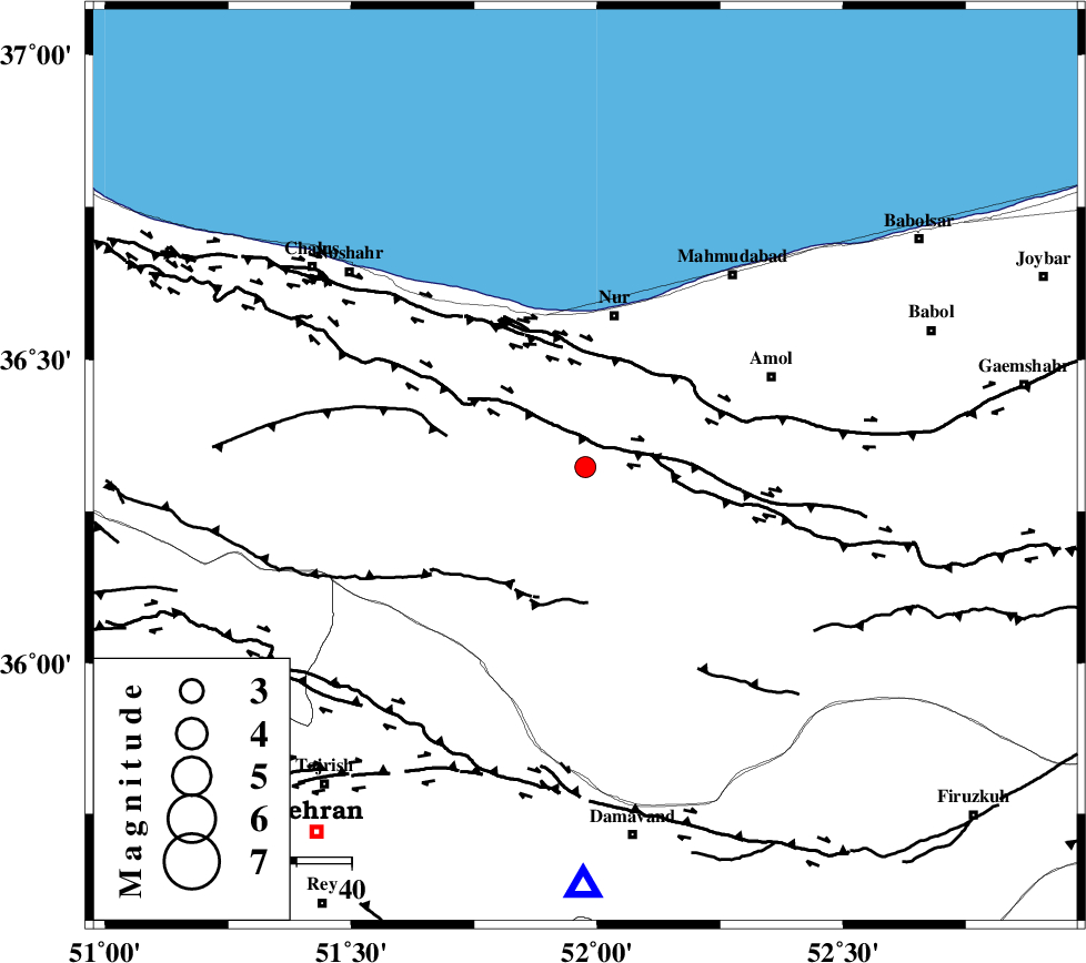
| Location | Lat:36.323 Lon: 51.976 |
| Region | Mazandaran Province, 28 km South of Nur |
Nearest Cities |
|
| 16 km North of Pil, Mazandaran Province | |
| 21 km North East of Baladeh, Mazandaran Province | |
| 21 km South West of Chamestan, Mazandaran Province | |
| 24 km East of Kujur, Mazandaran Province | |
| 25 km South East of Narenj bon, Mazandaran Province | |
| Depth | 7 km |
| Agency | |
Faults within 150 km: |
|
| N_ALBORZ_F (Length: 360 km) , Distance to epicenter: 8 km | |
| KHAZAR_F (Length: 523 km) , Distance to epicenter: 20 km | |
| KANDOVAN_F (Length: 90 km) , Distance to epicenter: 23 km | |
| Number of Phases | 5 |
| RMS | 0.3 |
| Number of Stations | 6 |
| Error in Latitude | >6.6 km |
| Error in Longitude | 4.8 km |
| Error in Depth | 7.2 km |
Download waveform in seisan format
to download seisan software Click here
to access information about IIEES stations Click here
Amplitude | ||||||||
| UID | Agency | Station | Component | Amplitude | Period | Arrival Time | Proccessing Time | Signal Clip |
| 100350 | IIEES | NASN | E | 15.4 | 0.53 | 2015-08-15 00:37:39 | 2015-08-15 06:19:00 | n |
| 100351 | IIEES | NASN | N | 13.3 | 0.58 | 2015-08-15 00:37:40 | 2015-08-15 06:19:00 | n |
Phase | ||||||||||||
| Agency | Station | Component | Phase Type | Phase Quality | First Motion | Observed Arrival Time | Time Residual | Loc. Flag | Input Weight | Distance | Azimuth | |
| IIEES | DAMV | Z | Pg | E | 2015-08-15 00:35:45 | 0.24 | y | 76.9 | 180 | |||
| IIEES | CHTH | Z | Pg | E | 2015-08-15 00:35:47 | -0.45 | y | 89.3 | 239 | |||
| IIEES | GHVR | Z | Pn | E | 2015-08-15 00:36:06 | -0.06 | y | 215 | 198 | |||
| IIEES | ZNJK | Z | Pn | E | 2015-08-15 00:36:17 | 0.34 | y | 297 | 278 | |||
| IIEES | SHRO | Z | Pn | E | 2015-08-15 00:36:25 | -0.07 | y | 365 | 94 | |||