
Magnitude |
:3.5 |
| Date & Time (UTC) | 2015-08-13 08:49:01.7 |
| Date & Time (Local) | 1394/5/22 13:19:01.7 |
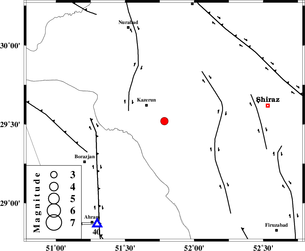
| Location | Lat:29.52 Lon: 51.784 |
| Region | Fars Province, 17 km South-East of Kazerun |
Nearest Cities |
|
| 11 km of Kalani, Fars Province | |
| 12 km East of Mehranjan, Fars Province | |
| 17 km South East of Kazerun, Fars Province | |
| 24 km North of Dadin-e olia, Fars Province | |
| 27 km South East of Deris, Fars Province | |
| Depth | 6 km |
| Agency | |
Faults within 150 km: |
|
| KAZERUN_F (Length: 96 km) , Distance to epicenter: 26 km | |
| KAREBASS_F (Length: 98 km) , Distance to epicenter: 38 km | |
| BORAZJAN_F (Length: 168 km) , Distance to epicenter: 48 km | |
| Number of Phases | 6 |
| RMS | 0 |
| Number of Stations | 5 |
| Error in Latitude | >3.1 km |
| Error in Longitude | 3.2 km |
| Error in Depth | 9.6 km |
Download waveform in seisan format
to download seisan software Click here
to access information about IIEES stations Click here
Amplitude | ||||||||
| UID | Agency | Station | Component | Amplitude | Period | Arrival Time | Proccessing Time | Signal Clip |
| 100339 | IIEES | AHRM | N | 1720.2 | 0.65 | 2015-08-13 08:49:30 | 2015-08-15 06:19:00 | n |
Phase | ||||||||||||
| Agency | Station | Component | Phase Type | Phase Quality | First Motion | Observed Arrival Time | Time Residual | Loc. Flag | Input Weight | Distance | Azimuth | |
| IIEES | AHRM | Z | Pg | E | 2015-08-13 08:49:16 | -0.05 | y | 86.6 | 213 | |||
| IIEES | AHRM | N | Sg | E | 2015-08-13 08:49:27 | 0.04 | y | 86.6 | 213 | |||
| IIEES | NASN | Z | Pn | E | 2015-08-13 08:49:57 | -0.05 | y | 376 | 15 | |||
| IIEES | YZKH | Z | Pn | E | 2015-08-13 08:50:02 | 0.07 | y | 416 | 39 | |||
| IIEES | KRBR | Z | Pn | E | 2015-08-13 08:50:10 | -0.02 | y | 484 | 83 | |||
| IIEES | KHMZ | Z | Pn | E | 2015-08-13 08:50:12 | 0.02 | y | 499 | 340 | |||