
Magnitude |
:2.7 |
| Date & Time (UTC) | 2015-08-11 18:32:36.9 |
| Date & Time (Local) | 1394/5/20 23:02:36.9 |
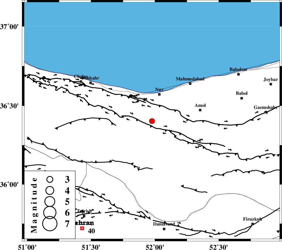
| Location | Lat:36.402 Lon: 51.977 |
| Region | Mazandaran Province, 20 km South of Nur |
Nearest Cities |
|
| 15 km West of Chamestan, Mazandaran Province | |
| 17 km South East of Narenj bon, Mazandaran Province | |
| 20 km South of Nur, Mazandaran Province | |
| 23 km North East of Kujur, Mazandaran Province | |
| 25 km North of Pil, Mazandaran Province | |
| Depth | 15 km |
| Agency | |
Faults within 150 km: |
|
| N_ALBORZ_F (Length: 360 km) , Distance to epicenter: 5 km | |
| KHAZAR_F (Length: 523 km) , Distance to epicenter: 13 km | |
| KOJOOR (Length: 75 km) , Distance to epicenter: 25 km | |
| Number of Phases | 6 |
| RMS | 0.3 |
| Number of Stations | 6 |
| Error in Latitude | >9.1 km |
| Error in Longitude | 6 km |
| Error in Depth | 7.4 km |
Download waveform in seisan format
to download seisan software Click here
to access information about IIEES stations Click here
Amplitude | ||||||||
| UID | Agency | Station | Component | Amplitude | Period | Arrival Time | Proccessing Time | Signal Clip |
| 100304 | IIEES | ASAO | N | 38.1 | 0.55 | 2015-08-11 18:33:59 | 2015-08-12 08:24:00 | n |
Phase | ||||||||||||
| Agency | Station | Component | Phase Type | Phase Quality | First Motion | Observed Arrival Time | Time Residual | Loc. Flag | Input Weight | Distance | Azimuth | |
| IIEES | DAMV | Z | Pg | E | 2015-08-11 18:32:51 | -0.1 | y | 85.6 | 180 | |||
| IIEES | CHTH | Z | Pg | E | 2015-08-11 18:32:53 | 0.46 | y | 94.1 | 235 | |||
| IIEES | THKV | Z | Pg | E | 2015-08-11 18:32:55 | -0.58 | y | 113 | 242 | |||
| IIEES | GHVR | Z | Pn | E | 2015-08-11 18:33:12 | -0.12 | y | 223 | 198 | |||
| IIEES | ASAO | Z | Pn | E | 2015-08-11 18:33:18 | 0.33 | y | 271 | 221 | |||
| IIEES | SHRO | Z | Pn | E | 2015-08-11 18:33:29 | 0.01 | y | 366 | 96 | |||