
Magnitude |
:3.2 |
| Date & Time (UTC) | 2015-08-08 00:39:28.8 |
| Date & Time (Local) | 1394/5/17 05:09:28.8 |
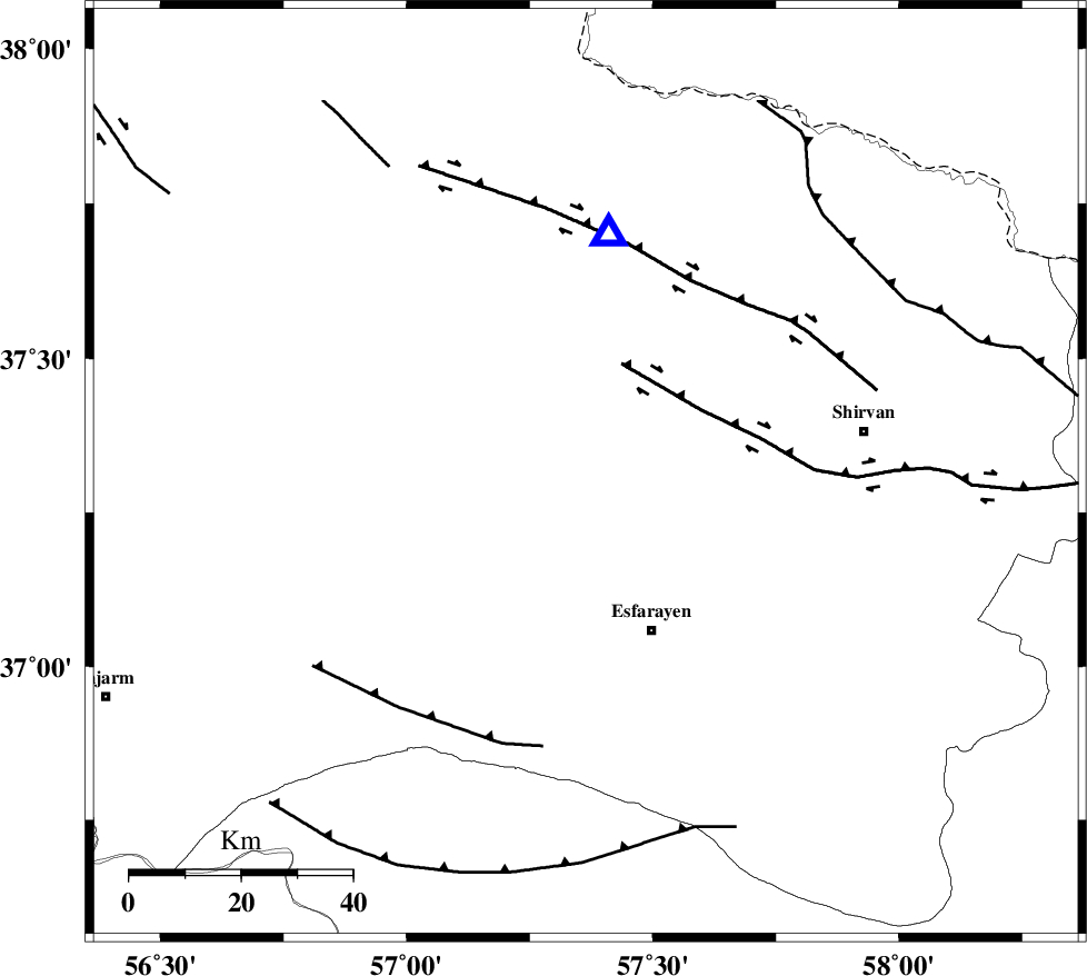
| Location | Lat:37.314 Lon: 57.364 |
| Region | Khorasan(north) Province, 18 km South of Bojnurd |
Nearest Cities |
|
| 18 km South of Void, Khorasan(north) Province | |
| 18 km South of Bojnurd, Khorasan(north) Province | |
| 22 km North of Eraj, Khorasan(north) Province | |
| 25 km South West of Hesar-egarmkhanh, Khorasan(north) Province | |
| 27 km North East of Cheharborj, Khorasan(north) Province | |
| Depth | 14 km |
| Agency | |
Faults within 150 km: |
|
| ESFARAYEN_F (Length: 111 km) , Distance to epicenter: 19 km | |
| ROBATE_QARABIL_F (Length: 168 km) , Distance to epicenter: 32 km | |
| JAJARAM_F (Length: 77 km) , Distance to epicenter: 59 km | |
| Number of Phases | 5 |
| RMS | 0 |
| Number of Stations | 4 |
| Error in Latitude | >1.7 km |
| Error in Longitude | 4.1 km |
| Error in Depth | 6.4 km |
Download waveform in seisan format
to download seisan software Click here
to access information about IIEES stations Click here
Amplitude | ||||||||
| UID | Agency | Station | Component | Amplitude | Period | Arrival Time | Proccessing Time | Signal Clip |
| 100273 | IIEES | SHRO | E | 386.1 | 0.59 | 2015-08-08 00:40:26 | 2015-08-09 06:31:00 | n |
| 100274 | IIEES | SHRO | N | 188 | 0.68 | 2015-08-08 00:40:31 | 2015-08-09 06:31:00 | n |
Phase | ||||||||||||
| Agency | Station | Component | Phase Type | Phase Quality | First Motion | Observed Arrival Time | Time Residual | Loc. Flag | Input Weight | Distance | Azimuth | |
| IIEES | BJRD | Z | Pg | E | 2015-08-08 00:39:36 | -0.07 | y | 43 | 5 | |||
| IIEES | BJRD | E | Sg | E | 2015-08-08 00:39:42 | 0.05 | y | 43 | 5 | |||
| IIEES | MRVT | Z | Pg | E | 2015-08-08 00:39:48 | 0.02 | y | 119 | 289 | |||
| IIEES | SHRO | Z | Pg | E | 2015-08-08 00:39:59 | -0.02 | y | 189 | 220 | |||
| IIEES | TABS | Z | Pn | E | 2015-08-08 00:40:27 | 0.02 | y | 407 | 183 | |||