
Magnitude |
:2.9 |
| Date & Time (UTC) | 2015-08-03 15:25:12.5 |
| Date & Time (Local) | 1394/5/12 19:55:12.5 |
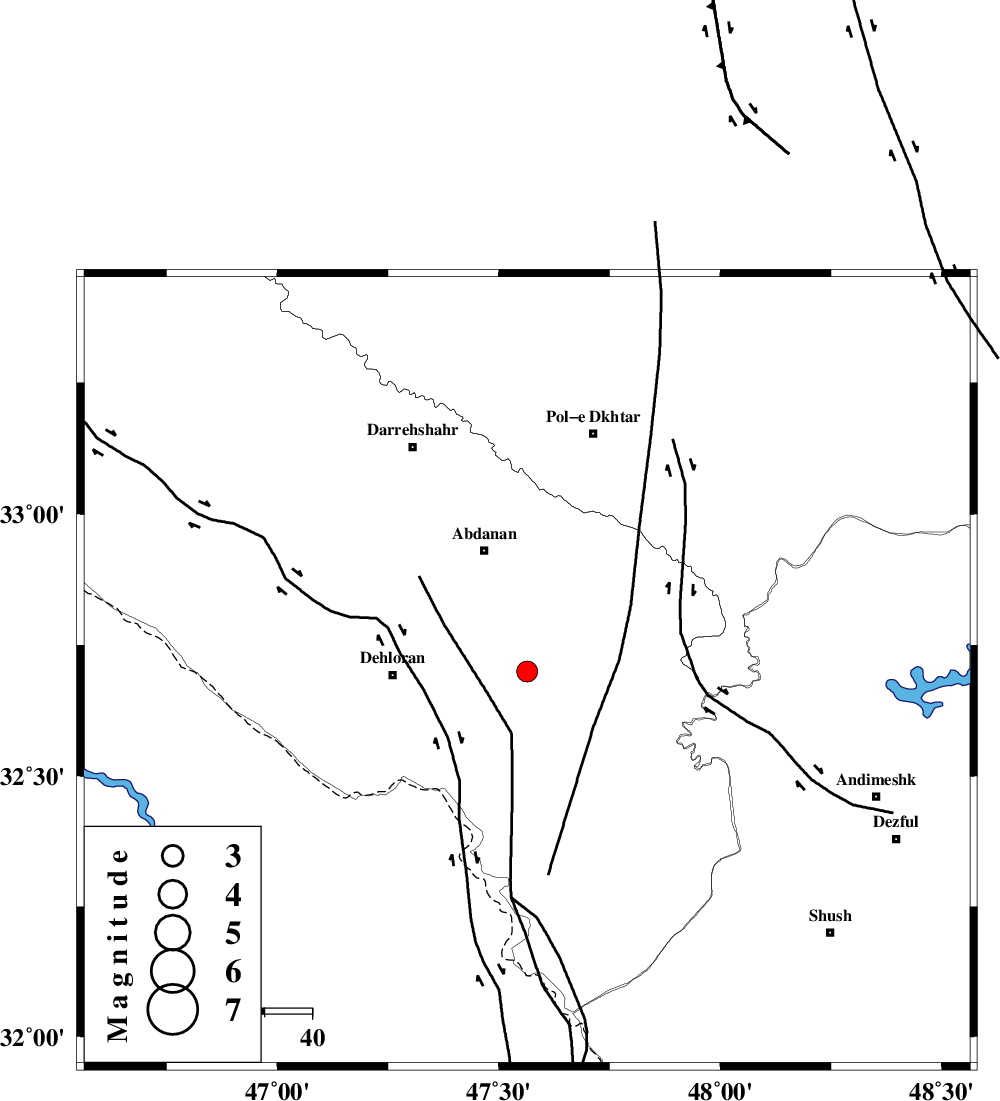
| Location | Lat:32.7 Lon: 47.564 |
| Region | Ilam Province, 28 km -East of Dehloran |
Nearest Cities |
|
| 22 km South of Sarabbagh, Ilam Province | |
| 26 km North East of Musian, Ilam Province | |
| 27 km South of Abdanan, Ilam Province | |
| 28 km North East of Dehloran, Ilam Province | |
| 46 km South West of Sarab hammam, Lorestan Province | |
| Depth | 14 km |
| Agency | |
Faults within 150 km: |
|
| MFF6 (Length: 144 km) , Distance to epicenter: 2 km | |
| BALARUD_F_Z1 (Length: 87 km) , Distance to epicenter: 25 km | |
| BALARUD_F_Z3 (Length: 53 km) , Distance to epicenter: 48 km | |
| Number of Phases | 4 |
| RMS | 0.3 |
| Number of Stations | 3 |
| Error in Latitude | >5.3 km |
| Error in Longitude | 5.7 km |
| Error in Depth | 0 km |
Download waveform in seisan format
to download seisan software Click here
to access information about IIEES stations Click here
Amplitude | ||||||||
| UID | Agency | Station | Component | Amplitude | Period | Arrival Time | Proccessing Time | Signal Clip |
| 100244 | IIEES | SHGR | N | 226 | 0.25 | 2015-08-03 15:25:58 | 2015-08-04 11:00:00 | n |
| 100245 | IIEES | SHGR | E | 260.3 | 0.36 | 2015-08-03 15:26:04 | 2015-08-04 11:00:00 | n |
Phase | ||||||||||||
| Agency | Station | Component | Phase Type | Phase Quality | First Motion | Observed Arrival Time | Time Residual | Loc. Flag | Input Weight | Distance | Azimuth | |
| IIEES | SHGR | Z | Pg | E | 2015-08-03 15:25:35 | 0.34 | y | 134 | 119 | |||
| IIEES | SHGR | E | Sg | E | 2015-08-03 15:25:50 | -0.34 | y | 134 | 119 | |||
| IIEES | KHMZ | Z | P | E | 2015-08-03 15:25:51 | 0.29 | y | 252 | 62 | |||
| IIEES | SNGE | Z | P | E | 2015-08-03 15:25:53 | -0.29 | y | 266 | 356 | |||