
Magnitude |
:3.2 |
| Date & Time (UTC) | 2015-08-01 17:43:33.0 |
| Date & Time (Local) | 1394/5/10 22:13:33.0 |
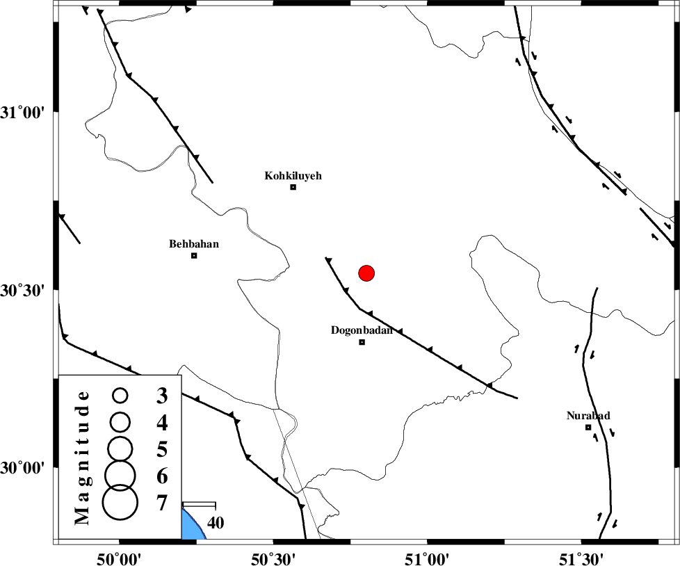
| Location | Lat:30.546 Lon: 50.802 |
| Region | Kohkiluieh va boyerahmad Province, 22 km North of Dogonbadan |
Nearest Cities |
|
| 22 km North of Dogonbadan, Kohkiluieh va boyerahmad Province | |
| 26 km North West of Abdehgah, Kohkiluieh va boyerahmad Province | |
| 35 km South East of Dehdasht, Kohkiluieh va boyerahmad Province | |
| 39 km South of Savari, Kohkiluieh va boyerahmad Province | |
| 40 km North West of Basht, Kohkiluieh va boyerahmad Province | |
| Depth | 18 km |
| Agency | |
Faults within 150 km: |
|
| MISHAN_F (Length: 76 km) , Distance to epicenter: 9 km | |
| MFF4 (Length: 62 km) , Distance to epicenter: 55 km | |
| RAG_E_SEFID_F (Length: 84 km) , Distance to epicenter: 61 km | |
| Number of Phases | 7 |
| RMS | 0.1 |
| Number of Stations | 6 |
| Error in Latitude | >3.1 km |
| Error in Longitude | 2.7 km |
| Error in Depth | 8.8 km |
Download waveform in seisan format
to download seisan software Click here
to access information about IIEES stations Click here
Amplitude | ||||||||
| UID | Agency | Station | Component | Amplitude | Period | Arrival Time | Proccessing Time | Signal Clip |
| 100231 | IIEES | SHGR | N | 132.4 | 0.59 | 2015-08-01 17:44:52 | 2015-08-02 07:17:00 | n |
| 100232 | IIEES | SHGR | E | 132.2 | 0.46 | 2015-08-01 17:44:53 | 2015-08-02 07:17:00 | n |
Phase | ||||||||||||
| Agency | Station | Component | Phase Type | Phase Quality | First Motion | Observed Arrival Time | Time Residual | Loc. Flag | Input Weight | Distance | Azimuth | |
| IIEES | AHRM | Z | Pg | E | 2015-08-01 17:44:04 | -0.02 | y | 192 | 165 | |||
| IIEES | AHRM | N | Sg | E | 2015-08-01 17:44:27 | 0.03 | y | 192 | 165 | |||
| IIEES | SHGR | Z | Pn | E | 2015-08-01 17:44:12 | -0.08 | y | 257 | 313 | |||
| IIEES | NASN | Z | Pn | E | 2015-08-01 17:44:19 | 0.01 | y | 314 | 37 | |||
| IIEES | KHMZ | Z | Pn | E | 2015-08-01 17:44:25 | 0.09 | y | 363 | 348 | |||
| IIEES | ASAO | Z | Pn | E | 2015-08-01 17:44:36 | 0.05 | y | 450 | 351 | |||
| IIEES | KRBR | Z | P | E | 2015-08-01 17:44:52 | -0.1 | y | 577 | 95 | |||