
Magnitude |
:3.5 |
| Date & Time (UTC) | 2015-07-28 19:51:03.7 |
| Date & Time (Local) | 1394/5/7 00:21:03.7 |
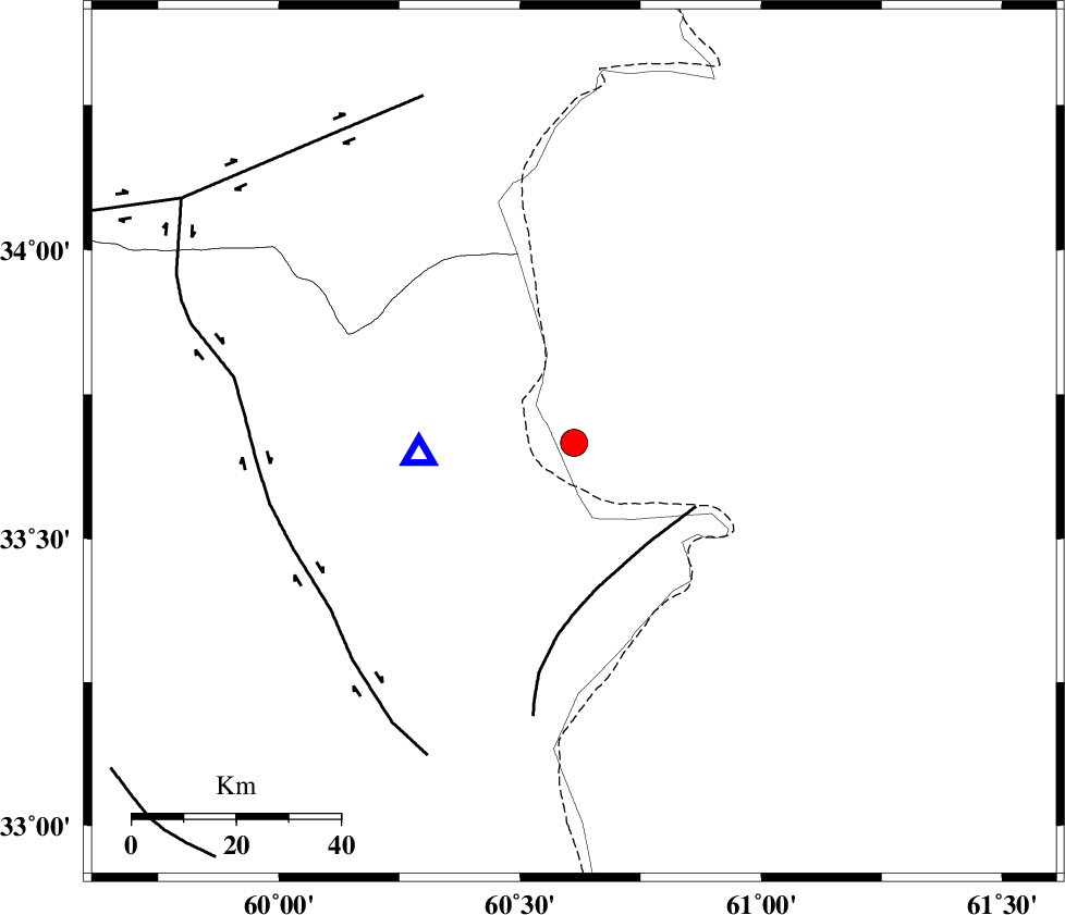
| Location | Lat:33.666 Lon: 60.612 |
| Region | |
Nearest Cities |
|
| 31 km North West of Yazdan, Khorasan(south) Province | |
| 42 km North East of Shahdokht, Khorasan(south) Province | |
| 51 km South East of Sirkhun, Khorasan(center) Province | |
| 55 km South East of Chahkand, Khorasan(center) Province | |
| 61 km East of Abiz, Khorasan(south) Province | |
| Depth | 18 km |
| Agency | |
Faults within 150 km: |
|
| PATARGAN_F (Length: 52 km) , Distance to epicenter: 24 km | |
| ABRIZ_F (Length: 114 km) , Distance to epicenter: 57 km | |
| DASHT_E_BAYAZ_F (Length: 177 km) , Distance to epicenter: 73 km | |
| Number of Phases | 7 |
| RMS | 0.4 |
| Number of Stations | 5 |
| Error in Latitude | >6.5 km |
| Error in Longitude | 9.6 km |
| Error in Depth | 7.3 km |
Download waveform in seisan format
to download seisan software Click here
to access information about IIEES stations Click here
Amplitude | ||||||||
| UID | Agency | Station | Component | Amplitude | Period | Arrival Time | Proccessing Time | Signal Clip |
| 100204 | IIEES | TABS | N | 155.5 | 0.97 | 2015-07-28 19:52:52 | 2015-07-29 09:10:00 | n |
Phase | ||||||||||||
| Agency | Station | Component | Phase Type | Phase Quality | First Motion | Observed Arrival Time | Time Residual | Loc. Flag | Input Weight | Distance | Azimuth | |
| IIEES | SHRT | Z | Pg | E | 2015-07-28 19:51:10 | 0.68 | y | 29.8 | 266 | |||
| IIEES | BSRN | Z | Pn | E | 2015-07-28 19:51:39 | -0.23 | y | 234 | 217 | |||
| IIEES | TABS | Z | Pn | E | 2015-07-28 19:51:51 | -0.01 | y | 324 | 271 | |||
| IIEES | TABS | E | Sg | E | 2015-07-28 19:52:34 | -0.33 | y | 324 | 271 | |||
| IIEES | SHRO | Z | Pn | E | 2015-07-28 19:52:11 | -0.57 | y | 494 | 303 | |||
| IIEES | SHRO | N | Sg | E | 2015-07-28 19:53:21 | 0.16 | y | 494 | 303 | |||
| IIEES | YZKH | Z | Pn | E | 2015-07-28 19:52:23 | 0.23 | y | 580 | 258 | |||