
Magnitude |
:2.9 |
| Date & Time (UTC) | 2015-07-28 14:05:50.3 |
| Date & Time (Local) | 1394/5/6 18:35:50.3 |
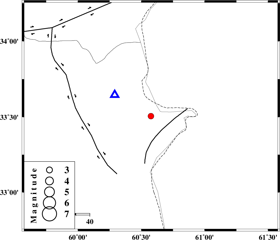
| Location | Lat:33.505 Lon: 60.576 |
| Region | Khorasan(south) Province, 139 km South-West of Taybad |
Nearest Cities |
|
| 29 km West of Yazdan, Khorasan(south) Province | |
| 41 km South East of Shahdokht, Khorasan(south) Province | |
| 62 km South East of Abiz, Khorasan(south) Province | |
| 62 km East of Hajiabad, Khorasan(south) Province | |
| 66 km South East of Sirkhun, Khorasan(center) Province | |
| Depth | 20 km |
| Agency | |
Faults within 150 km: |
|
| PATARGAN_F (Length: 52 km) , Distance to epicenter: 13 km | |
| ABRIZ_F (Length: 114 km) , Distance to epicenter: 46 km | |
| DASHT_E_BAYAZ_F (Length: 177 km) , Distance to epicenter: 89 km | |
| Number of Phases | 6 |
| RMS | 0.1 |
| Number of Stations | 5 |
| Error in Latitude | >4 km |
| Error in Longitude | 6.8 km |
| Error in Depth | 3.1 km |
Download waveform in seisan format
to download seisan software Click here
to access information about IIEES stations Click here
Amplitude | ||||||||
| UID | Agency | Station | Component | Amplitude | Period | Arrival Time | Proccessing Time | Signal Clip |
| 100202 | IIEES | SHRT | E | 1018.3 | 0.34 | 2015-07-28 14:06:03 | 2015-07-29 09:10:00 | n |
| 100203 | IIEES | BSRN | E | 148.1 | 0.63 | 2015-07-28 14:06:58 | 2015-07-29 09:10:00 | n |
Phase | ||||||||||||
| Agency | Station | Component | Phase Type | Phase Quality | First Motion | Observed Arrival Time | Time Residual | Loc. Flag | Input Weight | Distance | Azimuth | |
| IIEES | SHRT | Z | Pg | E | 2015-07-28 14:05:56 | -0.02 | y | 30.8 | 301 | |||
| IIEES | SHRT | E | Sg | E | 2015-07-28 14:06:01 | 0.02 | y | 30.8 | 301 | |||
| IIEES | BSRN | Z | Pn | E | 2015-07-28 14:06:24 | 0.13 | y | 218 | 219 | |||
| IIEES | TABS | Z | Pn | E | 2015-07-28 14:06:37 | -0.19 | y | 321 | 274 | |||
| IIEES | ZHSF | Z | Pn | E | 2015-07-28 14:06:51 | -0.07 | y | 432 | 177 | |||
| IIEES | SHRO | Z | Pn | E | 2015-07-28 14:07:00 | 0.15 | y | 502 | 305 | |||