
Magnitude |
:3.1 |
| Date & Time (UTC) | 2015-07-27 14:47:23.9 |
| Date & Time (Local) | 1394/5/5 19:17:23.9 |
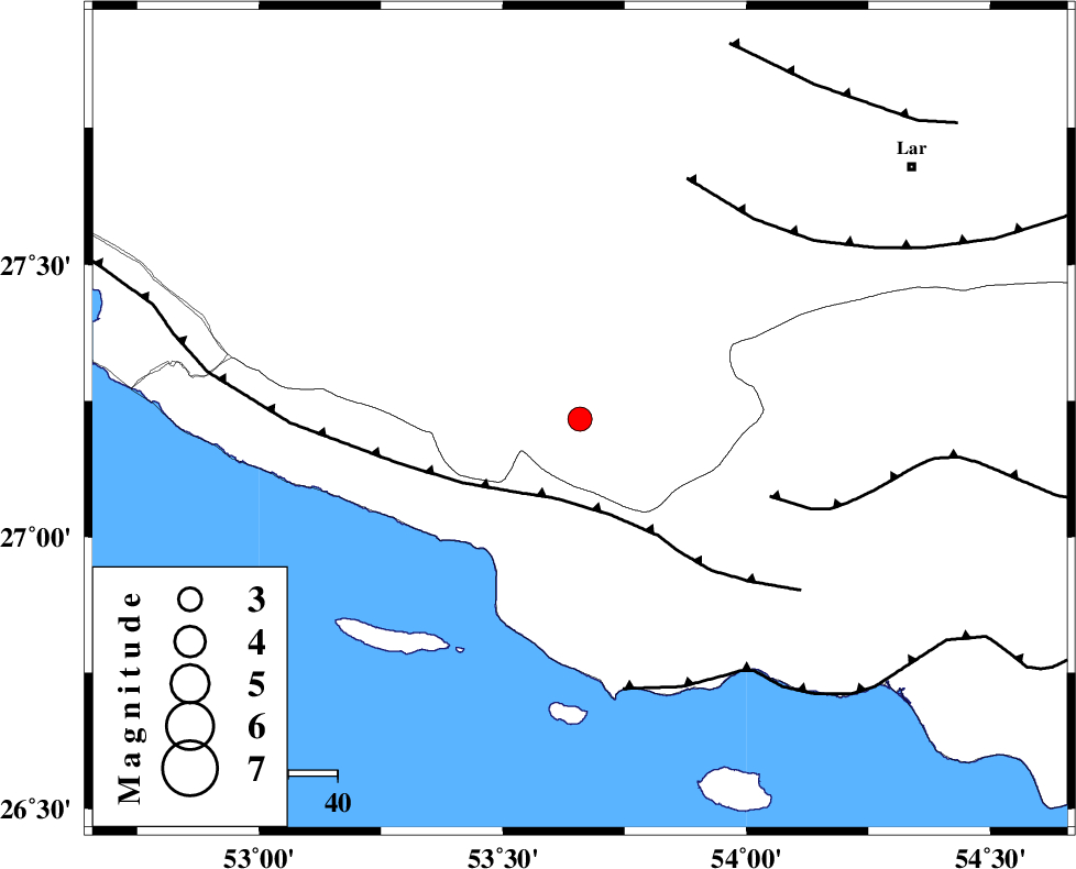
| Location | Lat:27.216 Lon: 53.658 |
| Region | Fars Province, 50 km South-East of Lamerd |
Nearest Cities |
|
| 5 km of Ashkenan, Fars Province | |
| 9 km North of Ahl, Fars Province | |
| 27 km South East of Beyram, Fars Province | |
| 43 km South East of Fedagh, Fars Province | |
| 49 km South West of Bagh, Fars Province | |
| Depth | 14 km |
| Agency | |
Faults within 150 km: |
|
| MFF3 (Length: 292 km) , Distance to epicenter: 17 km | |
| MFF1 (Length: 180 km) , Distance to epicenter: 42 km | |
| LAR_F (Length: 99 km) , Distance to epicenter: 54 km | |
| Number of Phases | 5 |
| RMS | 0.1 |
| Number of Stations | 4 |
| Error in Latitude | >7.1 km |
| Error in Longitude | 3.6 km |
| Error in Depth | 9.4 km |
Download waveform in seisan format
to download seisan software Click here
to access information about IIEES stations Click here
Amplitude | ||||||||
| UID | Agency | Station | Component | Amplitude | Period | Arrival Time | Proccessing Time | Signal Clip |
| 100195 | IIEES | KRBR | N | 29.5 | 0.31 | 2015-07-27 14:49:32 | 2015-07-28 10:50:00 | n |
Phase | ||||||||||||
| Agency | Station | Component | Phase Type | Phase Quality | First Motion | Observed Arrival Time | Time Residual | Loc. Flag | Input Weight | Distance | Azimuth | |
| IIEES | BNDS | Z | Pn | E | 2015-07-27 14:48:02 | -0.13 | y | 250 | 85 | |||
| IIEES | AHRM | Z | Pn | E | 2015-07-27 14:48:08 | 0.13 | y | 295 | 309 | |||
| IIEES | AHRM | N | Sg | E | 2015-07-27 14:48:46 | -0.08 | y | 295 | 309 | |||
| IIEES | KRBR | Z | Pn | E | 2015-07-27 14:48:25 | 0.22 | y | 431 | 44 | |||
| IIEES | YZKH | Z | Pn | E | 2015-07-27 14:48:43 | -0.15 | y | 581 | 9 | |||