
Magnitude |
:3.4 |
| Date & Time (UTC) | 2015-07-22 22:36:59.0 |
| Date & Time (Local) | 1394/5/1 03:06:59.0 |
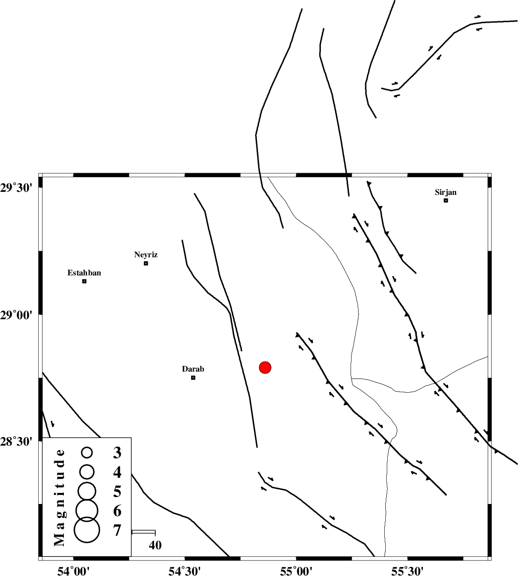
| Location | Lat:28.791 Lon: 54.86 |
| Region | Fars Province, 32 km -East of Darab |
Nearest Cities |
|
| 23 km North East of Dehkheyr, Fars Province | |
| 31 km East of Sang-e charak, Fars Province | |
| 32 km North East of Darab, Fars Province | |
| 33 km North East of Shahnan, Fars Province | |
| 42 km South East of Qataruyeh, Fars Province | |
| Depth | 18 km |
| Agency | |
Faults within 150 km: |
|
| MAIN_ZAGROS_R_F (Length: 1106 km) , Distance to epicenter: 11 km | |
| HZF1 (Length: 102 km) , Distance to epicenter: 25 km | |
| HZF2 (Length: 437 km) , Distance to epicenter: 46 km | |
| Number of Phases | 5 |
| RMS | 0.2 |
| Number of Stations | 3 |
| Error in Latitude | >3.4 km |
| Error in Longitude | 2.1 km |
| Error in Depth | 6 km |
Download waveform in seisan format
to download seisan software Click here
to access information about IIEES stations Click here
Amplitude | ||||||||
| UID | Agency | Station | Component | Amplitude | Period | Arrival Time | Proccessing Time | Signal Clip |
| 100173 | IIEES | KRBR | N | 256 | 0.58 | 2015-07-22 22:38:09 | 2015-07-25 11:55:00 | n |
| 100174 | IIEES | KRBR | E | 267.3 | 0.64 | 2015-07-22 22:38:10 | 2015-07-25 11:55:00 | n |
Phase | ||||||||||||
| Agency | Station | Component | Phase Type | Phase Quality | First Motion | Observed Arrival Time | Time Residual | Loc. Flag | Input Weight | Distance | Azimuth | |
| IIEES | BNDS | Z | Pg | E | 2015-07-22 22:37:33 | 0.06 | y | 201 | 140 | |||
| IIEES | KRBR | Z | Pn | E | 2015-07-22 22:37:35 | 0.13 | y | 227 | 54 | |||
| IIEES | KRBR | N | Sg | E | 2015-07-22 22:38:04 | -0.02 | y | 227 | 54 | |||
| IIEES | AHRM | Z | Pn | E | 2015-07-22 22:37:49 | -0.47 | y | 348 | 272 | |||
| IIEES | AHRM | N | Sg | E | 2015-07-22 22:38:37 | 0.27 | y | 348 | 272 | |||