
Magnitude |
:2.6 |
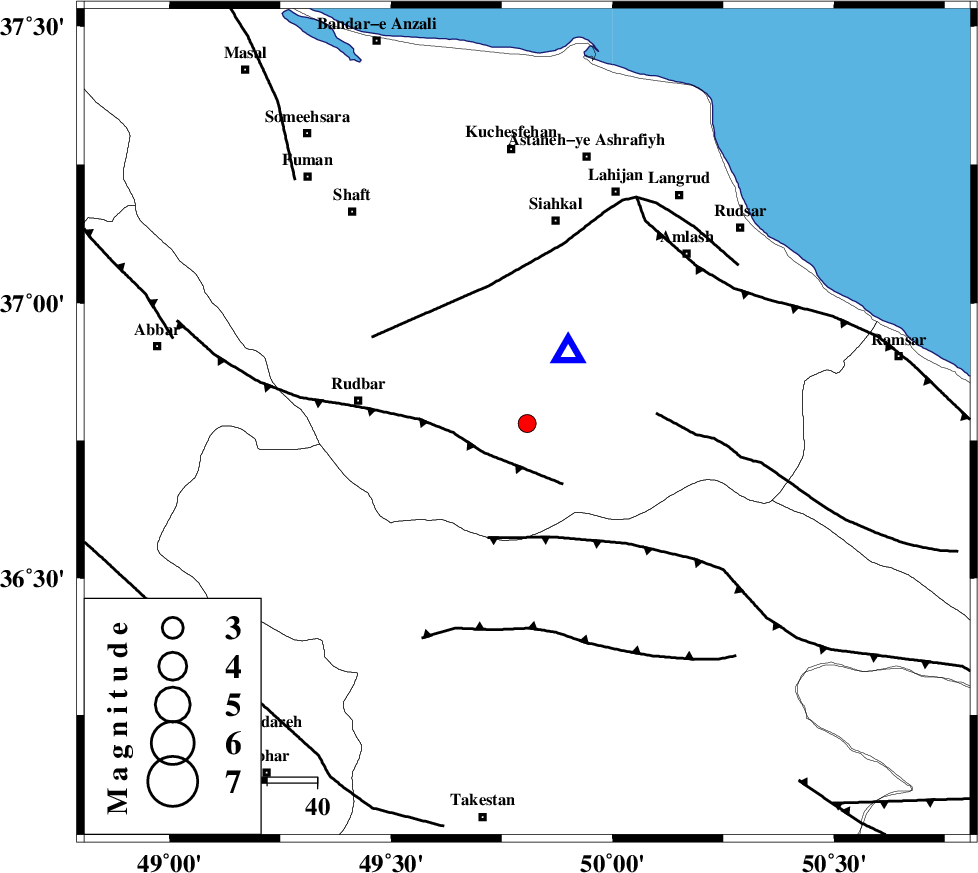
| Date & Time (UTC) | 2015-07-23 06:08:03.1 |
| Date & Time (Local) | 1394/5/1 10:38:03.1 |
| Location | Lat:36.781 Lon: 49.807 |
| Region | Gilan Province, 34 km -East of Rudbar |
Nearest Cities |
|
| 9 km North of Jirhandeh, Gilan Province | |
| 12 km of Barresar, Gilan Province | |
| 15 km East of Dashtvil, Gilan Province | |
| 17 km North West of Kelishom, Gilan Province | |
| 30 km South East of Shahr-e bijar, Gilan Province | |
| Depth | 14 km |
| Agency | |
Faults within 150 km: |
|
| RUDBAR_F (Length: 93 km) , Distance to epicenter: 11 km | |
| ALAMUTRUD_F (Length: 140 km) , Distance to epicenter: 24 km | |
| BONAN_F (Length: 74 km) , Distance to epicenter: 26 km | |
| Number of Phases | 5 |
| RMS | 0.1 |
| Number of Stations | 4 |
| Error in Latitude | >2.5 km |
| Error in Longitude | 2.8 km |
| Error in Depth | 4.5 km |
Download waveform in seisan format
to download seisan software Click here
to access information about IIEES stations Click here
Amplitude | ||||||||
| UID | Agency | Station | Component | Amplitude | Period | Arrival Time | Proccessing Time | Signal Clip |
| 100168 | IIEES | DAMV | E | 46.5 | 0.23 | 2015-07-23 06:09:10 | 2015-07-25 11:55:00 | n |
Phase | ||||||||||||
| Agency | Station | Component | Phase Type | Phase Quality | First Motion | Observed Arrival Time | Time Residual | Loc. Flag | Input Weight | Distance | Azimuth | |
| IIEES | ZNJK | Z | Pg | E | 2015-07-23 06:08:20 | -0.02 | y | 101 | 263 | |||
| IIEES | CHTH | Z | Pg | E | 2015-07-23 06:08:28 | -0.2 | y | 153 | 129 | |||
| IIEES | DAMV | Z | Pn | E | 2015-07-23 06:08:40 | 0.2 | y | 233 | 123 | |||
| IIEES | ASAO | Z | Pn | E | 2015-07-23 06:08:41 | 0 | y | 249 | 175 | |||
| IIEES | ASAO | E | Sg | E | 2015-07-23 06:09:13 | 0.03 | y | 249 | 175 | |||