
Magnitude |
:2.9 |
| Date & Time (UTC) | 2015-07-18 22:15:54.5 |
| Date & Time (Local) | 1394/4/28 02:45:54.5 |
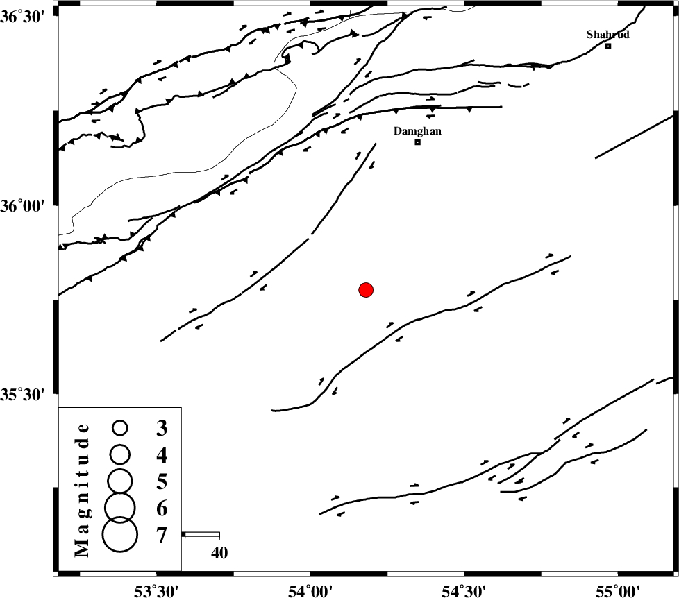
| Location | Lat:35.776 Lon: 54.18 |
| Region | Semnan Province, 46 km South-West of Damghan |
Nearest Cities |
|
| 28 km South of Amirabad, Semnan Province | |
| 31 km South of Seydabad, Semnan Province | |
| 35 km South East of Darvar, Semnan Province | |
| 46 km South West of Damghan, Semnan Province | |
| 60 km South West of Mehmandust, Semnan Province | |
| Depth | 15 km |
| Agency | |
Faults within 150 km: |
|
| ATARI_F (Length: 185 km) , Distance to epicenter: 32 km | |
| DAMGHAN_F (Length: 95 km) , Distance to epicenter: 47 km | |
| ASTANEH_F (Length: 72 km) , Distance to epicenter: 54 km | |
| Number of Phases | 8 |
| RMS | 0.2 |
| Number of Stations | 5 |
| Error in Latitude | >3.2 km |
| Error in Longitude | 2.5 km |
| Error in Depth | 5.3 km |
Download waveform in seisan format
to download seisan software Click here
to access information about IIEES stations Click here
Amplitude | ||||||||
| UID | Agency | Station | Component | Amplitude | Period | Arrival Time | Proccessing Time | Signal Clip |
| 100126 | IIEES | DAMV | E | 113.9 | 0.6 | 2015-07-18 22:16:54 | 2015-07-21 11:03:00 | n |
| 100127 | IIEES | GHVR | E | 50.8 | 0.41 | 2015-07-18 22:17:25 | 2015-07-21 11:03:00 | n |
| 100128 | IIEES | GHVR | N | 41.1 | 0.37 | 2015-07-18 22:17:26 | 2015-07-21 11:03:00 | n |
Phase | ||||||||||||
| Agency | Station | Component | Phase Type | Phase Quality | First Motion | Observed Arrival Time | Time Residual | Loc. Flag | Input Weight | Distance | Azimuth | |
| IIEES | SHRO | Z | Pg | E | 2015-07-18 22:16:22 | 0.25 | y | 168 | 81 | |||
| IIEES | DAMV | Z | Pg | E | 2015-07-18 22:16:27 | 0.27 | y | 201 | 266 | |||
| IIEES | DAMV | E | Sg | E | 2015-07-18 22:16:51 | 0.1 | y | 201 | 266 | |||
| IIEES | MRVT | Z | Pn | E | 2015-07-18 22:16:35 | 0.15 | y | 270 | 39 | |||
| IIEES | MRVT | N | Sg | E | 2015-07-18 22:17:10 | -0.34 | y | 270 | 39 | |||
| IIEES | GHVR | Z | Pn | E | 2015-07-18 22:16:39 | -0.04 | y | 304 | 243 | |||
| IIEES | GHVR | N | Sg | E | 2015-07-18 22:17:19 | -0.33 | y | 304 | 243 | |||
| IIEES | YZKH | Z | Pn | E | 2015-07-18 22:16:49 | -0.14 | y | 377 | 174 | |||