
Magnitude |
:3.2 |
| Date & Time (UTC) | 2015-07-16 13:08:21.4 |
| Date & Time (Local) | 1394/4/25 17:38:21.4 |
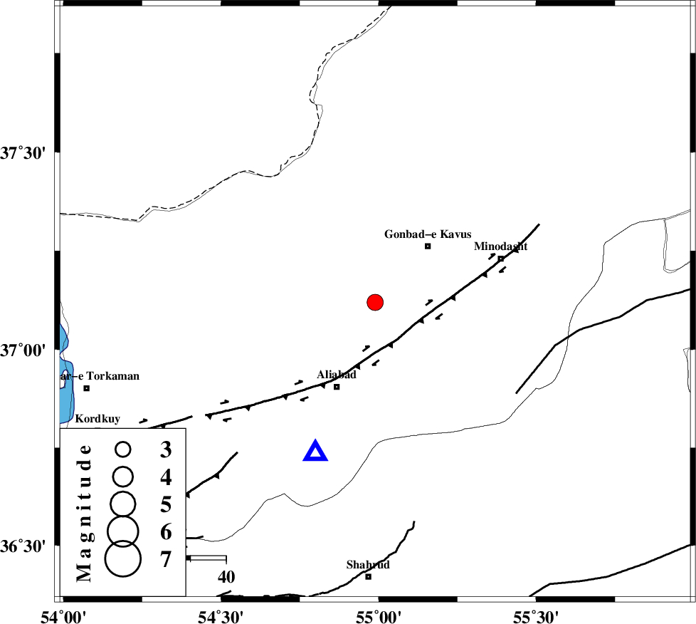
| Location | Lat:37.119 Lon: 54.989 |
| Region | Golestan Province, 17 km -West of Azadshahr |
Nearest Cities |
|
| 7 km of Baghli marma, Golestan Province | |
| 11 km North of Deland, Golestan Province | |
| 12 km North of Khanbebin, Golestan Province | |
| 16 km West of Nezamabad, Golestan Province | |
| 17 km North West of Azadshahr, Golestan Province | |
| Depth | 15 km |
| Agency | |
Faults within 150 km: |
|
| KHAZAR_F (Length: 523 km) , Distance to epicenter: 13 km | |
| SHAVAR_F (Length: 87 km) , Distance to epicenter: 43 km | |
| ROBATE_QARABIL_F (Length: 168 km) , Distance to epicenter: 47 km | |
| Number of Phases | 5 |
| RMS | 0.1 |
| Number of Stations | 5 |
| Error in Latitude | >3.2 km |
| Error in Longitude | 3.2 km |
| Error in Depth | 6.3 km |
Download waveform in seisan format
to download seisan software Click here
to access information about IIEES stations Click here
Amplitude | ||||||||
| UID | Agency | Station | Component | Amplitude | Period | Arrival Time | Proccessing Time | Signal Clip |
| 100105 | IIEES | SHRO | N | 482.9 | 0.24 | 2015-07-16 13:09:11 | 2015-07-20 11:19:00 | n |
| 100106 | IIEES | SHRO | E | 291.8 | 0.35 | 2015-07-16 13:09:14 | 2015-07-20 11:19:00 | n |
Phase | ||||||||||||
| Agency | Station | Component | Phase Type | Phase Quality | First Motion | Observed Arrival Time | Time Residual | Loc. Flag | Input Weight | Distance | Azimuth | |
| IIEES | MRVT | Z | P | E | 2015-07-16 13:08:40 | 0.01 | y | 114 | 58 | |||
| IIEES | SHRO | Z | Pg | E | 2015-07-16 13:08:46 | -0.01 | y | 154 | 143 | |||
| IIEES | BJRD | Z | P | E | 2015-07-16 13:08:56 | -0.01 | y | 224 | 73 | |||
| IIEES | CHTH | Z | Pn | E | 2015-07-16 13:09:15 | -0.07 | y | 371 | 250 | |||
| IIEES | ASAO | Z | Pn | E | 2015-07-16 13:09:35 | 0.1 | y | 531 | 239 | |||