
Magnitude |
:3.4 |
| Date & Time (UTC) | 2015-07-15 15:41:57.3 |
| Date & Time (Local) | 1394/4/24 20:11:57.3 |
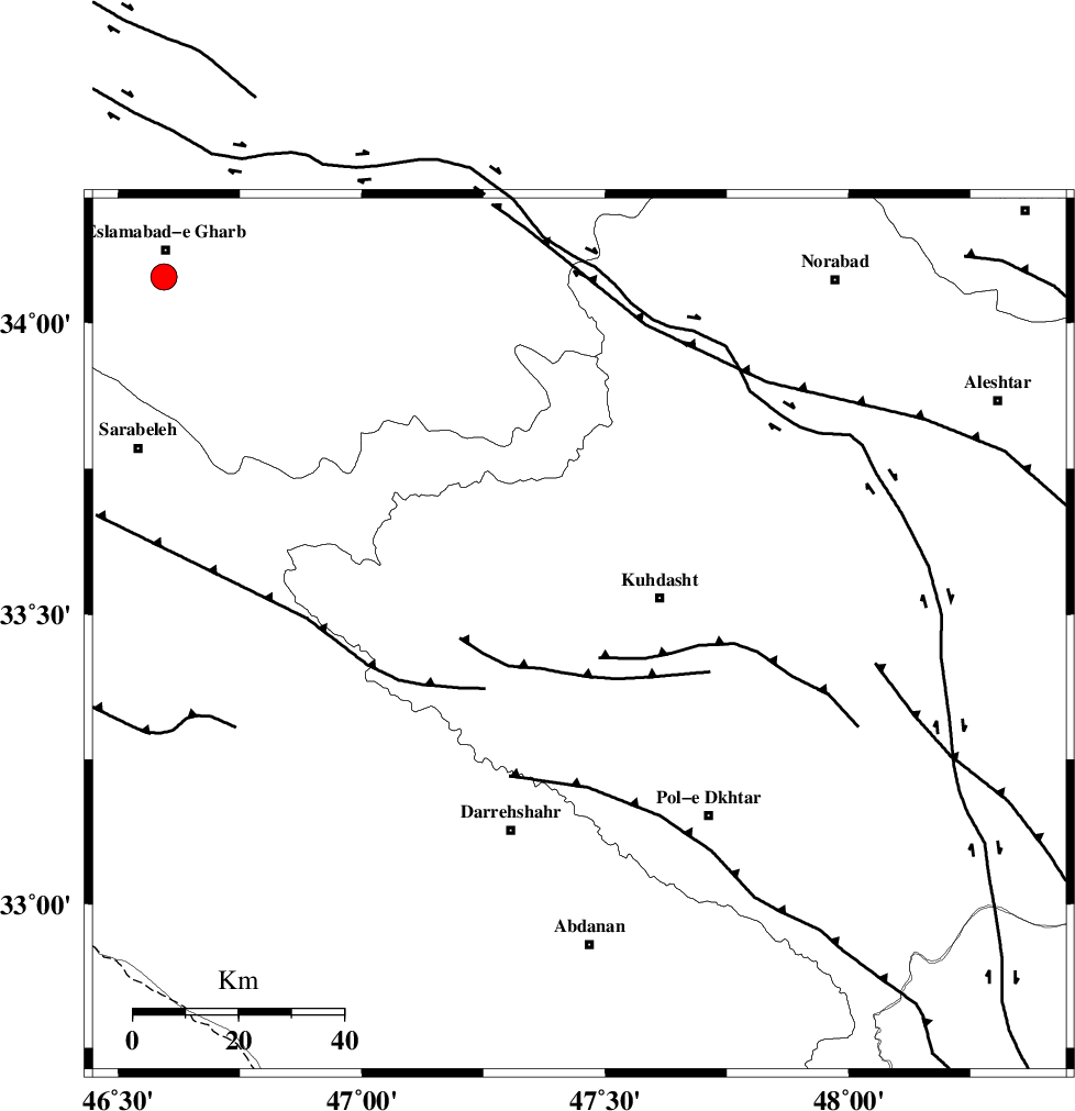
| Location | Lat:33.464 Lon: 47.447 |
| Region | Lorestan Province, 17 km -West of Kuhdasht |
Nearest Cities |
|
| 5 km of Ashtarheh golgol, Lorestan Province | |
| 12 km North East of Kunani, Lorestan Province | |
| 15 km North of Suri, Lorestan Province | |
| 17 km West of Kuhdasht, Lorestan Province | |
| 18 km East of Garab, Lorestan Province | |
| Depth | 14 km |
| Agency | |
Faults within 150 km: |
|
| BALARUD_F_Z1 (Length: 87 km) , Distance to epicenter: 47 km | |
| HZF4 (Length: 492 km) , Distance to epicenter: 49 km | |
| MFF6 (Length: 144 km) , Distance to epicenter: 82 km | |
| Number of Phases | 9 |
| RMS | 0.4 |
| Number of Stations | 8 |
| Error in Latitude | >5.1 km |
| Error in Longitude | 14.1 km |
| Error in Depth | 8.5 km |
Download waveform in seisan format
to download seisan software Click here
to access information about IIEES stations Click here
Amplitude | ||||||||
| UID | Agency | Station | Component | Amplitude | Period | Arrival Time | Proccessing Time | Signal Clip |
| 100102 | IIEES | ASAO | E | 178.1 | 0.58 | 2015-07-15 15:43:12 | 2015-07-20 11:19:00 | n |
| 100103 | IIEES | ASAO | N | 232.8 | 0.58 | 2015-07-15 15:43:16 | 2015-07-20 11:19:00 | n |
Phase | ||||||||||||
| Agency | Station | Component | Phase Type | Phase Quality | First Motion | Observed Arrival Time | Time Residual | Loc. Flag | Input Weight | Distance | Azimuth | |
| IIEES | SNGE | Z | Pg | E | 2015-07-15 15:42:27 | 0.08 | y | 181 | 357 | |||
| IIEES | SHGR | Z | Pg | E | 2015-07-15 15:42:29 | -0.12 | y | 197 | 139 | |||
| IIEES | ASAO | Z | Pn | E | 2015-07-15 15:42:38 | -0.06 | y | 267 | 62 | |||
| IIEES | GHVR | Z | P | E | 2015-07-15 15:42:51 | 0.63 | y | 369 | 71 | |||
| IIEES | ZNJK | Z | Pn | E | 2015-07-15 15:42:51 | 0.27 | y | 373 | 17 | |||
| IIEES | THKV | Z | P | E | 2015-07-15 15:42:56 | -0.79 | y | 416 | 48 | |||
| IIEES | CHTH | Z | P | E | 2015-07-15 15:42:59 | 0.11 | y | 433 | 50 | |||
| IIEES | GRMI | Z | Pn | E | 2015-07-15 15:43:18 | -0.07 | y | 595 | 4 | |||
| IIEES | GRMI | E | Sg | E | 2015-07-15 15:44:42 | -0.16 | y | 595 | 4 | |||