
Magnitude |
:2.7 |
| Date & Time (UTC) | 2015-07-12 14:39:46.8 |
| Date & Time (Local) | 1394/4/21 19:09:46.8 |
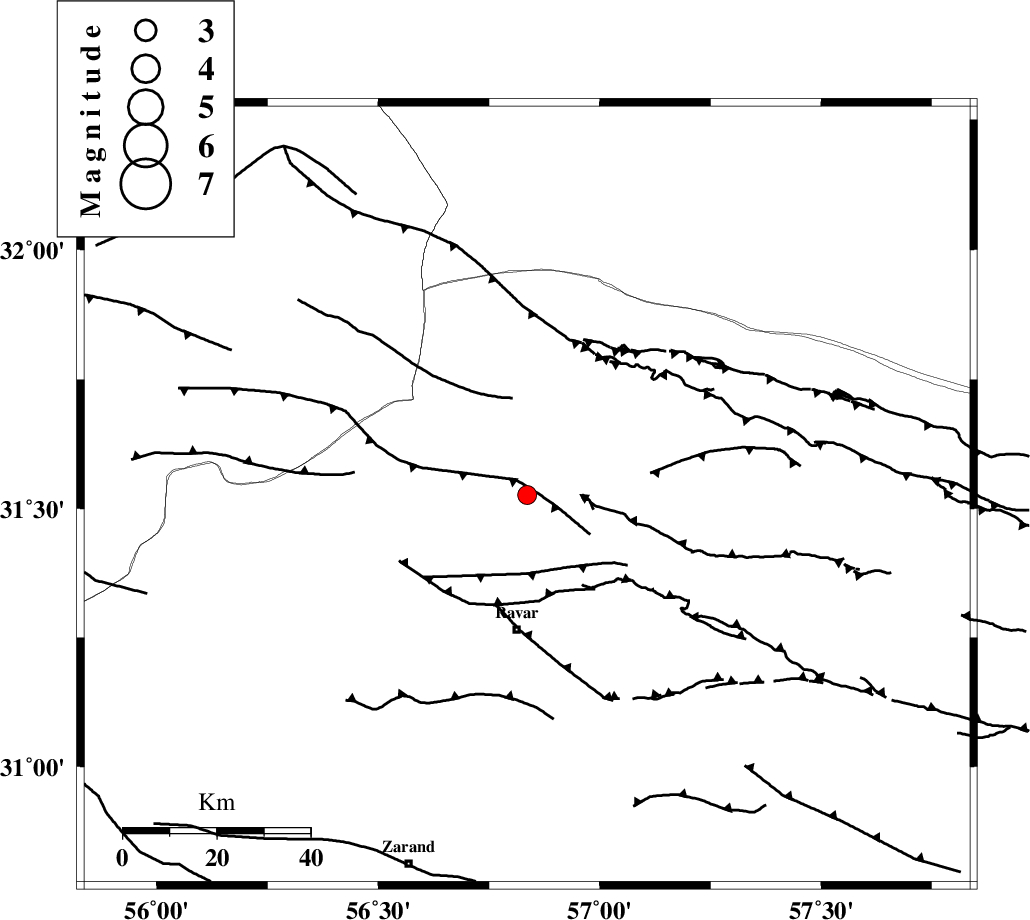
| Location | Lat:31.526 Lon: 56.836 |
| Region | Kerman Province, 29 km North of Ravar |
Nearest Cities |
|
| 23 km North of Dehali, Kerman Province | |
| 29 km North of Ravar, Kerman Province | |
| 53 km North East of Kuhbanan, Kerman Province | |
| 55 km North East of Jor, Kerman Province | |
| 58 km North East of Toghroljerd, Kerman Province | |
| Depth | 14 km |
| Agency | |
Faults within 150 km: |
|
| LAKARKUH_F (Length: 138 km) , Distance to epicenter: 16 km | |
| KUHBANAN_F (Length: 189 km) , Distance to epicenter: 57 km | |
| JAFARABAD_F (Length: 60 km) , Distance to epicenter: 58 km | |
| Number of Phases | 6 |
| RMS | 0.2 |
| Number of Stations | 4 |
| Error in Latitude | >3.2 km |
| Error in Longitude | 3.3 km |
| Error in Depth | 9.1 km |
Download waveform in seisan format
to download seisan software Click here
to access information about IIEES stations Click here
Amplitude | ||||||||
| UID | Agency | Station | Component | Amplitude | Period | Arrival Time | Proccessing Time | Signal Clip |
| 100097 | IIEES | KRBR | E | 91.1 | 0.16 | 2015-07-12 14:40:39 | 2015-07-13 09:14:00 | n |
Phase | ||||||||||||
| Agency | Station | Component | Phase Type | Phase Quality | First Motion | Observed Arrival Time | Time Residual | Loc. Flag | Input Weight | Distance | Azimuth | |
| IIEES | KRBR | Z | Pg | E | 2015-07-12 14:40:15 | 0.16 | y | 171 | 182 | |||
| IIEES | KRBR | N | Sg | E | 2015-07-12 14:40:36 | -0.03 | y | 171 | 182 | |||
| IIEES | BSRN | Z | Pn | E | 2015-07-12 14:40:22 | 0.08 | y | 222 | 77 | |||
| IIEES | BSRN | N | Sg | E | 2015-07-12 14:40:49 | -0.16 | y | 222 | 77 | |||
| IIEES | YZKH | Z | Pn | E | 2015-07-12 14:40:23 | -0.31 | y | 233 | 295 | |||
| IIEES | TABS | Z | Pn | E | 2015-07-12 14:40:24 | 0.27 | y | 237 | 6 | |||