
Magnitude |
:3.2 |
| Date & Time (UTC) | 2015-07-01 07:04:51.9 |
| Date & Time (Local) | 1394/4/10 11:34:51.9 |
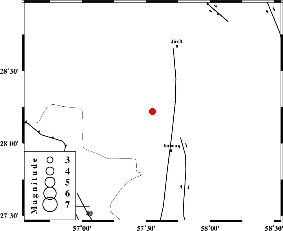
| Location | Lat:28.22 Lon: 57.55 |
| Region | Kerman Province, 33 km North-West of Kahnuj |
Nearest Cities |
|
| 1 km North of Bolock, Kerman Province | |
| 20 km North East of Mehrueye-e paeen, Kerman Province | |
| 23 km North East of Hurpasefid, Kerman Province | |
| 32 km North East of Faryab, Kerman Province | |
| 33 km North West of Kahnuj, Kerman Province | |
| Depth | 16 km |
| Agency | |
Faults within 150 km: |
|
| SABZEVARAN_F (Length: 190 km) , Distance to epicenter: 19 km | |
| JIROFT_F (Length: 144 km) , Distance to epicenter: 29 km | |
| MAIN_ZAGROS_R_F (Length: 1106 km) , Distance to epicenter: 72 km | |
| Number of Phases | 6 |
| RMS | 0.2 |
| Number of Stations | 4 |
| Error in Latitude | >3.6 km |
| Error in Longitude | 4.9 km |
| Error in Depth | 6.3 km |
Download waveform in seisan format
to download seisan software Click here
to access information about IIEES stations Click here
Amplitude | ||||||||
| UID | Agency | Station | Component | Amplitude | Period | Arrival Time | Proccessing Time | Signal Clip |
| 96093 | IIEES | BNDS | N | 395.3 | 0.42 | 2015-07-01 07:05:41 | 2015-07-01 08:31:00 | n |
| 96094 | IIEES | KRBR | N | 186.1 | 0.29 | 2015-07-01 07:06:01 | 2015-07-01 08:31:00 | n |
Phase | ||||||||||||
| Agency | Station | Component | Phase Type | Phase Quality | First Motion | Observed Arrival Time | Time Residual | Loc. Flag | Input Weight | Distance | Azimuth | |
| IIEES | BNDS | Z | Pg | E | 2015-07-01 07:05:19 | 0.18 | y | 164 | 237 | |||
| IIEES | BNDS | E | Sg | E | 2015-07-01 07:05:38 | -0.12 | y | 164 | 237 | |||
| IIEES | KRBR | Z | Pn | E | 2015-07-01 07:05:25 | -0.15 | y | 211 | 339 | |||
| IIEES | ZHSF | Z | Pn | E | 2015-07-01 07:05:42 | -0.22 | y | 350 | 63 | |||
| IIEES | BSRN | Z | Pn | E | 2015-07-01 07:05:54 | 0.46 | y | 442 | 20 | |||
| IIEES | BSRN | E | Sg | E | 2015-07-01 07:06:55 | -0.07 | y | 442 | 20 | |||