
Magnitude |
:3.1 |
| Date & Time (UTC) | 2015-06-28 13:38:53.4 |
| Date & Time (Local) | 1394/4/7 18:08:53.4 |
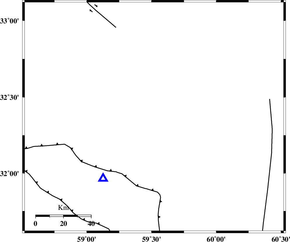
| Location | Lat:32.37 Lon: 59.52 |
| Region | Khorasan(south) Province, 38 km South-West of Sarbisheh |
Nearest Cities |
|
| 17 km East of Mokhtaran, Khorasan(south) Province | |
| 19 km South of Kalateh soleyman, Khorasan(south) Province | |
| 30 km South East of Gaz, Khorasan(south) Province | |
| 35 km South West of Salmabad, Khorasan(south) Province | |
| 38 km South West of Sarbisheh, Khorasan(south) Province | |
| Depth | 14 km |
| Agency | |
Faults within 150 km: |
|
| E_NEH_F (Length: 148 km) , Distance to epicenter: 70 km | |
| MOHAMMADABAD_F (Length: 71 km) , Distance to epicenter: 71 km | |
| NOZAD_F (Length: 27 km) , Distance to epicenter: 72 km | |
| Number of Phases | 6 |
| RMS | 0.1 |
| Number of Stations | 5 |
| Error in Latitude | >3.1 km |
| Error in Longitude | 2.2 km |
| Error in Depth | 5.6 km |
Download waveform in seisan format
to download seisan software Click here
to access information about IIEES stations Click here
Amplitude | ||||||||
| UID | Agency | Station | Component | Amplitude | Period | Arrival Time | Proccessing Time | Signal Clip |
| 96070 | IIEES | YZKH | N | 20.9 | 0.32 | 2015-06-28 13:41:13 | 2015-06-28 03:09:00 | n |
| 96071 | IIEES | YZKH | E | 22 | 0.56 | 2015-06-28 13:41:14 | 2015-06-28 03:09:00 | n |
Phase | ||||||||||||
| Agency | Station | Component | Phase Type | Phase Quality | First Motion | Observed Arrival Time | Time Residual | Loc. Flag | Input Weight | Distance | Azimuth | |
| IIEES | SHRT | Z | Pg | E | 2015-06-28 13:39:19 | -0.07 | y | 159 | 27 | |||
| IIEES | TABS | Z | Pn | E | 2015-06-28 13:39:34 | 0.22 | y | 266 | 303 | |||
| IIEES | TABS | E | Sg | E | 2015-06-28 13:40:08 | -0.13 | y | 266 | 303 | |||
| IIEES | ZHSF | Z | Pn | E | 2015-06-28 13:39:41 | -0.06 | y | 328 | 158 | |||
| IIEES | YZKH | Z | Pn | E | 2015-06-28 13:39:58 | -0.08 | y | 464 | 272 | |||
| IIEES | SHRO | Z | Pn | E | 2015-06-28 13:40:05 | 0.13 | y | 517 | 322 | |||