
Magnitude |
:2.5 |
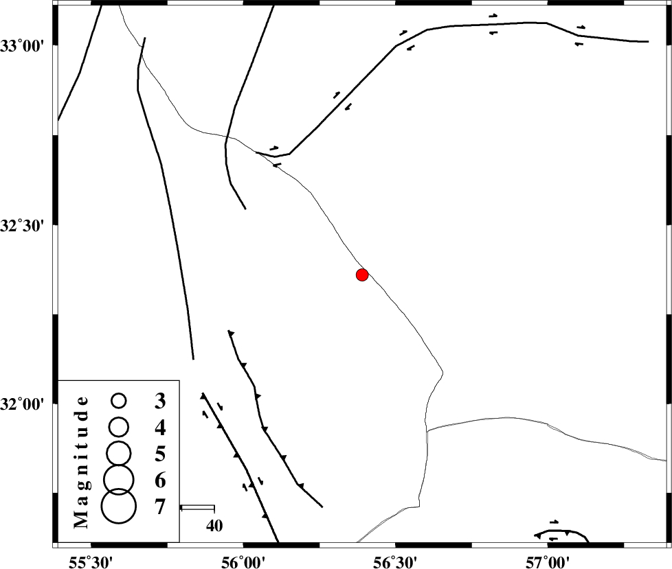
| Date & Time (UTC) | 2015-06-25 07:30:03.6 |
| Date & Time (Local) | 1394/4/4 12:00:03.6 |
| Location | Lat:32.36 Lon: 56.39 |
| Region | Yazd Province, 128 km North-West of Ravar |
Nearest Cities |
|
| 64 km North East of Behabad, Yazd Province | |
| 75 km North East of Benestan, Yazd Province | |
| 78 km North East of Asfih, Yazd Province | |
| 90 km North East of Kushk, Yazd Province | |
| 102 km North West of Hoz-e qorban, Yazd Province | |
| Depth | 15 km |
| Agency | |
Faults within 150 km: |
|
| NAINI_F (Length: 342 km) , Distance to epicenter: 41 km | |
| CHESHMEH_ROSTAM_ (Length: 142 km) , Distance to epicenter: 44 km | |
| JAFARABAD_F (Length: 60 km) , Distance to epicenter: 45 km | |
| Number of Phases | 3 |
| RMS | 0 |
| Number of Stations | 4 |
| Error in Latitude | >2.4 km |
| Error in Longitude | 1.7 km |
| Error in Depth | 0 km |
Download waveform in seisan format
to download seisan software Click here
to access information about IIEES stations Click here
Amplitude | ||||||||
| UID | Agency | Station | Component | Amplitude | Period | Arrival Time | Proccessing Time | Signal Clip |
| 96050 | IIEES | KRBR | E | 24.7 | 0.36 | 2015-06-25 07:31:22 | 2015-06-25 09:04:00 | n |
Phase | ||||||||||||
| Agency | Station | Component | Phase Type | Phase Quality | First Motion | Observed Arrival Time | Time Residual | Loc. Flag | Input Weight | Distance | Azimuth | |
| IIEES | TABS | Z | Pg | E | 2015-06-25 07:30:29 | 0 | y | 159 | 25 | |||
| IIEES | YZKH | Z | Pg | E | 2015-06-25 07:30:31 | 0 | y | 169 | 272 | |||
| IIEES | BSRN | Z | Pn | E | 2015-06-25 07:30:43 | 0 | y | 262 | 99 | |||