
Magnitude |
:2.7 |
| Date & Time (UTC) | 2015-06-14 04:38:11.3 |
| Date & Time (Local) | 1394/3/24 09:08:11.3 |
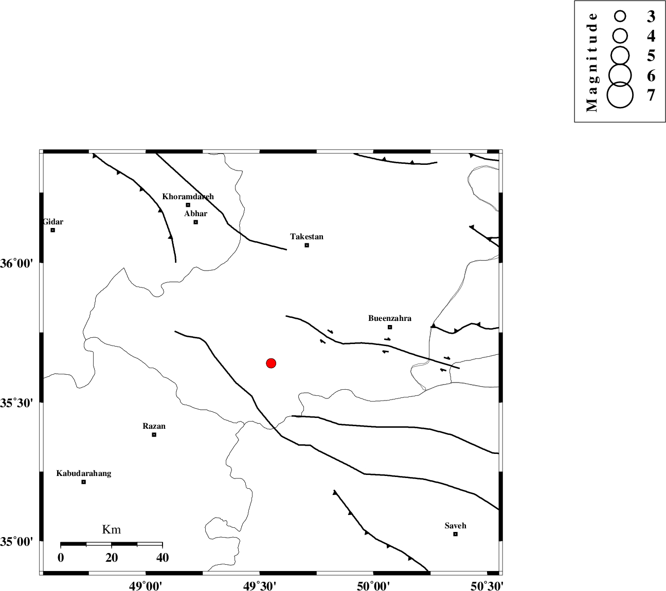
| Location | Lat:35.64 Lon: 49.55 |
| Region | Ghazvin Province, 49 km South-West of Takestan |
Nearest Cities |
|
| 8 km North of Kolanjin, Ghazvin Province | |
| 23 km South West of Danesfahan, Ghazvin Province | |
| 26 km South East of Hoseynabad, Ghazvin Province | |
| 27 km South East of Ab-e garm, Ghazvin Province | |
| 29 km North East of Avaj, Ghazvin Province | |
| Depth | 14 km |
| Agency | |
Faults within 150 km: |
|
| KUSHK_E_NOSRAT_F (Length: 230 km) , Distance to epicenter: 15 km | |
| IPAK_F (Length: 80 km) , Distance to epicenter: 20 km | |
| S_PARANDAK_F (Length: 116 km) , Distance to epicenter: 23 km | |
| Number of Phases | 8 |
| RMS | 0.2 |
| Number of Stations | 7 |
| Error in Latitude | >1.8 km |
| Error in Longitude | 2.1 km |
| Error in Depth | 3.9 km |
Download waveform in seisan format
to download seisan software Click here
to access information about IIEES stations Click here
Amplitude | ||||||||
| UID | Agency | Station | Component | Amplitude | Period | Arrival Time | Proccessing Time | Signal Clip |
| 95934 | IIEES | GHVR | E | 75 | 0.31 | 2015-06-14 04:39:19 | 2015-06-14 06:06:00 | n |
| 95935 | IIEES | DAMV | E | 54.1 | 0.24 | 2015-06-14 04:39:18 | 2015-06-14 06:06:00 | n |
Phase | ||||||||||||
| Agency | Station | Component | Phase Type | Phase Quality | First Motion | Observed Arrival Time | Time Residual | Loc. Flag | Input Weight | Distance | Azimuth | |
| IIEES | THKV | N | Sg | E | 2015-06-14 04:38:47 | -0.2 | y | 124 | 75 | |||
| IIEES | ASAO | Z | Pg | E | 2015-06-14 04:38:32 | -0.06 | y | 129 | 160 | |||
| IIEES | ZNJK | Z | Pg | E | 2015-06-14 04:38:34 | -0.05 | y | 138 | 326 | |||
| IIEES | CHTH | Z | Pg | E | 2015-06-14 04:38:35 | 0.04 | y | 146 | 78 | |||
| IIEES | GHVR | Z | Pn | E | 2015-06-14 04:38:43 | -0.08 | y | 201 | 129 | |||
| IIEES | GHVR | E | Sg | E | 2015-06-14 04:39:08 | 0.03 | y | 201 | 129 | |||
| IIEES | KHMZ | Z | Pn | E | 2015-06-14 04:38:45 | -0.07 | y | 214 | 170 | |||
| IIEES | DAMV | Z | Pn | E | 2015-06-14 04:38:46 | 0.4 | y | 220 | 90 | |||