
Magnitude |
:1.8 |
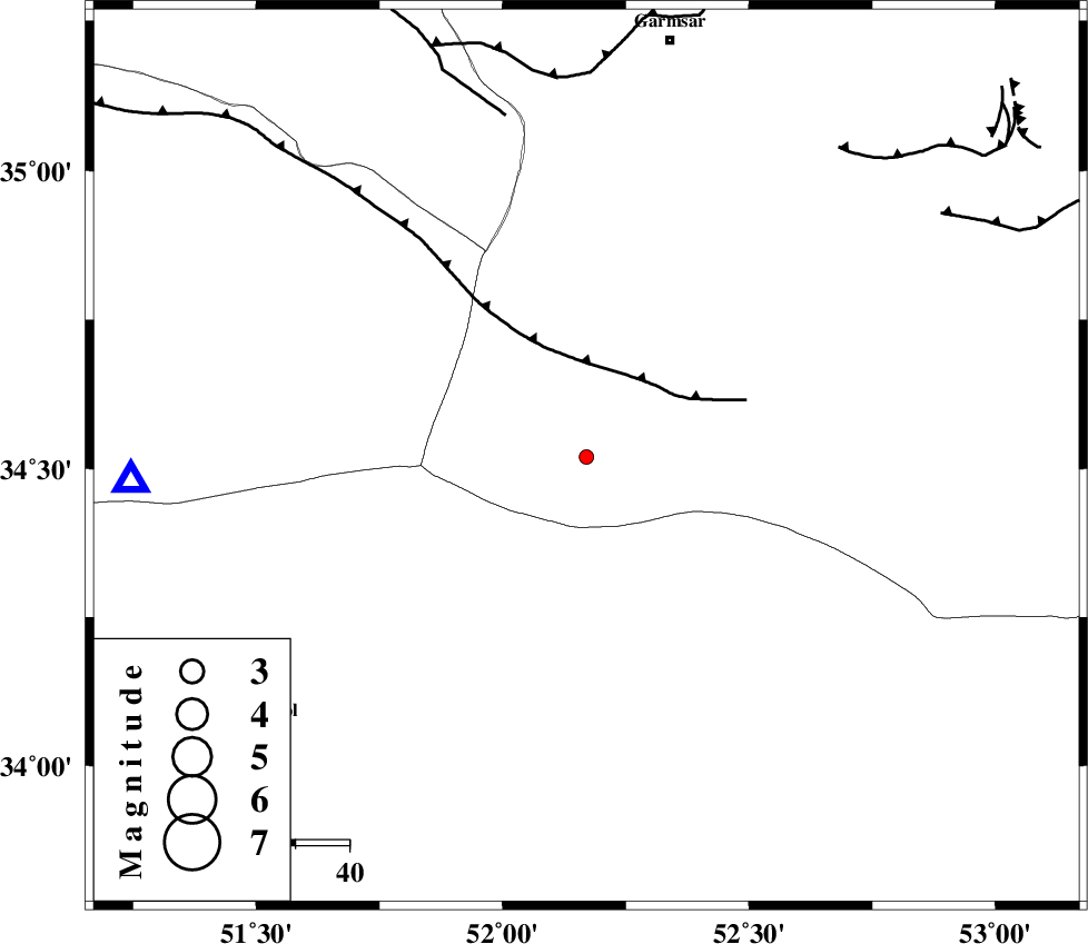
| Date & Time (UTC) | 2015-06-06 00:13:02.7 |
| Date & Time (Local) | 1394/3/16 04:43:02.7 |
| Location | Lat:34.52 Lon: 52.17 |
| Region | Semnan Province, 79 km South-West of Garmsar |
Nearest Cities |
|
| 37 km North East of Marnejab, Esfahan Province | |
| 76 km South West of Gardovan, Semnan Province | |
| 76 km South West of Lajran, Semnan Province | |
| 77 km North East of Abuzeidabad, Esfahan Province | |
| 79 km South West of Garmsar, Semnan Province | |
| Depth | 19 km |
| Agency | |
Faults within 150 km: |
|
| SIAHKUH_F (Length: 154 km) , Distance to epicenter: 17 km | |
| PISHAV_F (Length: 34 km) , Distance to epicenter: 65 km | |
| GARMSAR_F (Length: 77 km) , Distance to epicenter: 71 km | |
| Number of Phases | 6 |
| RMS | 0 |
| Number of Stations | 4 |
| Error in Latitude | >2.3 km |
| Error in Longitude | 3 km |
| Error in Depth | 5.4 km |
Download waveform in seisan format
to download seisan software Click here
to access information about IIEES stations Click here
Amplitude | ||||||||
| UID | Agency | Station | Component | Amplitude | Period | Arrival Time | Proccessing Time | Signal Clip |
| 95891 | IIEES | GHVR | E | 52.5 | 0.51 | 2015-06-06 00:13:34 | 2015-06-06 01:38:00 | n |
| 95892 | IIEES | GHVR | N | 23.6 | 0.52 | 2015-06-06 00:13:46 | 2015-06-06 01:38:00 | n |
Phase | ||||||||||||
| Agency | Station | Component | Phase Type | Phase Quality | First Motion | Observed Arrival Time | Time Residual | Loc. Flag | Input Weight | Distance | Azimuth | |
| IIEES | GHVR | Z | Pg | E | 2015-06-06 00:13:17 | -0.06 | y | 84.7 | 267 | |||
| IIEES | GHVR | E | Sg | E | 2015-06-06 00:13:27 | 0.03 | y | 84.7 | 267 | |||
| IIEES | CHTH | Z | Pn | E | 2015-06-06 00:13:32 | 0.03 | y | 181 | 329 | |||
| IIEES | ASAO | Z | Pn | E | 2015-06-06 00:13:34 | -0.06 | y | 197 | 272 | |||
| IIEES | ASAO | N | Sg | E | 2015-06-06 00:13:57 | 0.03 | y | 197 | 272 | |||
| IIEES | NASN | Z | Pn | E | 2015-06-06 00:13:35 | 0.03 | y | 200 | 163 | |||