
Magnitude |
:3.1 |
| Date & Time (UTC) | 2015-05-30 10:46:16.9 |
| Date & Time (Local) | 1394/3/9 15:16:16.9 |
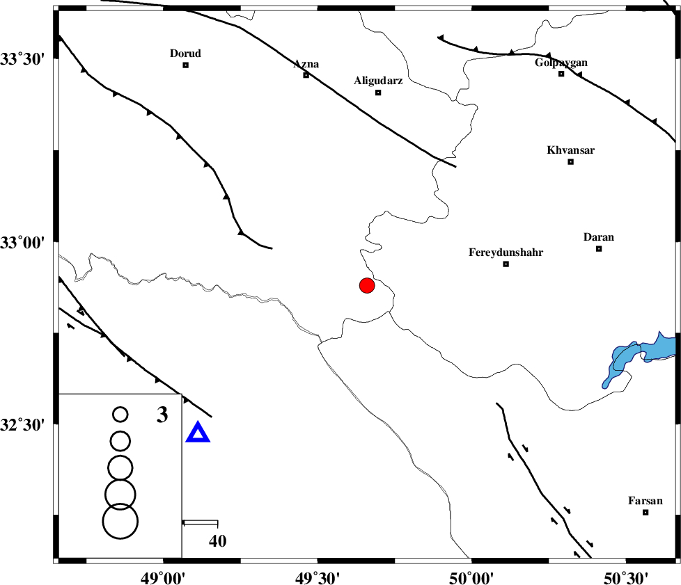
| Location | Lat:32.88 Lon: 49.66 |
| Region | Lorestan Province, 42 km West of Fereydunshahr |
Nearest Cities |
|
| 17 km East of Parchal, Lorestan Province | |
| 19 km North West of Masir, Esfahan Province | |
| 28 km North West of Durak, Chaharmahal Bakhtiari Province | |
| 30 km South West of Farsesh, Lorestan Province | |
| 37 km West of Sibak, Esfahan Province | |
| Depth | 17 km |
| Agency | |
Faults within 150 km: |
|
| HZF4 (Length: 492 km) , Distance to epicenter: 13 km | |
| ZARDKUH_F (Length: 139 km) , Distance to epicenter: 13 km | |
| MAIN_ZAGROS_R_F (Length: 1106 km) , Distance to epicenter: 15 km | |
| Number of Phases | 5 |
| RMS | 0.1 |
| Number of Stations | 3 |
| Error in Latitude | >3.6 km |
| Error in Longitude | 5.5 km |
| Error in Depth | 4.1 km |
Download waveform in seisan format
to download seisan software Click here
to access information about IIEES stations Click here
Amplitude | ||||||||
| UID | Agency | Station | Component | Amplitude | Period | Arrival Time | Proccessing Time | Signal Clip |
| 95824 | IIEES | SHGR | E | 426.5 | 0.72 | 2015-05-30 10:46:54 | 2015-05-30 01:20:00 | n |
| 95825 | IIEES | SHGR | N | 498 | 0.72 | 2015-05-30 10:46:54 | 2015-05-30 01:20:00 | n |
Phase | ||||||||||||
| Agency | Station | Component | Phase Type | Phase Quality | First Motion | Observed Arrival Time | Time Residual | Loc. Flag | Input Weight | Distance | Azimuth | |
| IIEES | SHGR | Z | Pg | E | 2015-05-30 10:46:36 | -0.1 | y | 118 | 224 | |||
| IIEES | SHGR | N | Sg | E | 2015-05-30 10:46:51 | 0.08 | y | 118 | 224 | |||
| IIEES | ASAO | Z | Pg | E | 2015-05-30 10:46:47 | -0.01 | y | 188 | 10 | |||
| IIEES | GHVR | Z | Pn | E | 2015-05-30 10:46:52 | 0 | y | 230 | 39 | |||
| IIEES | GHVR | N | Sg | E | 2015-05-30 10:47:22 | 0.02 | y | 230 | 39 | |||