
Magnitude |
:3 |
| Date & Time (UTC) | 2015-05-23 00:15:17.4 |
| Date & Time (Local) | 1394/3/2 04:45:17.4 |
| Location | Lat:32.59 Lon: 47.7 |
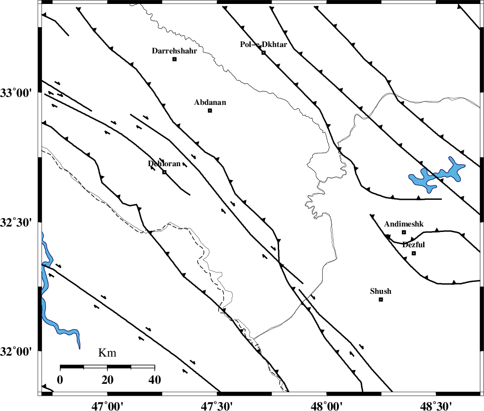
| Region | Ilam Province, 43 km South-East of Dehloran |
Nearest Cities |
|
| 32 km North East of Musian, Ilam Province | |
| 36 km South East of Sarabbagh, Ilam Province | |
| 43 km South East of Dehloran, Ilam Province | |
| 44 km South East of Abdanan, Ilam Province | |
| 52 km West of Hoseinieh, Khoozestan Province | |
| Depth | 41 km |
| Agency | |
Faults within 150 km: |
|
| MFF6 (Length: 144 km) , Distance to epicenter: 14 km | |
| BALARUD_F_Z1 (Length: 87 km) , Distance to epicenter: 27 km | |
| DEZFUL_EMBAYMENT (Length: 228 km) , Distance to epicenter: 43 km | |
| Number of Phases | 7 |
| RMS | 0.1 |
| Number of Stations | 5 |
| Error in Latitude | >1.8 km |
| Error in Longitude | 4.1 km |
| Error in Depth | 4 km |
Download waveform in seisan format
to download seisan software Click here
to access information about IIEES stations Click here
Amplitude | ||||||||
| UID | Agency | Station | Component | Amplitude | Period | Arrival Time | Proccessing Time | Signal Clip |
| 95772 | IIEES | SHGR | N | 343.5 | 0.48 | 2015-05-23 00:15:55 | 2015-05-23 01:47:00 | n |
| 95773 | IIEES | SHGR | E | 574.3 | 0.4 | 2015-05-23 00:15:56 | 2015-05-23 01:47:00 | n |
| 95774 | IIEES | ASAO | N | 30.8 | 0.64 | 2015-05-23 00:16:46 | 2015-05-23 01:47:00 | n |
Phase | ||||||||||||
| Agency | Station | Component | Phase Type | Phase Quality | First Motion | Observed Arrival Time | Time Residual | Loc. Flag | Input Weight | Distance | Azimuth | |
| IIEES | SHGR | Z | Pg | E | 2015-05-23 00:15:37 | 0.07 | y | 117 | 117 | |||
| IIEES | SHGR | N | Sg | E | 2015-05-23 00:15:51 | -0.06 | y | 117 | 117 | |||
| IIEES | KHMZ | Z | Pn | E | 2015-05-23 00:15:53 | 0.19 | y | 247 | 58 | |||
| IIEES | SNGE | Z | Pn | E | 2015-05-23 00:15:57 | -0.04 | y | 280 | 353 | |||
| IIEES | ASAO | Z | Pn | E | 2015-05-23 00:16:00 | 0.01 | y | 307 | 44 | |||
| IIEES | ASAO | N | Sg | E | 2015-05-23 00:16:41 | 0.01 | y | 307 | 44 | |||
| IIEES | GHVR | Z | Pn | E | 2015-05-23 00:16:11 | -0.21 | y | 391 | 57 | |||