
Magnitude |
:2.8 |
| Date & Time (UTC) | 2015-05-21 19:30:41.9 |
| Date & Time (Local) | 1394/3/1 00:00:41.9 |
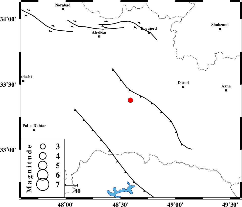
| Location | Lat:33.38 Lon: 48.59 |
| Region | Lorestan Province, 24 km South-East of Khorramabad |
Nearest Cities |
|
| 3 km of Emanabad, Lorestan Province | |
| 15 km East of Kamalvand-e gholamali, Lorestan Province | |
| 17 km South West of Zagheh, Lorestan Province | |
| 22 km East of Daraei, Lorestan Province | |
| 23 km East of Badrabad-e sofla, Lorestan Province | |
| Depth | 38 km |
| Agency | |
Faults within 150 km: |
|
| HZF4 (Length: 492 km) , Distance to epicenter: 14 km | |
| DORUD (Length: 100 km) , Distance to epicenter: 43 km | |
| MAIN_ZAGROS_R_F (Length: 1106 km) , Distance to epicenter: 48 km | |
| Number of Phases | 5 |
| RMS | 0.1 |
| Number of Stations | 4 |
| Error in Latitude | >1.4 km |
| Error in Longitude | 2.5 km |
| Error in Depth | 3.3 km |
Download waveform in seisan format
to download seisan software Click here
to access information about IIEES stations Click here
Amplitude | ||||||||
| UID | Agency | Station | Component | Amplitude | Period | Arrival Time | Proccessing Time | Signal Clip |
| 95763 | IIEES | SNGE | N | 65.7 | 0.32 | 2015-05-21 19:31:47 | 2015-05-21 09:17:00 | n |
Phase | ||||||||||||
| Agency | Station | Component | Phase Type | Phase Quality | First Motion | Observed Arrival Time | Time Residual | Loc. Flag | Input Weight | Distance | Azimuth | |
| IIEES | KHMZ | Z | Pg | E | 2015-05-21 19:31:04 | -0.11 | y | 134 | 72 | |||
| IIEES | SHGR | E | Sg | E | 2015-05-21 19:31:22 | 0.03 | y | 142 | 172 | |||
| IIEES | ASAO | Z | Pn | E | 2015-05-21 19:31:10 | 0.16 | y | 186 | 45 | |||
| IIEES | SNGE | Z | Pn | E | 2015-05-21 19:31:14 | -0.16 | y | 222 | 329 | |||
| IIEES | SNGE | Z | Sg | E | 2015-05-21 19:31:44 | 0.07 | y | 222 | 329 | |||