
Magnitude |
:4.3 |
| Date & Time (UTC) | 2015-05-21 18:04:10.3 |
| Date & Time (Local) | 1394/2/31 22:34:10.3 |
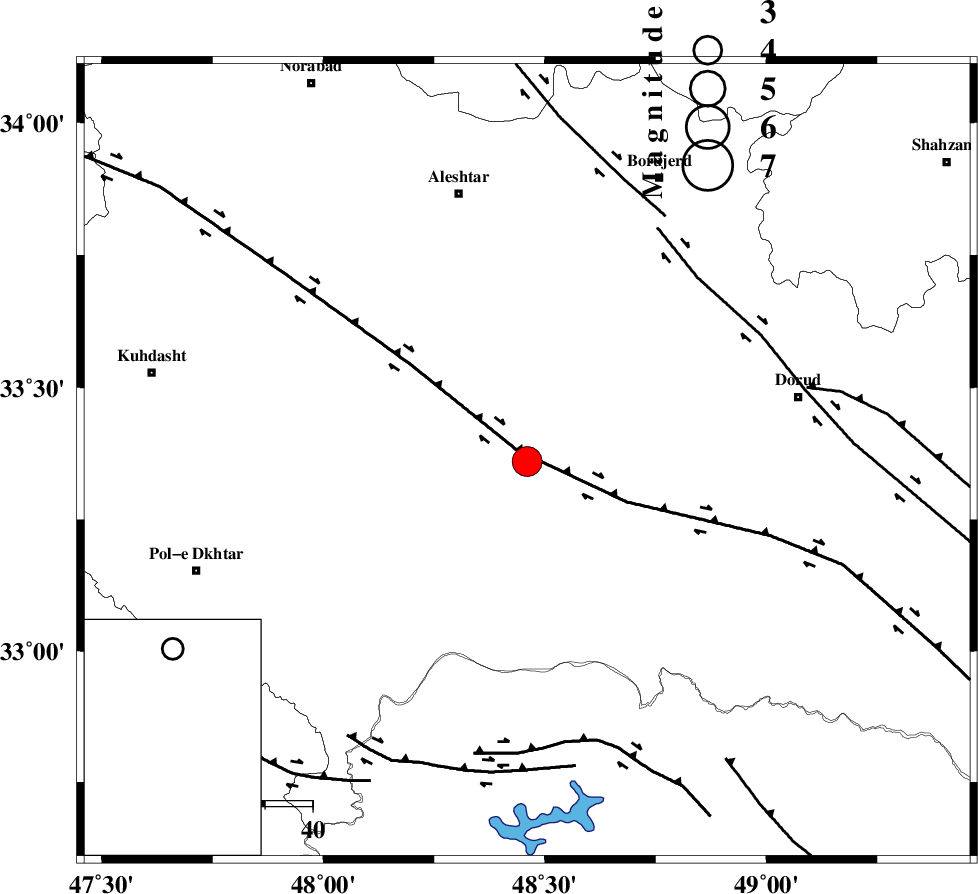
| Location | Lat:33.36 Lon: 48.46 |
| Region | Lorestan Province, 16 km South of Khorramabad |
Nearest Cities |
|
| 10 km of Kamalvand-e gholamali, Lorestan Province | |
| 10 km East of Daraei, Lorestan Province | |
| 14 km East of Badrabad-e sofla, Lorestan Province | |
| 15 km West of Emanabad, Lorestan Province | |
| 17 km South of Khorramabad, Lorestan Province | |
| Depth | 14 km |
| Agency | |
Faults within 150 km: |
|
| HZF4 (Length: 492 km) , Distance to epicenter: 3 km | |
| DORUD (Length: 100 km) , Distance to epicenter: 52 km | |
| NAHAVAND_F (Length: 102 km) , Distance to epicenter: 59 km | |
| Number of Phases | 8 |
| RMS | 0.2 |
| Number of Stations | 8 |
| Error in Latitude | >3.1 km |
| Error in Longitude | 4.8 km |
| Error in Depth | 6.4 km |
Download waveform in seisan format
to download seisan software Click here
to access information about IIEES stations Click here
Amplitude | ||||||||
| UID | Agency | Station | Component | Amplitude | Period | Arrival Time | Proccessing Time | Signal Clip |
| 95761 | IIEES | SHGR | N | 4955.6 | 0.52 | 2015-05-21 18:04:58 | 2015-05-21 07:27:00 | n |
| 95762 | IIEES | ASAO | N | 2938.8 | 0.56 | 2015-05-21 18:05:15 | 2015-05-21 07:27:00 | n |
Phase | ||||||||||||
| Agency | Station | Component | Phase Type | Phase Quality | First Motion | Observed Arrival Time | Time Residual | Loc. Flag | Input Weight | Distance | Azimuth | |
| IIEES | SHGR | Z | Pg | E | 2015-05-21 18:04:34 | 0.02 | y | 143 | 167 | |||
| IIEES | KHMZ | Z | Pg | E | 2015-05-21 18:04:34 | -0.22 | y | 146 | 73 | |||
| IIEES | ASAO | Z | Pg | E | 2015-05-21 18:04:42 | -0.21 | y | 196 | 47 | |||
| IIEES | SNGE | Z | Pn | E | 2015-05-21 18:04:44 | -0.24 | y | 218 | 332 | |||
| IIEES | THKV | Z | Pn | E | 2015-05-21 18:05:02 | 0.09 | y | 360 | 37 | |||
| IIEES | ZNJK | N | Pn | E | 2015-05-21 18:05:04 | 0.19 | y | 368 | 3 | |||
| IIEES | CHTH | Z | Pn | E | 2015-05-21 18:05:04 | 0.26 | y | 374 | 40 | |||
| IIEES | DAMV | Z | Pn | E | 2015-05-21 18:05:09 | 0.25 | y | 409 | 51 | |||