
Magnitude |
:3 |
| Date & Time (UTC) | 2015-05-18 11:03:31.3 |
| Date & Time (Local) | 1394/2/28 15:33:31.3 |
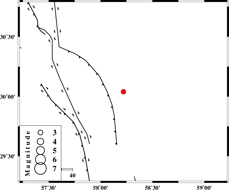
| Location | Lat:30.04 Lon: 58.22 |
| Region | Kerman Province, 105 km North-West of Bam |
Nearest Cities |
|
| 22 km North of Geshit, Kerman Province | |
| 46 km North East of Golbaft, Kerman Province | |
| 56 km South East of Estehkam, Kerman Province | |
| 58 km East of Jushan, Kerman Province | |
| 65 km South East of Shahdad, Kerman Province | |
| Depth | 15 km |
| Agency | |
Faults within 150 km: |
|
| SHAHDAD_F (Length: 108 km) , Distance to epicenter: 15 km | |
| GOLBAF_SIRCH_F (Length: 114 km) , Distance to epicenter: 49 km | |
| GOWK_F (Length: 152 km) , Distance to epicenter: 54 km | |
| Number of Phases | 4 |
| RMS | 0.1 |
| Number of Stations | 4 |
| Error in Latitude | >2.7 km |
| Error in Longitude | 1.5 km |
| Error in Depth | 0 km |
Download waveform in seisan format
to download seisan software Click here
to access information about IIEES stations Click here
Amplitude | ||||||||
| UID | Agency | Station | Component | Amplitude | Period | Arrival Time | Proccessing Time | Signal Clip |
| 95737 | IIEES | BSRN | E | 117.2 | 0.28 | 2015-05-18 11:04:42 | 2015-05-18 12:51:00 | n |
Phase | ||||||||||||
| Agency | Station | Component | Phase Type | Phase Quality | First Motion | Observed Arrival Time | Time Residual | Loc. Flag | Input Weight | Distance | Azimuth | |
| IIEES | KRBR | Z | Pn | E | 2015-05-18 11:03:56 | -0.04 | y | 141 | 268 | |||
| IIEES | BSRN | Z | Pn | E | 2015-05-18 11:04:07 | -0.14 | y | 230 | 22 | |||
| IIEES | ZHSF | Z | Pn | E | 2015-05-18 11:04:10 | 0.04 | y | 251 | 100 | |||
| IIEES | TABS | Z | Pn | E | 2015-05-18 11:04:30 | 0.18 | y | 413 | 346 | |||