
Magnitude |
:3 |
| Date & Time (UTC) | 2015-05-08 03:36:33.3 |
| Date & Time (Local) | 1394/2/18 08:06:33.3 |
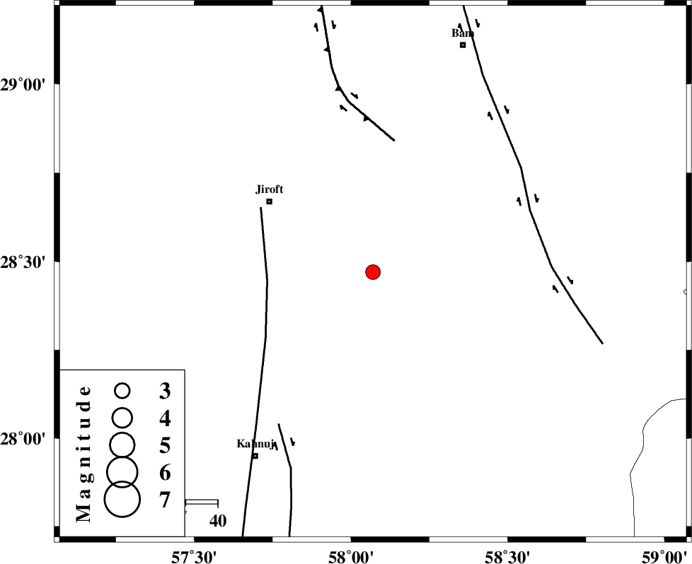
| Location | Lat:28.47 Lon: 58.07 |
| Region | Kerman Province, 39 km South-East of Jiroft |
Nearest Cities |
|
| 13 km North East of Dosari, Kerman Province | |
| 14 km South of Dahane-ye gomrokan, Kerman Province | |
| 17 km North West of Mardehak, Kerman Province | |
| 20 km North East of Aliabad-e qadiri, Kerman Province | |
| 23 km East of Khesrabad, Kerman Province | |
| Depth | 18 km |
| Agency | |
Faults within 150 km: |
|
| SABZEVARAN_F (Length: 190 km) , Distance to epicenter: 33 km | |
| GOWK_F (Length: 152 km) , Distance to epicenter: 42 km | |
| BAM_F (Length: 118 km) , Distance to epicenter: 53 km | |
| Number of Phases | 6 |
| RMS | 0.1 |
| Number of Stations | 4 |
| Error in Latitude | >1.2 km |
| Error in Longitude | 2.3 km |
| Error in Depth | 4.4 km |
Download waveform in seisan format
to download seisan software Click here
to access information about IIEES stations Click here
Amplitude | ||||||||
| UID | Agency | Station | Component | Amplitude | Period | Arrival Time | Proccessing Time | Signal Clip |
| 95604 | IIEES | BNDS | E | 118.3 | 0.56 | 2015-05-08 03:37:42 | 2015-05-08 05:23:00 | n |
Phase | ||||||||||||
| Agency | Station | Component | Phase Type | Phase Quality | First Motion | Observed Arrival Time | Time Residual | Loc. Flag | Input Weight | Distance | Azimuth | |
| IIEES | KRBR | Z | Pn | E | 2015-05-08 03:37:06 | -0.06 | y | 210 | 323 | |||
| IIEES | KRBR | N | Sg | E | 2015-05-08 03:37:33 | 0.03 | y | 210 | 323 | |||
| IIEES | BNDS | Z | Pn | E | 2015-05-08 03:37:08 | 0.03 | y | 221 | 238 | |||
| IIEES | BNDS | E | Sg | E | 2015-05-08 03:37:36 | -0.01 | y | 221 | 238 | |||
| IIEES | ZHSF | Z | Pn | E | 2015-05-08 03:37:17 | 0.08 | y | 292 | 64 | |||
| IIEES | BSRN | Z | Pn | E | 2015-05-08 03:37:30 | -0.07 | y | 401 | 14 | |||