
Magnitude |
:3.2 |
| Date & Time (UTC) | 2015-04-29 01:47:36.6 |
| Date & Time (Local) | 1394/2/9 06:17:36.6 |
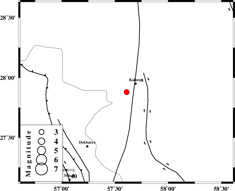
| Location | Lat:27.88 Lon: 57.61 |
| Region | Kerman Province, 11 km Kahnuj |
Nearest Cities |
|
| 11 km of Kahnuj, Kerman Province | |
| 28 km North of Bargah, Kerman Province | |
| 31 km South East of Mehrueye-e paeen, Kerman Province | |
| 33 km North East of Fariab, Hormozgan Province | |
| 35 km North East of Bejogan, Kerman Province | |
| Depth | 14 km |
| Agency | |
Faults within 150 km: |
|
| SABZEVARAN_F (Length: 190 km) , Distance to epicenter: 10 km | |
| JIROFT_F (Length: 144 km) , Distance to epicenter: 20 km | |
| ZENDAN_MINAB_F_Z1 (Length: 183 km) , Distance to epicenter: 68 km | |
| Number of Phases | 5 |
| RMS | 0.1 |
| Number of Stations | 3 |
| Error in Latitude | >2 km |
| Error in Longitude | 4.7 km |
| Error in Depth | 6.5 km |
Download waveform in seisan format
to download seisan software Click here
to access information about IIEES stations Click here
Amplitude | ||||||||
| UID | Agency | Station | Component | Amplitude | Period | Arrival Time | Proccessing Time | Signal Clip |
| 95529 | IIEES | BNDS | E | 431.8 | 0.32 | 2015-04-29 01:48:22 | 2015-04-29 03:05:00 | n |
| 95530 | IIEES | BNDS | N | 347.1 | 0.52 | 2015-04-29 01:48:23 | 2015-04-29 03:05:00 | n |
| 95531 | IIEES | KRBR | N | 113.8 | 0.64 | 2015-04-29 01:48:50 | 2015-04-29 03:05:00 | n |
| 95532 | IIEES | KRBR | E | 150.7 | 0.72 | 2015-04-29 01:48:52 | 2015-04-29 03:05:00 | n |
Phase | ||||||||||||
| Agency | Station | Component | Phase Type | Phase Quality | First Motion | Observed Arrival Time | Time Residual | Loc. Flag | Input Weight | Distance | Azimuth | |
| IIEES | BNDS | Z | Pg | E | 2015-04-29 01:48:01 | -0.02 | y | 152 | 250 | |||
| IIEES | BNDS | N | Sg | E | 2015-04-29 01:48:20 | -0.01 | y | 152 | 250 | |||
| IIEES | KRBR | Z | Pn | E | 2015-04-29 01:48:15 | 0.12 | y | 247 | 341 | |||
| IIEES | KRBR | E | Sg | E | 2015-04-29 01:48:46 | -0.03 | y | 247 | 341 | |||
| IIEES | BSRN | Z | Pn | E | 2015-04-29 01:48:43 | -0.09 | y | 476 | 18 | |||