
Magnitude |
:2.6 |
| Date & Time (UTC) | 2015-04-21 02:37:34.3 |
| Date & Time (Local) | 1394/2/1 07:07:34.3 |
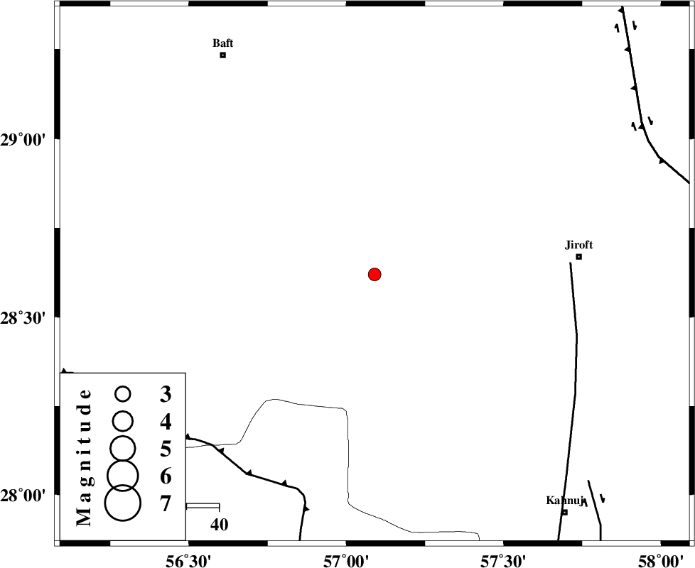
| Location | Lat:28.62 Lon: 57.09 |
| Region | Kerman Province, 64 km West of Jiroft |
Nearest Cities |
|
| 11 km of Dolatabad, Kerman Province | |
| 37 km North East of Sarkhan, Kerman Province | |
| 49 km South West of Eslamabad, Kerman Province | |
| 52 km North West of Hurpasefid, Kerman Province | |
| 59 km South East of Kashkueyeh, Kerman Province | |
| Depth | 17 km |
| Agency | |
Faults within 150 km: |
|
| SABZEVARAN_F (Length: 190 km) , Distance to epicenter: 61 km | |
| MAIN_ZAGROS_R_F (Length: 1106 km) , Distance to epicenter: 71 km | |
| JIROFT_F (Length: 144 km) , Distance to epicenter: 93 km | |
| Number of Phases | 6 |
| RMS | 0.2 |
| Number of Stations | 4 |
| Error in Latitude | >5.2 km |
| Error in Longitude | 4.8 km |
| Error in Depth | 8.8 km |
Download waveform in seisan format
to download seisan software Click here
to access information about IIEES stations Click here
Amplitude | ||||||||
| UID | Agency | Station | Component | Amplitude | Period | Arrival Time | Proccessing Time | Signal Clip |
| 95487 | IIEES | KRBR | N | 86.2 | 0.22 | 2015-04-21 02:38:24 | 2015-04-21 05:41:00 | n |
| 95488 | IIEES | KRBR | E | 92.4 | 0.26 | 2015-04-21 02:38:31 | 2015-04-21 05:41:00 | n |
Phase | ||||||||||||
| Agency | Station | Component | Phase Type | Phase Quality | First Motion | Observed Arrival Time | Time Residual | Loc. Flag | Input Weight | Distance | Azimuth | |
| IIEES | KRBR | Z | Pg | E | 2015-04-21 02:38:00 | 0.1 | y | 154 | 348 | |||
| IIEES | KRBR | E | Sg | E | 2015-04-21 02:38:18 | -0.27 | y | 154 | 348 | |||
| IIEES | BSRN | Z | Pn | E | 2015-04-21 02:38:33 | 0.03 | y | 419 | 27 | |||
| IIEES | YZKH | Z | Pn | E | 2015-04-21 02:38:41 | 0.17 | y | 481 | 331 | |||
| IIEES | YZKH | N | Sg | E | 2015-04-21 02:39:48 | 0.27 | y | 481 | 331 | |||
| IIEES | AHRM | Z | Pn | E | 2015-04-21 02:38:51 | -0.25 | y | 566 | 274 | |||