
Magnitude |
:3.3 |
| Date & Time (UTC) | 2015-04-21 02:08:27.8 |
| Date & Time (Local) | 1394/2/1 06:38:27.8 |
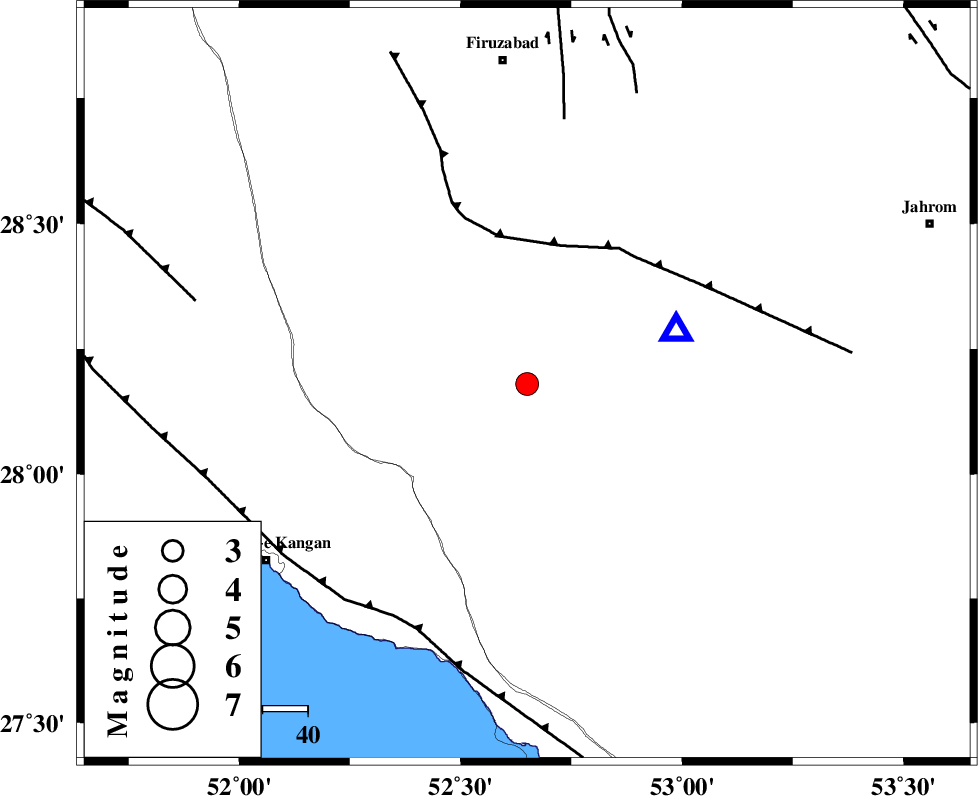
| Location | Lat:28.18 Lon: 52.65 |
| Region | Fars Province, 49 km South-West of Qir va Karzin |
Nearest Cities |
|
| 21 km South of Hengam, Fars Province | |
| 21 km North of Garmesht, Fars Province | |
| 35 km North East of Dolatabad, Fars Province | |
| 48 km South East of Dahrom, Fars Province | |
| 49 km North West of Seyfabad, Fars Province | |
| Depth | 17 km |
| Agency | |
Faults within 150 km: |
|
| QIR_F (Length: 130 km) , Distance to epicenter: 32 km | |
| SABZ_PUSHAN_F_Z1 (Length: 69 km) , Distance to epicenter: 59 km | |
| MFF3 (Length: 292 km) , Distance to epicenter: 59 km | |
| Number of Phases | 4 |
| RMS | 0 |
| Number of Stations | 3 |
| Error in Latitude | >7.4 km |
| Error in Longitude | 8.3 km |
| Error in Depth | 22.2 km |
Download waveform in seisan format
to download seisan software Click here
to access information about IIEES stations Click here
Amplitude | ||||||||
| UID | Agency | Station | Component | Amplitude | Period | Arrival Time | Proccessing Time | Signal Clip |
| 95484 | IIEES | AHRM | N | 519 | 0.6 | 2015-04-21 02:09:23 | 2015-04-21 02:28:00 | n |
| 95485 | IIEES | AHRM | E | 478.9 | 0.44 | 2015-04-21 02:09:24 | 2015-04-21 02:28:00 | n |
Phase | ||||||||||||
| Agency | Station | Component | Phase Type | Phase Quality | First Motion | Observed Arrival Time | Time Residual | Loc. Flag | Input Weight | Distance | Azimuth | |
| IIEES | AHRM | Z | P | E | 2015-04-21 02:08:52 | 0 | y | 153 | 300 | |||
| IIEES | AHRM | E | Sg | E | 2015-04-21 02:09:11 | 0 | y | 153 | 300 | |||
| IIEES | KRBR | Z | Pn | E | 2015-04-21 02:09:31 | 0.01 | y | 447 | 62 | |||
| IIEES | YZKH | Z | Pn | E | 2015-04-21 02:09:37 | 0 | y | 503 | 21 | |||