
Magnitude |
:3.6 |
| Date & Time (UTC) | 2015-04-20 20:37:36.2 |
| Date & Time (Local) | 1394/2/1 01:07:36.2 |
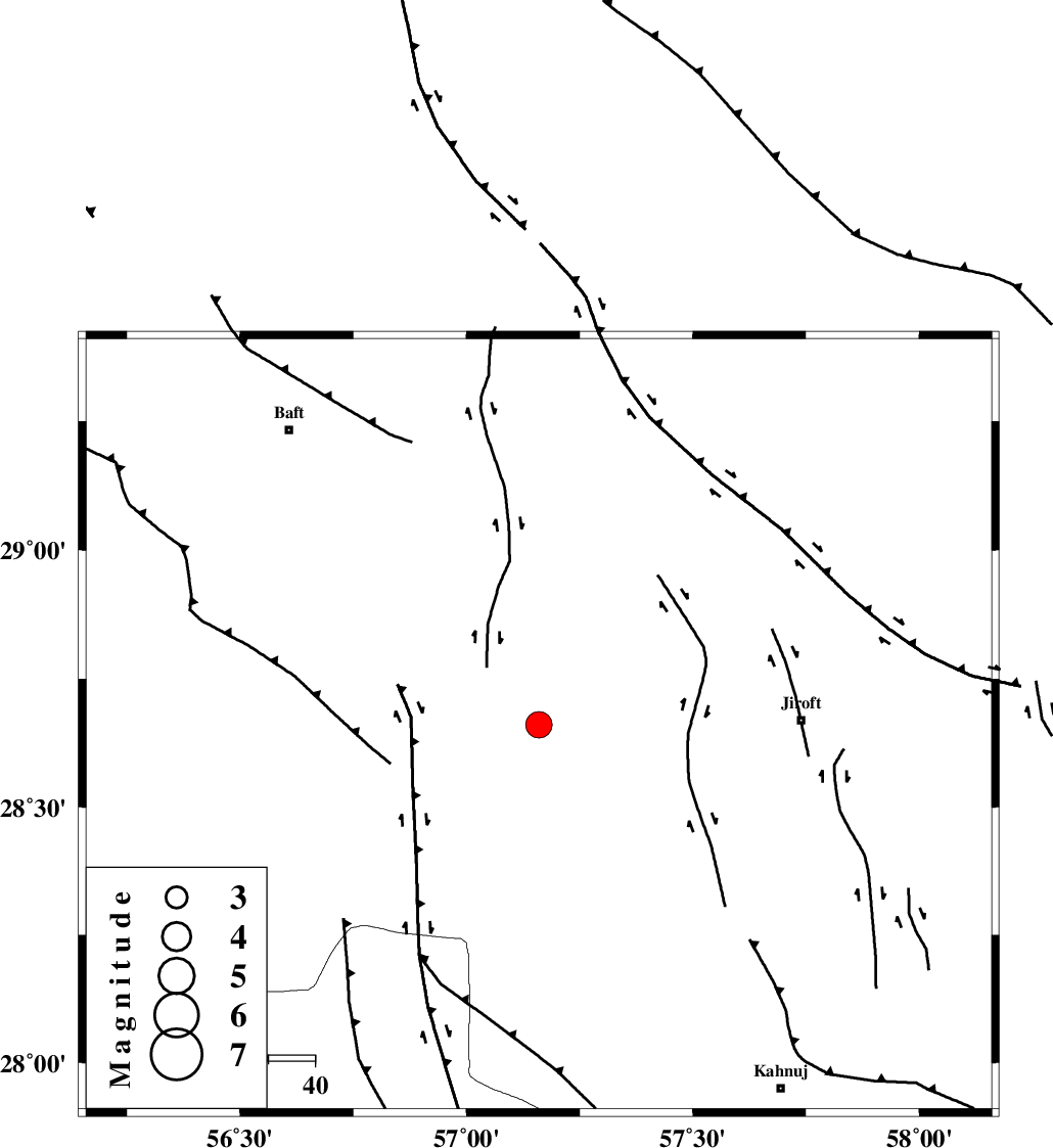
| Location | Lat:28.66 Lon: 57.16 |
| Region | Kerman Province, 57 km West of Jiroft |
Nearest Cities |
|
| 10 km of Dolatabad, Kerman Province | |
| 42 km South West of Eslamabad, Kerman Province | |
| 45 km North East of Sarkhan, Kerman Province | |
| 54 km North West of Khatunabad-e zangian, Kerman Province | |
| 54 km North West of Hurpasefid, Kerman Province | |
| Depth | 14 km |
| Agency | |
Faults within 150 km: |
|
| SABZEVARAN_F (Length: 190 km) , Distance to epicenter: 54 km | |
| MAIN_ZAGROS_R_F (Length: 1106 km) , Distance to epicenter: 78 km | |
| GOWK_F (Length: 152 km) , Distance to epicenter: 86 km | |
| Number of Phases | 5 |
| RMS | 0.1 |
| Number of Stations | 4 |
| Error in Latitude | >4.5 km |
| Error in Longitude | 2.8 km |
| Error in Depth | 6.4 km |
Download waveform in seisan format
to download seisan software Click here
to access information about IIEES stations Click here
Amplitude | ||||||||
| UID | Agency | Station | Component | Amplitude | Period | Arrival Time | Proccessing Time | Signal Clip |
| 95482 | IIEES | KRBR | E | 949.3 | 0.32 | 2015-04-20 20:38:30 | 2015-04-20 10:15:00 | n |
| 95483 | IIEES | AHRM | N | 33.3 | 0.4 | 2015-04-20 20:40:02 | 2015-04-20 10:15:00 | n |
Phase | ||||||||||||
| Agency | Station | Component | Phase Type | Phase Quality | First Motion | Observed Arrival Time | Time Residual | Loc. Flag | Input Weight | Distance | Azimuth | |
| IIEES | KRBR | Z | Pg | E | 2015-04-20 20:38:01 | -0.14 | y | 151 | 345 | |||
| IIEES | KRBR | E | Sg | E | 2015-04-20 20:38:19 | 0.04 | y | 151 | 345 | |||
| IIEES | BSRN | Z | Pn | E | 2015-04-20 20:38:35 | -0.04 | y | 412 | 27 | |||
| IIEES | BSRN | N | Sg | E | 2015-04-20 20:39:31 | 0.05 | y | 412 | 27 | |||
| IIEES | YZKH | Z | Pn | E | 2015-04-20 20:38:43 | 0.14 | y | 481 | 330 | |||