
Magnitude |
:3 |
| Date & Time (UTC) | 2015-04-16 07:11:57.0 |
| Date & Time (Local) | 1394/1/27 11:41:57.0 |
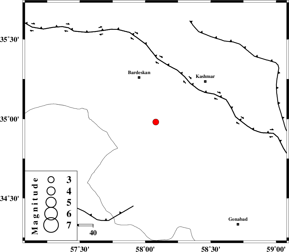
| Location | Lat:34.98 Lon: 58.08 |
| Region | Khorasan(center) Province, 33 km South-East of Bardeskan |
Nearest Cities |
|
| 23 km South East of Shahrabad, Khorasan(center) Province | |
| 25 km South of Konder, Khorasan(center) Province | |
| 33 km South East of Bardeskan, Khorasan(center) Province | |
| 38 km South West of Khalilabad, Khorasan(center) Province | |
| 38 km North West of Yoonesi, Khorasan(center) Province | |
| Depth | 16 km |
| Agency | |
Faults within 150 km: |
|
| NAINI_F (Length: 342 km) , Distance to epicenter: 7 km | |
| MEHDIABAD_F (Length: 64 km) , Distance to epicenter: 12 km | |
| KASHMAR_F (Length: 91 km) , Distance to epicenter: 18 km | |
| Number of Phases | 6 |
| RMS | 0.1 |
| Number of Stations | 4 |
| Error in Latitude | >2.6 km |
| Error in Longitude | 1.3 km |
| Error in Depth | 4.3 km |
Download waveform in seisan format
to download seisan software Click here
to access information about IIEES stations Click here
Amplitude | ||||||||
| UID | Agency | Station | Component | Amplitude | Period | Arrival Time | Proccessing Time | Signal Clip |
| 95439 | IIEES | SHRT | E | 93.7 | 0.32 | 2015-04-16 07:13:10 | 2015-04-16 07:34:00 | n |
Phase | ||||||||||||
| Agency | Station | Component | Phase Type | Phase Quality | First Motion | Observed Arrival Time | Time Residual | Loc. Flag | Input Weight | Distance | Azimuth | |
| IIEES | SHRO | Z | Pn | E | 2015-04-16 07:12:31 | 0.03 | y | 220 | 302 | |||
| IIEES | SHRT | Z | Pn | E | 2015-04-16 07:12:35 | -0.13 | y | 251 | 125 | |||
| IIEES | SHRT | E | Sg | E | 2015-04-16 07:13:08 | 0.03 | y | 251 | 125 | |||
| IIEES | BSRN | Z | Pn | E | 2015-04-16 07:12:47 | 0.11 | y | 348 | 164 | |||
| IIEES | YZKH | Z | Pn | E | 2015-04-16 07:12:58 | 0.02 | y | 433 | 229 | |||
| IIEES | YZKH | E | Sg | E | 2015-04-16 07:13:57 | -0.04 | y | 433 | 229 | |||