
Magnitude |
:3.8 |
| Date & Time (UTC) | 2015-03-30 11:47:32.9 |
| Date & Time (Local) | 1394/1/10 16:17:32.9 |
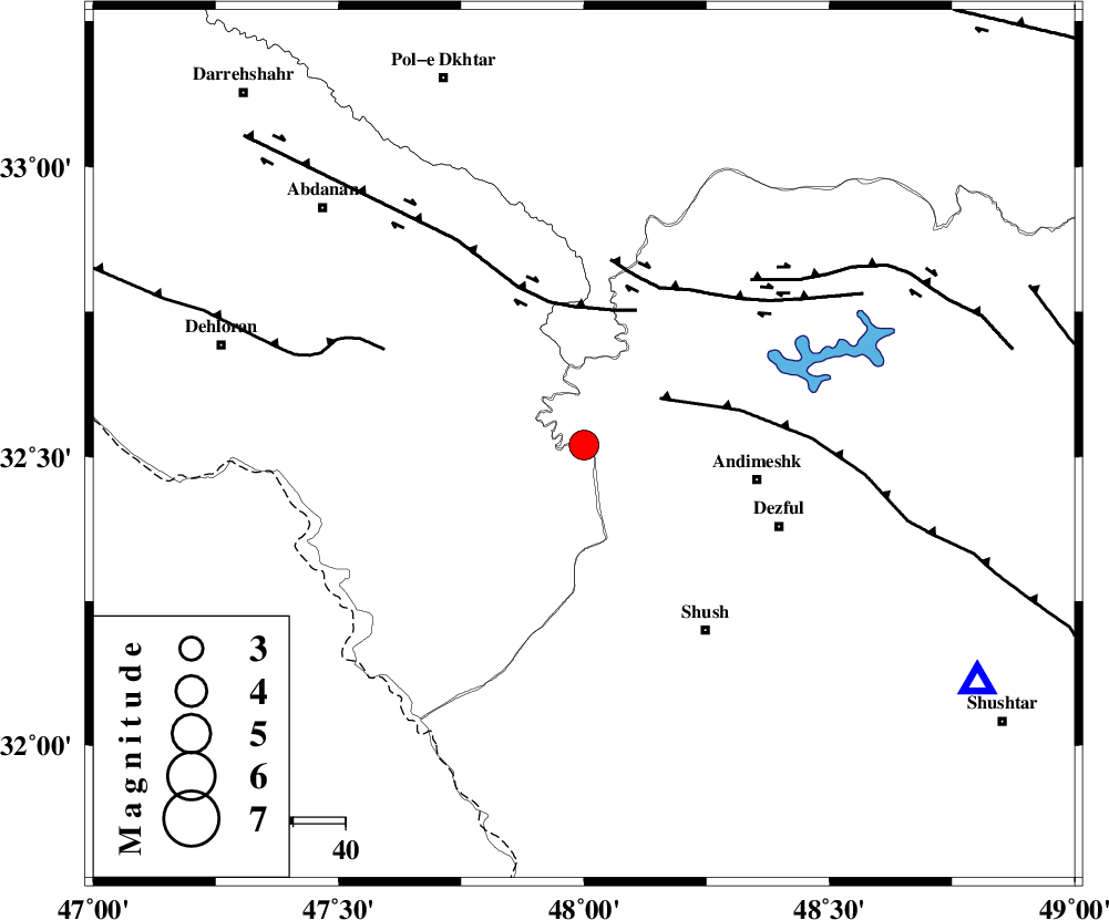
| Location | Lat:32.52 Lon: 48 |
| Region | Ilam Province, 34 km West of Andimeshk |
Nearest Cities |
|
| 29 km South West of Hoseinieh, Khoozestan Province | |
| 34 km North West of Andimeshk, Khoozestan Province | |
| 34 km South West of Bidruyeh, Khoozestan Province | |
| 41 km North West of Dezful, Khoozestan Province | |
| 42 km South West of Sorkhakan, Khoozestan Province | |
| Depth | 14 km |
| Agency | |
Faults within 150 km: |
|
| DEZFUL_EMBAYMENT (Length: 228 km) , Distance to epicenter: 17 km | |
| BALARUD_F_Z1 (Length: 87 km) , Distance to epicenter: 27 km | |
| BALARUD_F_Z3 (Length: 53 km) , Distance to epicenter: 34 km | |
| Number of Phases | 6 |
| RMS | 0.2 |
| Number of Stations | 4 |
| Error in Latitude | >2.2 km |
| Error in Longitude | 9.1 km |
| Error in Depth | 8.3 km |
Download waveform in seisan format
to download seisan software Click here
to access information about IIEES stations Click here
Amplitude | ||||||||
| UID | Agency | Station | Component | Amplitude | Period | Arrival Time | Proccessing Time | Signal Clip |
| 95299 | IIEES | SHGR | E | 3827.3 | 0.48 | 2015-03-30 11:48:03 | 2015-03-30 12:10:00 | n |
| 95300 | IIEES | SHGR | N | 3027.5 | 0.48 | 2015-03-30 11:48:12 | 2015-03-30 12:10:00 | n |
Phase | ||||||||||||
| Agency | Station | Component | Phase Type | Phase Quality | First Motion | Observed Arrival Time | Time Residual | Loc. Flag | Input Weight | Distance | Azimuth | |
| IIEES | SHGR | Z | Pg | E | 2015-03-30 11:47:47 | -0.13 | y | 88.1 | 121 | |||
| IIEES | SHGR | E | Sg | E | 2015-03-30 11:47:59 | 0.17 | y | 88.1 | 121 | |||
| IIEES | ASAO | Z | Pn | E | 2015-03-30 11:48:17 | 0.19 | y | 293 | 39 | |||
| IIEES | ASAO | N | Sg | E | 2015-03-30 11:48:55 | -0.06 | y | 293 | 39 | |||
| IIEES | NASN | Z | Pn | E | 2015-03-30 11:48:36 | -0.4 | y | 452 | 85 | |||
| IIEES | CHTH | Z | Pn | E | 2015-03-30 11:48:39 | 0.19 | y | 474 | 37 | |||