
Magnitude |
:4.3 |
| Date & Time (UTC) | 2015-03-30 07:04:04.3 |
| Date & Time (Local) | 1394/1/10 11:34:04.3 |
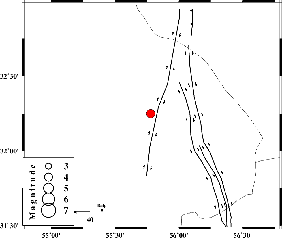
| Location | Lat:32.24 Lon: 55.79 |
| Region | Yazd Province, 80 km North-East of Bafq |
Nearest Cities |
|
| 47 km North West of Behabad, Yazd Province | |
| 56 km North of Kushk, Yazd Province | |
| 63 km North West of Benestan, Yazd Province | |
| 76 km North West of Asfih, Yazd Province | |
| 76 km North East of Mobarake, Yazd Province | |
| Depth | 17 km |
| Agency | |
Faults within 150 km: |
|
| SARBALA_F (Length: 92 km) , Distance to epicenter: 4 km | |
| JAFARABAD_F (Length: 60 km) , Distance to epicenter: 16 km | |
| KUHBANAN_F (Length: 189 km) , Distance to epicenter: 24 km | |
| Number of Phases | 6 |
| RMS | 0.2 |
| Number of Stations | 5 |
| Error in Latitude | >6.4 km |
| Error in Longitude | 4.7 km |
| Error in Depth | 8.5 km |
Download waveform in seisan format
to download seisan software Click here
to access information about IIEES stations Click here
Amplitude | ||||||||
| UID | Agency | Station | Component | Amplitude | Period | Arrival Time | Proccessing Time | Signal Clip |
| 95298 | IIEES | KRBR | N | 1580.1 | 0.62 | 2015-03-30 07:05:22 | 2015-03-30 08:02:00 | n |
Phase | ||||||||||||
| Agency | Station | Component | Phase Type | Phase Quality | First Motion | Observed Arrival Time | Time Residual | Loc. Flag | Input Weight | Distance | Azimuth | |
| IIEES | YZKH | Z | Pg | E | 2015-03-30 07:04:23 | 0.38 | y | 114 | 279 | |||
| IIEES | YZKH | E | Sg | E | 2015-03-30 07:04:37 | -0.36 | y | 114 | 279 | |||
| IIEES | KRBR | Z | Pn | E | 2015-03-30 07:04:45 | 0.04 | y | 267 | 159 | |||
| IIEES | NASN | Z | Pn | E | 2015-03-30 07:04:47 | 0.02 | y | 287 | 283 | |||
| IIEES | BSRN | Z | Pn | E | 2015-03-30 07:04:50 | -0.23 | y | 317 | 95 | |||
| IIEES | GHVR | Z | Pn | E | 2015-03-30 07:05:12 | 0.19 | y | 490 | 302 | |||