
Magnitude |
:2.9 |
| Date & Time (UTC) | 2015-02-22 10:32:42.6 |
| Date & Time (Local) | 1393/12/3 14:02:42.6 |
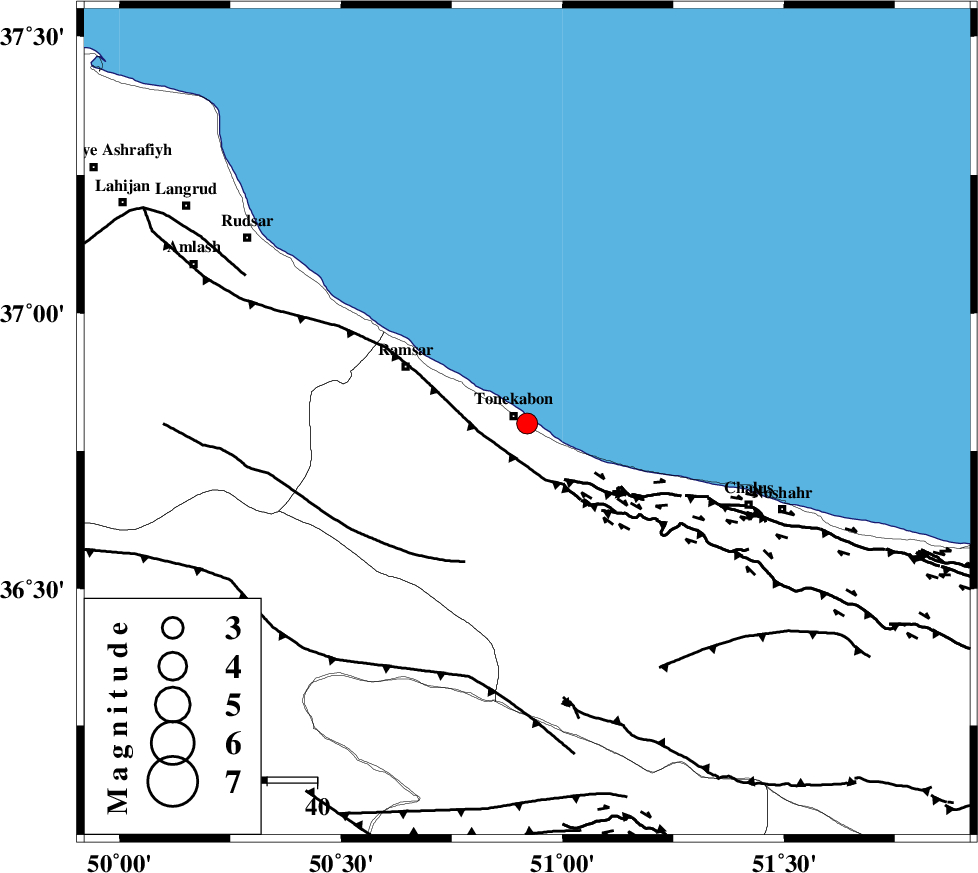
| Location | Lat:36.8 Lon: 50.92 |
| Region | Mazandaran Province, 3 km Tonekabon |
Nearest Cities |
|
| 3 km North of Khorramabad, Mazandaran Province | |
| 3 km of Tonekabon, Mazandaran Province | |
| 8 km North of Soleymanabad, Mazandaran Province | |
| 9 km North of Kanza, Mazandaran Province | |
| 19 km North West of Abbasabad, Mazandaran Province | |
| Depth | 14 km |
| Agency | |
Faults within 150 km: |
|
| KHAZAR_F (Length: 523 km) , Distance to epicenter: 10 km | |
| N_ALBORZ_F (Length: 360 km) , Distance to epicenter: 12 km | |
| BONAN_F (Length: 74 km) , Distance to epicenter: 31 km | |
| Number of Phases | 7 |
| RMS | 0.1 |
| Number of Stations | 5 |
| Error in Latitude | >2.4 km |
| Error in Longitude | 2.9 km |
| Error in Depth | 4.4 km |
Download waveform in seisan format
to download seisan software Click here
to access information about IIEES stations Click here
Amplitude | ||||||||
| UID | Agency | Station | Component | Amplitude | Period | Arrival Time | Proccessing Time | Signal Clip |
| 95079 | IIEES | THKV | N | 388 | 0.28 | 2015-02-22 10:33:13 | 2015-02-22 11:51:00 | n |
Phase | ||||||||||||
| Agency | Station | Component | Phase Type | Phase Quality | First Motion | Observed Arrival Time | Time Residual | Loc. Flag | Input Weight | Distance | Azimuth | |
| IIEES | THKV | Z | Pg | E | 2015-02-22 10:32:59 | 0.17 | y | 97.8 | 182 | |||
| IIEES | THKV | N | Sg | E | 2015-02-22 10:33:11 | 0.04 | y | 97.8 | 182 | |||
| IIEES | DAMV | Z | Pg | E | 2015-02-22 10:33:09 | -0.1 | y | 160 | 144 | |||
| IIEES | ZNJK | Z | Pn | E | 2015-02-22 10:33:15 | -0.04 | y | 200 | 267 | |||
| IIEES | GHVR | Z | Pn | E | 2015-02-22 10:33:22 | -0.05 | y | 259 | 173 | |||
| IIEES | ASAO | Z | Pn | E | 2015-02-22 10:33:23 | 0.09 | y | 262 | 198 | |||
| IIEES | ASAO | N | Sg | E | 2015-02-22 10:33:56 | -0.12 | y | 262 | 198 | |||