
Magnitude |
:3.8 |
| Date & Time (UTC) | 2015-02-22 08:18:22.7 |
| Date & Time (Local) | 1393/12/3 11:48:22.7 |
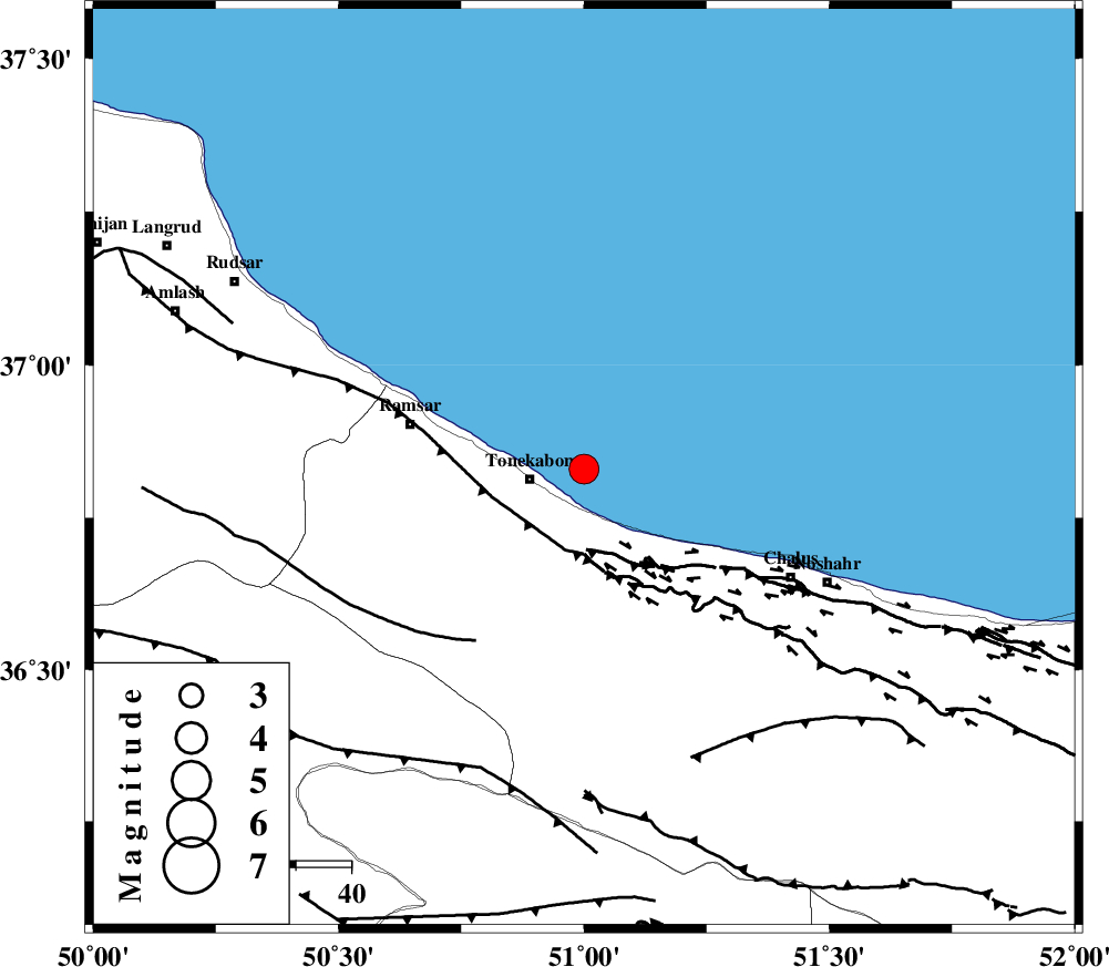
| Location | Lat:36.83 Lon: 51 |
| Region | Caspian Sea, 10 km East of Tonekabon |
Nearest Cities |
|
| 10 km North East of Tonekabon, Mazandaran Province | |
| 11 km North East of Khorramabad, Mazandaran Province | |
| 12 km North of Kanza, Mazandaran Province | |
| 15 km North East of Soleymanabad, Mazandaran Province | |
| 15 km North West of Abbasabad, Mazandaran Province | |
| Depth | 18 km |
| Agency | |
Faults within 150 km: |
|
| KHAZAR_F (Length: 523 km) , Distance to epicenter: 15 km | |
| N_ALBORZ_F (Length: 360 km) , Distance to epicenter: 15 km | |
| BONAN_F (Length: 74 km) , Distance to epicenter: 37 km | |
| Number of Phases | 7 |
| RMS | 0.1 |
| Number of Stations | 5 |
| Error in Latitude | >5.5 km |
| Error in Longitude | 3.5 km |
| Error in Depth | 3.6 km |
Download waveform in seisan format
to download seisan software Click here
to access information about IIEES stations Click here
Amplitude | ||||||||
| UID | Agency | Station | Component | Amplitude | Period | Arrival Time | Proccessing Time | Signal Clip |
| 95076 | IIEES | THKV | N | 3912.9 | 0.28 | 2015-02-22 08:18:54 | 2015-02-22 11:51:00 | n |
| 95077 | IIEES | DAMV | E | 2189.3 | 1.04 | 2015-02-22 08:19:15 | 2015-02-22 11:51:00 | n |
| 95078 | IIEES | ASAO | N | 266.6 | 0.28 | 2015-02-22 08:19:38 | 2015-02-22 11:51:00 | n |
Phase | ||||||||||||
| Agency | Station | Component | Phase Type | Phase Quality | First Motion | Observed Arrival Time | Time Residual | Loc. Flag | Input Weight | Distance | Azimuth | |
| IIEES | THKV | Z | Pg | E | 2015-02-22 08:18:40 | 0.26 | y | 102 | 186 | |||
| IIEES | DAMV | Z | Pg | E | 2015-02-22 08:18:49 | -0.05 | y | 159 | 146 | |||
| IIEES | DAMV | E | Sg | E | 2015-02-22 08:19:08 | -0.1 | y | 159 | 146 | |||
| IIEES | ZNJK | Z | Pn | E | 2015-02-22 08:18:56 | 0.1 | y | 207 | 266 | |||
| IIEES | ZNJK | N | Sg | E | 2015-02-22 08:19:21 | -0.12 | y | 207 | 266 | |||
| IIEES | GHVR | Z | Pn | E | 2015-02-22 08:19:02 | -0.02 | y | 262 | 175 | |||
| IIEES | ASAO | Z | Pn | E | 2015-02-22 08:19:03 | -0.07 | y | 268 | 199 | |||