
Magnitude |
:2.8 |
| Date & Time (UTC) | 2015-01-30 10:28:02.8 |
| Date & Time (Local) | 1393/11/10 13:58:02.8 |
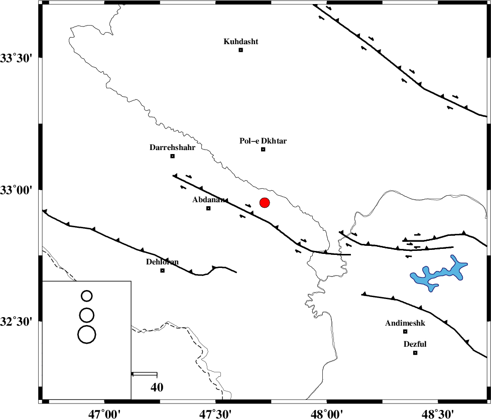
| Location | Lat:32.95 Lon: 47.72 |
| Region | Ilam Province, 23 km South of Pol-e dokhtar |
Nearest Cities |
|
| 15 km North East of Sarabbagh, Ilam Province | |
| 17 km South of Sarab hammam, Lorestan Province | |
| 23 km South of Pol-e dokhtar, Lorestan Province | |
| 24 km North East of Abdanan, Ilam Province | |
| 33 km South of Morani, Lorestan Province | |
| Depth | 14 km |
| Agency | |
Faults within 150 km: |
|
| BALARUD_F_Z1 (Length: 87 km) , Distance to epicenter: 9 km | |
| MFF6 (Length: 144 km) , Distance to epicenter: 32 km | |
| BALARUD_F_Z3 (Length: 53 km) , Distance to epicenter: 34 km | |
| Number of Phases | 6 |
| RMS | 0.2 |
| Number of Stations | 4 |
| Error in Latitude | >2.2 km |
| Error in Longitude | 9.7 km |
| Error in Depth | 8.4 km |
Download waveform in seisan format
to download seisan software Click here
to access information about IIEES stations Click here
Amplitude | ||||||||
| UID | Agency | Station | Component | Amplitude | Period | Arrival Time | Proccessing Time | Signal Clip |
| 94901 | IIEES | SHGR | E | 161.5 | 0.68 | 2015-01-30 10:28:46 | 2015-01-30 11:02:00 | n |
| 94902 | IIEES | SHGR | N | 182.4 | 0.56 | 2015-01-30 10:28:50 | 2015-01-30 11:02:00 | n |
Phase | ||||||||||||
| Agency | Station | Component | Phase Type | Phase Quality | First Motion | Observed Arrival Time | Time Residual | Loc. Flag | Input Weight | Distance | Azimuth | |
| IIEES | SHGR | Z | Pg | E | 2015-01-30 10:28:25 | -0.07 | y | 138 | 132 | |||
| IIEES | SHGR | E | Sg | E | 2015-01-30 10:28:42 | 0.05 | y | 138 | 132 | |||
| IIEES | KHMZ | Z | Pn | E | 2015-01-30 10:28:39 | 0.18 | y | 227 | 67 | |||
| IIEES | ASAO | Z | Pn | E | 2015-01-30 10:28:45 | 0.21 | y | 278 | 50 | |||
| IIEES | ASAO | E | Sg | E | 2015-01-30 10:29:21 | -0.02 | y | 278 | 50 | |||
| IIEES | GHVR | Z | Pn | E | 2015-01-30 10:28:55 | -0.41 | y | 369 | 62 | |||