
Magnitude |
:3.2 |
| Date & Time (UTC) | 2015-01-26 08:28:47.4 |
| Date & Time (Local) | 1393/11/6 11:58:47.4 |
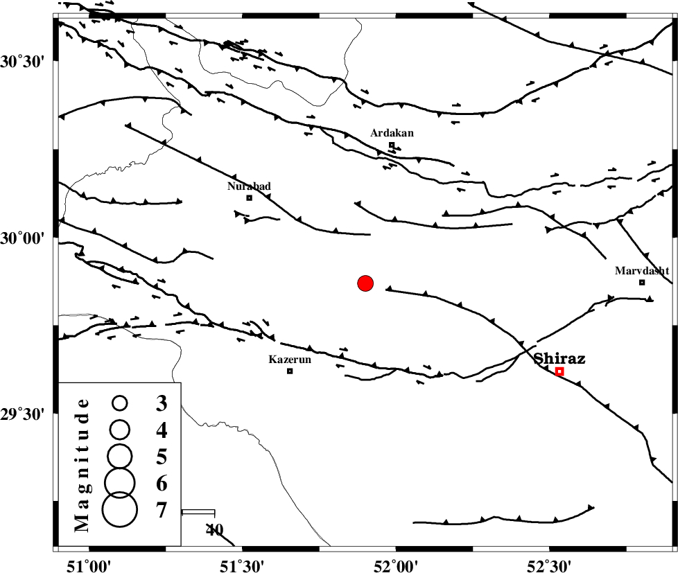
| Location | Lat:29.87 Lon: 51.9 |
| Region | Fars Province, 44 km South of Ardakan |
Nearest Cities |
|
| 21 km North East of Nodan, Fars Province | |
| 27 km North East of Seyyed hasan, Fars Province | |
| 31 km North of Kalani, Fars Province | |
| 36 km North East of Kazerun, Fars Province | |
| 38 km North East of Deris, Fars Province | |
| Depth | 6 km |
| Agency | |
Faults within 150 km: |
|
| KAREBASS_F (Length: 98 km) , Distance to epicenter: 15 km | |
| KAZERUN_F (Length: 96 km) , Distance to epicenter: 29 km | |
| HZF3 (Length: 197 km) , Distance to epicenter: 41 km | |
| Number of Phases | 5 |
| RMS | 0.1 |
| Number of Stations | 4 |
| Error in Latitude | >3.3 km |
| Error in Longitude | 3.7 km |
| Error in Depth | 11 km |
Download waveform in seisan format
to download seisan software Click here
to access information about IIEES stations Click here
Amplitude | ||||||||
| UID | Agency | Station | Component | Amplitude | Period | Arrival Time | Proccessing Time | Signal Clip |
| 94878 | IIEES | AHRM | N | 420.1 | 0.5 | 2015-01-26 08:29:29 | 2015-01-26 10:44:00 | n |
| 94879 | IIEES | KRBR | E | 33.4 | 0.79 | 2015-01-26 08:30:57 | 2015-01-26 10:44:00 | n |
| 94880 | IIEES | KRBR | N | 27.1 | 0.48 | 2015-01-26 08:31:03 | 2015-01-26 10:44:00 | n |
Phase | ||||||||||||
| Agency | Station | Component | Phase Type | Phase Quality | First Motion | Observed Arrival Time | Time Residual | Loc. Flag | Input Weight | Distance | Azimuth | |
| IIEES | AHRM | Z | Pg | E | 2015-01-26 08:29:09 | 0 | y | 126 | 208 | |||
| IIEES | AHRM | N | Sg | E | 2015-01-26 08:29:25 | -0.01 | y | 126 | 208 | |||
| IIEES | NASN | Z | Pn | E | 2015-01-26 08:29:37 | -0.1 | y | 336 | 15 | |||
| IIEES | KRBR | Z | Pn | E | 2015-01-26 08:29:54 | 0.04 | y | 470 | 87 | |||
| IIEES | ASAO | Z | P | E | 2015-01-26 08:30:04 | 0.07 | y | 548 | 342 | |||