
Magnitude |
:3.3 |
| Date & Time (UTC) | 2014-12-19 03:23:17.3 |
| Date & Time (Local) | 1393/9/28 06:53:17.3 |
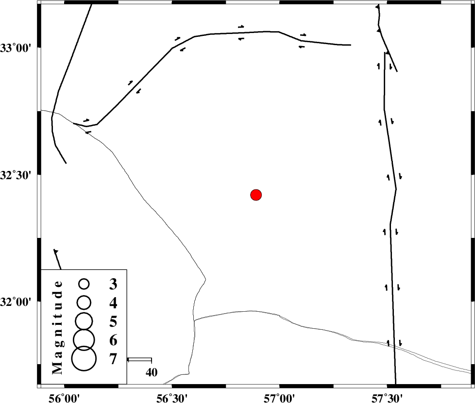
| Location | Lat:32.42 Lon: 56.89 |
| Region | Yazd Province, 131 km South of Tabas |
Nearest Cities |
|
| 61 km North West of Hoz-e qorban, Yazd Province | |
| 102 km North East of Behabad, Yazd Province | |
| 103 km South West of Arababad, Yazd Province | |
| 104 km North East of Asfih, Yazd Province | |
| 108 km North East of Benestan, Yazd Province | |
| Depth | 18 km |
| Agency | |
Faults within 150 km: |
|
| NAYBAND_F (Length: 258 km) , Distance to epicenter: 60 km | |
| CHESHMEH_ROSTAM_ (Length: 142 km) , Distance to epicenter: 70 km | |
| ESFARDIAR_F (Length: 94 km) , Distance to epicenter: 82 km | |
| Number of Phases | 6 |
| RMS | 0.2 |
| Number of Stations | 5 |
| Error in Latitude | >4.9 km |
| Error in Longitude | 2.9 km |
| Error in Depth | 9.7 km |
Download waveform in seisan format
to download seisan software Click here
to access information about IIEES stations Click here
Amplitude | ||||||||
| UID | Agency | Station | Component | Amplitude | Period | Arrival Time | Proccessing Time | Signal Clip |
| 94555 | IIEES | BSRN | E | 219.2 | 0.28 | 2014-12-19 03:24:21 | 2014-12-19 03:51:00 | n |
Phase | ||||||||||||
| Agency | Station | Component | Phase Type | Phase Quality | First Motion | Observed Arrival Time | Time Residual | Loc. Flag | Input Weight | Distance | Azimuth | |
| IIEES | TABS | Z | Pg | E | 2014-12-19 03:23:40 | 0.05 | y | 138 | 9 | |||
| IIEES | YZKH | Z | Pn | E | 2014-12-19 03:23:51 | -0.12 | y | 217 | 270 | |||
| IIEES | BSRN | Z | Pn | E | 2014-12-19 03:23:51 | -0.41 | y | 217 | 103 | |||
| IIEES | KRBR | Z | Pn | E | 2014-12-19 03:23:58 | 0.29 | y | 271 | 183 | |||
| IIEES | SHRT | Z | Pn | E | 2014-12-19 03:24:07 | 0.13 | y | 345 | 66 | |||
| IIEES | SHRT | N | Sg | E | 2014-12-19 03:24:54 | 0.1 | y | 345 | 66 | |||