
Magnitude |
:5.2 |
| Date & Time (UTC) | 2014-12-12 20:45:42.3 |
| Date & Time (Local) | 1393/9/22 00:15:42.3 |
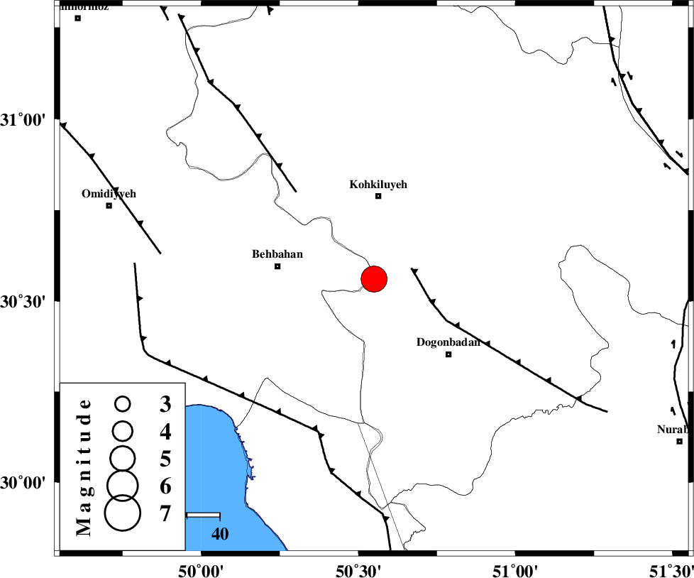
| Location | Lat:30.56 Lon: 50.55 |
| Region | Kohkiluieh va boyerahmad Province, 26 km South of Dehdasht |
Nearest Cities |
|
| 25 km East of Mansuriyeh, Khoozestan Province | |
| 25 km South of Dehdasht, Kohkiluieh va boyerahmad Province | |
| 30 km East of Behbahan, Khoozestan Province | |
| 32 km North West of Dogonbadan, Kohkiluieh va boyerahmad Province | |
| 39 km South East of Dodange-ye bozorg, Khoozestan Province | |
| Depth | 14 km |
| Agency | |
Faults within 150 km: |
|
| MISHAN_F (Length: 76 km) , Distance to epicenter: 12 km | |
| MFF4 (Length: 62 km) , Distance to epicenter: 36 km | |
| RAG_E_SEFID_F (Length: 84 km) , Distance to epicenter: 50 km | |
| Number of Phases | 10 |
| RMS | 0.1 |
| Number of Stations | 9 |
| Error in Latitude | >2.1 km |
| Error in Longitude | 3 km |
| Error in Depth | 4.8 km |
Download waveform in seisan format
to download seisan software Click here
to access information about IIEES stations Click here
Amplitude | ||||||||
| UID | Agency | Station | Component | Amplitude | Period | Arrival Time | Proccessing Time | Signal Clip |
| 94505 | IIEES | SHGR | N | 10491.7 | 0.72 | 2014-12-12 20:47:02 | 2014-12-12 09:17:00 | n |
| 94506 | IIEES | KRBR | N | 406.8 | 0.48 | 2014-12-12 20:48:09 | 2014-12-12 09:17:00 | n |
| 94507 | IIEES | CHBR | E | 192 | 0.48 | 2014-12-12 20:49:54 | 2014-12-12 09:17:00 | n |
Phase | ||||||||||||
| Agency | Station | Component | Phase Type | Phase Quality | First Motion | Observed Arrival Time | Time Residual | Loc. Flag | Input Weight | Distance | Azimuth | |
| IIEES | AHRM | Z | Pg | E | 2014-12-12 20:46:15 | -0.15 | y | 201 | 159 | |||
| IIEES | AHRM | E | Sg | E | 2014-12-12 20:46:39 | 0.15 | y | 201 | 159 | |||
| IIEES | SHGR | Z | Pn | E | 2014-12-12 20:46:19 | -0.13 | y | 239 | 316 | |||
| IIEES | SHGR | E | Sg | E | 2014-12-12 20:46:49 | 0 | y | 239 | 316 | |||
| IIEES | KHMZ | Z | Pn | E | 2014-12-12 20:46:34 | 0.12 | y | 357 | 351 | |||
| IIEES | YZKH | Z | Pn | E | 2014-12-12 20:46:44 | -0.04 | y | 434 | 61 | |||
| IIEES | GHVR | Z | Pn | E | 2014-12-12 20:46:44 | 0.08 | y | 440 | 8 | |||
| IIEES | ASAO | Z | Pn | E | 2014-12-12 20:46:45 | 0.14 | y | 445 | 354 | |||
| IIEES | KRBR | Z | Pn | E | 2014-12-12 20:47:04 | -0.09 | y | 601 | 95 | |||
| IIEES | TABS | Z | Pn | E | 2014-12-12 20:47:17 | -0.13 | y | 708 | 59 | |||