
Magnitude |
:2 |
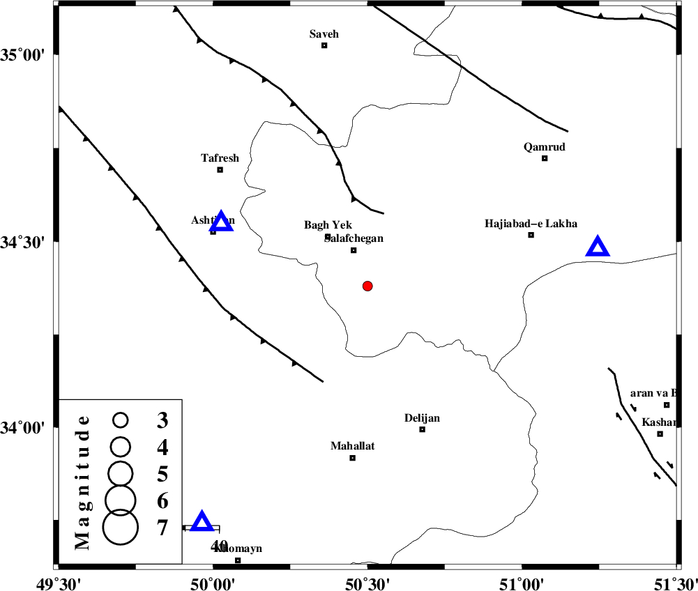
| Date & Time (UTC) | 2014-10-12 12:39:26.6 |
| Date & Time (Local) | 1393/7/20 16:09:26.6 |
| Location | Lat:34.38 Lon: 50.5 |
| Region | Qom Province, 52 km North of Mahallat |
Nearest Cities |
|
| 12 km of Salafchegan, Qom Province | |
| 19 km South East of Bagh yek, Qom Province | |
| 27 km North East of Salehabad, Markazi Province | |
| 28 km North of Dudhak, Markazi Province | |
| 30 km South East of Dastjerd, Qom Province | |
| Depth | 31 km |
| Agency | |
Faults within 150 km: |
|
| INDES_F (Length: 98 km) , Distance to epicenter: 22 km | |
| TAFRESH_F (Length: 117 km) , Distance to epicenter: 32 km | |
| KUSHK_E_NOSRAT_F (Length: 230 km) , Distance to epicenter: 70 km | |
| Number of Phases | 6 |
| RMS | 0.1 |
| Number of Stations | 5 |
| Error in Latitude | >2.1 km |
| Error in Longitude | 2.1 km |
| Error in Depth | 2.5 km |
Download waveform in seisan format
to download seisan software Click here
to access information about IIEES stations Click here
Amplitude | ||||||||
| UID | Agency | Station | Component | Amplitude | Period | Arrival Time | Proccessing Time | Signal Clip |
| 93869 | IIEES | DAMV | E | 15.6 | 0.24 | 2014-10-12 12:40:26 | 2014-10-13 04:21:00 | n |
Phase | ||||||||||||
| Agency | Station | Component | Phase Type | Phase Quality | First Motion | Observed Arrival Time | Time Residual | Loc. Flag | Input Weight | Distance | Azimuth | |
| IIEES | ASAO | Z | Pg | E | 2014-10-12 12:39:36 | 0.04 | y | 47.1 | 293 | |||
| IIEES | GHVR | Z | Pg | E | 2014-10-12 12:39:39 | -0.04 | y | 69.6 | 81 | |||
| IIEES | KHMZ | Z | Pg | E | 2014-10-12 12:39:41 | -0.02 | y | 86.6 | 215 | |||
| IIEES | CHTH | Z | Pn | E | 2014-10-12 12:39:55 | -0.16 | y | 179 | 19 | |||
| IIEES | DAMV | Z | Pn | E | 2014-10-12 12:39:57 | 0.17 | y | 193 | 44 | |||
| IIEES | DAMV | E | Sg | E | 2014-10-12 12:40:20 | 0 | y | 193 | 44 | |||