
Magnitude |
:3.1 |
| Date & Time (UTC) | 2014-10-11 21:38:49.0 |
| Date & Time (Local) | 1393/7/20 01:08:49.0 |
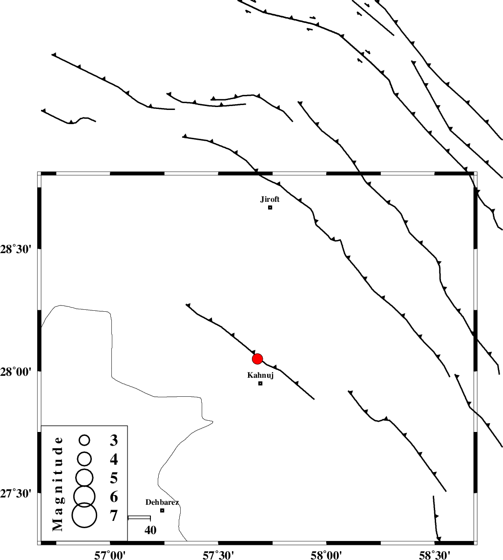
| Location | Lat:28.05 Lon: 57.68 |
| Region | Kerman Province, 12 km North of Kahnuj |
Nearest Cities |
|
| 11 km North of Kahnuj, Kerman Province | |
| 22 km South East of Bolock, Kerman Province | |
| 27 km East of Mehrueye-e paeen, Kerman Province | |
| 39 km South East of Hurpasefid, Kerman Province | |
| 40 km East of Faryab, Kerman Province | |
| Depth | 14 km |
| Agency | |
Faults within 150 km: |
|
| SABZEVARAN_F (Length: 190 km) , Distance to epicenter: 2 km | |
| JIROFT_F (Length: 144 km) , Distance to epicenter: 9 km | |
| MAIN_ZAGROS_R_F (Length: 1106 km) , Distance to epicenter: 80 km | |
| Number of Phases | 6 |
| RMS | 0.2 |
| Number of Stations | 4 |
| Error in Latitude | >2.1 km |
| Error in Longitude | 4.3 km |
| Error in Depth | 7.7 km |
Download waveform in seisan format
to download seisan software Click here
to access information about IIEES stations Click here
Amplitude | ||||||||
| UID | Agency | Station | Component | Amplitude | Period | Arrival Time | Proccessing Time | Signal Clip |
| 93853 | IIEES | BNDS | E | 287.3 | 0.28 | 2014-10-11 21:39:38 | 2014-10-12 07:32:00 | n |
| 93854 | IIEES | BNDS | N | 218.2 | 0.55 | 2014-10-11 21:39:38 | 2014-10-12 07:32:00 | n |
Phase | ||||||||||||
| Agency | Station | Component | Phase Type | Phase Quality | First Motion | Observed Arrival Time | Time Residual | Loc. Flag | Input Weight | Distance | Azimuth | |
| IIEES | BNDS | Z | Pg | E | 2014-10-11 21:39:16 | -0.34 | y | 166 | 244 | |||
| IIEES | BNDS | E | Sg | E | 2014-10-11 21:39:36 | 0.26 | y | 166 | 244 | |||
| IIEES | KRBR | Z | Pn | E | 2014-10-11 21:39:25 | -0.09 | y | 232 | 337 | |||
| IIEES | KRBR | N | Sg | E | 2014-10-11 21:39:54 | 0.02 | y | 232 | 337 | |||
| IIEES | ZHSF | Z | Pn | E | 2014-10-11 21:39:40 | 0.1 | y | 348 | 60 | |||
| IIEES | YZKH | Z | Pn | E | 2014-10-11 21:40:07 | 0.11 | y | 565 | 329 | |||