
Magnitude |
:3 |
| Date & Time (UTC) | 2014-09-19 17:31:32.2 |
| Date & Time (Local) | 1393/6/28 22:01:32.2 |
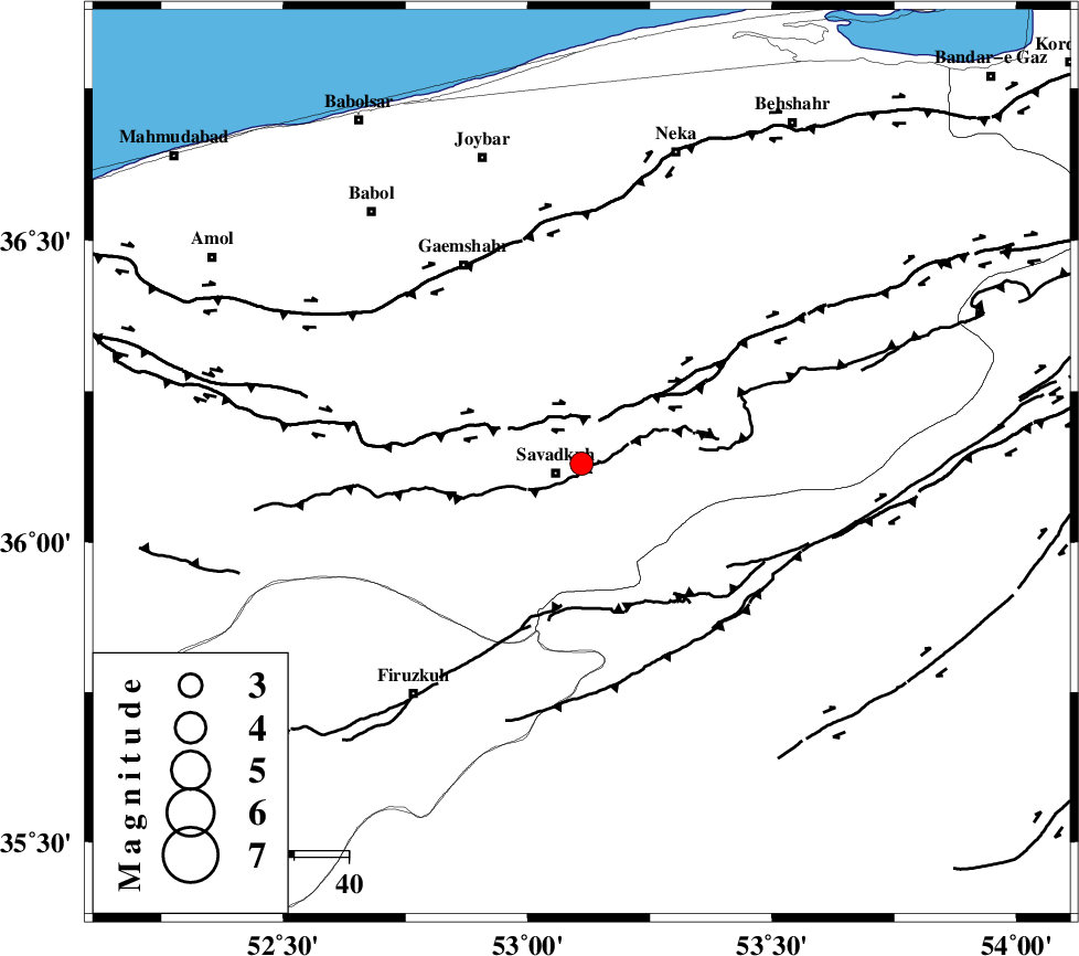
| Location | Lat:36.13 Lon: 53.11 |
| Region | Mazandaran Province, 5 km Pol-E-Sefid |
Nearest Cities |
|
| 5 km North of Pol-E-Sefid, Mazandaran Province | |
| 7 km North of Shurmast-e peyrudbar, Mazandaran Province | |
| 13 km North West of Sangdeh, Mazandaran Province | |
| 13 km North East of Elahband, Mazandaran Province | |
| 13 km East of Zirab, Mazandaran Province | |
| Depth | 14 km |
| Agency | |
Faults within 150 km: |
|
| N_ALBORZ_F (Length: 360 km) , Distance to epicenter: 8 km | |
| KHAZAR_F (Length: 523 km) , Distance to epicenter: 39 km | |
| ATARI_F (Length: 185 km) , Distance to epicenter: 48 km | |
| Number of Phases | 7 |
| RMS | 0.2 |
| Number of Stations | 5 |
| Error in Latitude | >4.7 km |
| Error in Longitude | 8.1 km |
| Error in Depth | 7.7 km |
Download waveform in seisan format
to download seisan software Click here
to access information about IIEES stations Click here
Amplitude | ||||||||
| UID | Agency | Station | Component | Amplitude | Period | Arrival Time | Proccessing Time | Signal Clip |
| 93641 | IIEES | THKV | N | 127.4 | 0.6 | 2014-09-19 17:32:39 | 2014-09-19 05:59:00 | n |
Phase | ||||||||||||
| Agency | Station | Component | Phase Type | Phase Quality | First Motion | Observed Arrival Time | Time Residual | Loc. Flag | Input Weight | Distance | Azimuth | |
| IIEES | DAMV | Z | Pg | E | 2014-09-19 17:31:51 | -0.36 | y | 117 | 242 | |||
| IIEES | DAMV | E | Sg | E | 2014-09-19 17:32:06 | 0.09 | y | 117 | 242 | |||
| IIEES | CHTH | Z | Pn | E | 2014-09-19 17:32:02 | -0.07 | y | 181 | 263 | |||
| IIEES | THKV | Z | Pn | E | 2014-09-19 17:32:05 | 0.21 | y | 203 | 264 | |||
| IIEES | GHVR | Z | Pn | E | 2014-09-19 17:32:11 | 0.15 | y | 250 | 223 | |||
| IIEES | GHVR | N | Sg | E | 2014-09-19 17:32:42 | 0.01 | y | 250 | 223 | |||
| IIEES | ASAO | Z | Pn | E | 2014-09-19 17:32:21 | -0.05 | y | 331 | 239 | |||