
Magnitude |
:3.6 |
| Date & Time (UTC) | 2014-09-15 21:08:32.6 |
| Date & Time (Local) | 1393/6/25 01:38:32.6 |
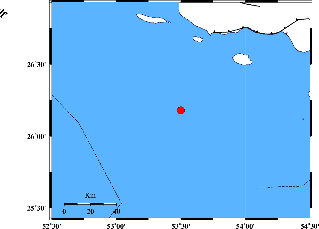
| Location | Lat:26.18 Lon: 53.5 |
| Region | Persian Gulf |
Nearest Cities |
|
| 112 km South West of Ahl, Fars Province | |
| 116 km South West of Ashkenan, Fars Province | |
| 121 km South West of Jenah, Hormozgan Province | |
| 132 km South East of Lamerd, Fars Province | |
| 139 km South of Beyram, Fars Province | |
| Depth | 14 km |
| Agency | |
Faults within 150 km: |
|
| ZFF1 (Length: 165 km) , Distance to epicenter: 65 km | |
| MFF3 (Length: 292 km) , Distance to epicenter: 94 km | |
| MFF1 (Length: 180 km) , Distance to epicenter: 113 km | |
| Number of Phases | 5 |
| RMS | 0.1 |
| Number of Stations | 3 |
| Error in Latitude | >6 km |
| Error in Longitude | 4 km |
| Error in Depth | 8.4 km |
Download waveform in seisan format
to download seisan software Click here
to access information about IIEES stations Click here
Amplitude | ||||||||
| UID | Agency | Station | Component | Amplitude | Period | Arrival Time | Proccessing Time | Signal Clip |
| 93598 | IIEES | AHRM | N | 149 | 0.79 | 2014-09-15 21:10:39 | 2014-09-16 08:24:00 | n |
Phase | ||||||||||||
| Agency | Station | Component | Phase Type | Phase Quality | First Motion | Observed Arrival Time | Time Residual | Loc. Flag | Input Weight | Distance | Azimuth | |
| IIEES | BNDS | Z | Pn | E | 2014-09-15 21:09:17 | -0.02 | y | 299 | 62 | |||
| IIEES | BNDS | N | Sn | 2014-09-15 21:09:50 | 0.12 | y | 299 | 62 | ||||
| IIEES | AHRM | Z | Pn | E | 2014-09-15 21:09:26 | 0.11 | y | 369 | 324 | |||
| IIEES | AHRM | N | Sg | E | 2014-09-15 21:10:15 | -0.01 | y | 369 | 324 | |||
| IIEES | KRBR | Z | Pn | E | 2014-09-15 21:09:46 | -0.29 | y | 530 | 36 | |||