
Magnitude |
:3.6 |
| Date & Time (UTC) | 2014-09-15 17:59:49.5 |
| Date & Time (Local) | 1393/6/24 22:29:49.5 |
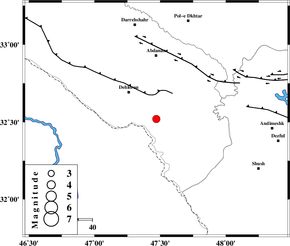
| Location | Lat:32.52 Lon: 47.47 |
| Region | Ilam Province, 28 km South-East of Dehloran |
Nearest Cities |
|
| 11 km East of Musian, Ilam Province | |
| 28 km South East of Dehloran, Ilam Province | |
| 43 km South of Sarabbagh, Ilam Province | |
| 46 km South of Abdanan, Ilam Province | |
| 57 km South East of Bishehzar, Ilam Province | |
| Depth | 18 km |
| Agency | |
Faults within 150 km: |
|
| MFF6 (Length: 144 km) , Distance to epicenter: 17 km | |
| BALARUD_F_Z1 (Length: 87 km) , Distance to epicenter: 47 km | |
| DEZFUL_EMBAYMENT (Length: 228 km) , Distance to epicenter: 65 km | |
| Number of Phases | 8 |
| RMS | 0.1 |
| Number of Stations | 7 |
| Error in Latitude | >2.8 km |
| Error in Longitude | 6.1 km |
| Error in Depth | 3.7 km |
Download waveform in seisan format
to download seisan software Click here
to access information about IIEES stations Click here
Amplitude | ||||||||
| UID | Agency | Station | Component | Amplitude | Period | Arrival Time | Proccessing Time | Signal Clip |
| 93588 | IIEES | SHGR | N | 1151.9 | 0.45 | 2014-09-15 18:00:32 | 2014-09-15 06:07:00 | n |
| 93589 | IIEES | AHRM | N | 47.2 | 0.58 | 2014-09-15 18:02:52 | 2014-09-15 06:07:00 | n |
Phase | ||||||||||||
| Agency | Station | Component | Phase Type | Phase Quality | First Motion | Observed Arrival Time | Time Residual | Loc. Flag | Input Weight | Distance | Azimuth | |
| IIEES | SHGR | Z | Pg | E | 2014-09-15 18:00:11 | 0.05 | y | 134 | 109 | |||
| IIEES | KHMZ | Z | Pn | E | 2014-09-15 18:00:30 | -0.23 | y | 270 | 59 | |||
| IIEES | SNGE | Z | Pn | E | 2014-09-15 18:00:32 | -0.18 | y | 286 | 358 | |||
| IIEES | SNGE | N | Sg | E | 2014-09-15 18:01:10 | 0.13 | y | 286 | 358 | |||
| IIEES | GHVR | Z | Pn | E | 2014-09-15 18:00:48 | 0.15 | y | 413 | 57 | |||
| IIEES | ZNJK | Z | Pn | E | 2014-09-15 18:00:56 | 0.11 | y | 474 | 13 | |||
| IIEES | CHTH | Z | Pn | E | 2014-09-15 18:00:59 | -0.09 | y | 505 | 41 | |||
| IIEES | AHRM | Z | Pn | E | 2014-09-15 18:01:04 | 0.13 | y | 546 | 137 | |||