
Magnitude |
:3.5 |
| Date & Time (UTC) | 2014-09-12 12:00:29.4 |
| Date & Time (Local) | 1393/6/21 16:30:29.4 |
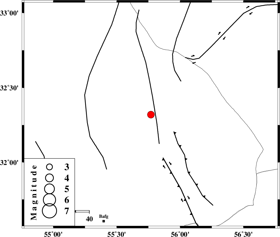
| Location | Lat:32.32 Lon: 55.77 |
| Region | Yazd Province, 87 km North-East of Bafq |
Nearest Cities |
|
| 56 km North West of Behabad, Yazd Province | |
| 65 km North of Kushk, Yazd Province | |
| 71 km North West of Benestan, Yazd Province | |
| 80 km South East of Robat-e posht-e badam, Yazd Province | |
| 84 km North East of Mobarake, Yazd Province | |
| Depth | 18 km |
| Agency | |
Faults within 150 km: |
|
| SARBALA_F (Length: 92 km) , Distance to epicenter: 8 km | |
| JAFARABAD_F (Length: 60 km) , Distance to epicenter: 21 km | |
| NAINI_F (Length: 342 km) , Distance to epicenter: 33 km | |
| Number of Phases | 6 |
| RMS | 0.1 |
| Number of Stations | 4 |
| Error in Latitude | >2.8 km |
| Error in Longitude | 2.2 km |
| Error in Depth | 5.7 km |
Download waveform in seisan format
to download seisan software Click here
to access information about IIEES stations Click here
Amplitude | ||||||||
| UID | Agency | Station | Component | Amplitude | Period | Arrival Time | Proccessing Time | Signal Clip |
| 93573 | IIEES | KRBR | E | 227.3 | 0.8 | 2014-09-12 12:01:53 | 2014-09-14 07:54:00 | n |
Phase | ||||||||||||
| Agency | Station | Component | Phase Type | Phase Quality | First Motion | Observed Arrival Time | Time Residual | Loc. Flag | Input Weight | Distance | Azimuth | |
| IIEES | YZKH | Z | Pg | E | 2014-09-12 12:00:48 | 0.17 | y | 111 | 274 | |||
| IIEES | YZKH | N | Sg | E | 2014-09-12 12:01:01 | -0.14 | y | 111 | 274 | |||
| IIEES | TABS | Z | Pn | E | 2014-09-12 12:01:00 | 0.05 | y | 194 | 40 | |||
| IIEES | TABS | N | Sg | E | 2014-09-12 12:01:24 | 0 | y | 194 | 40 | |||
| IIEES | KRBR | Z | Pn | E | 2014-09-12 12:01:11 | 0.05 | y | 276 | 160 | |||
| IIEES | BSRN | Z | Pn | E | 2014-09-12 12:01:16 | -0.14 | y | 319 | 96 | |||