
Magnitude |
:3.3 |
| Date & Time (UTC) | 2014-09-07 03:00:14.3 |
| Date & Time (Local) | 1393/6/16 07:30:14.3 |
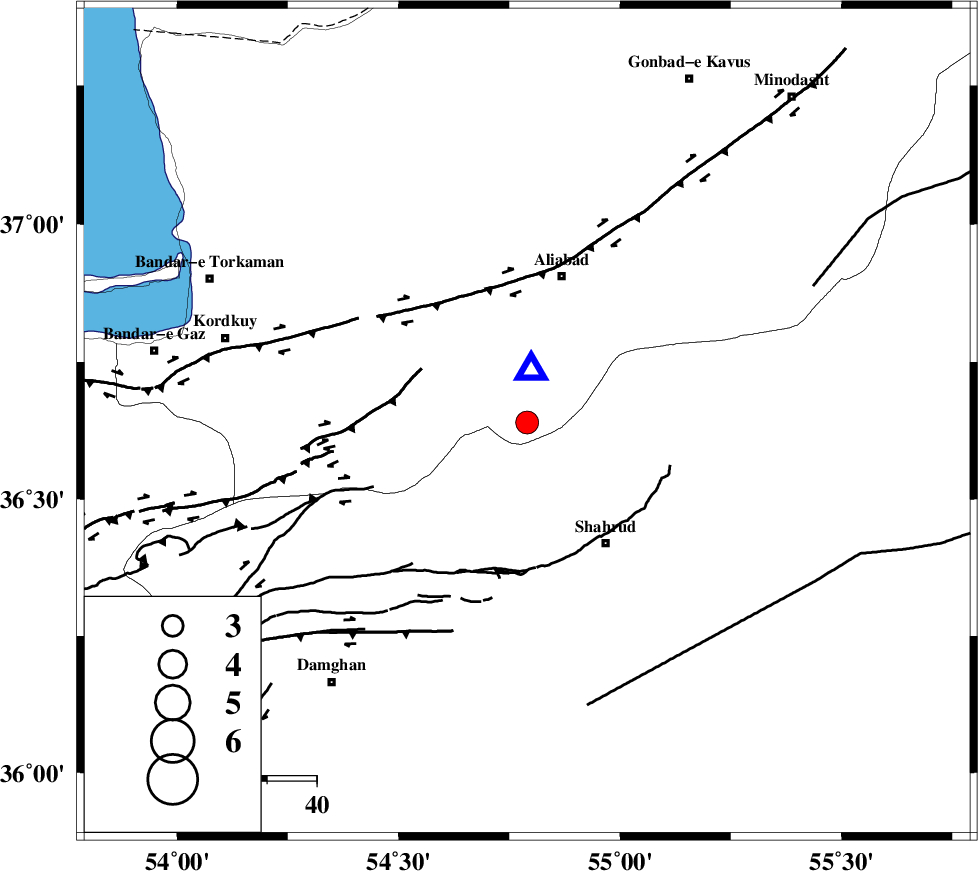
| Location | Lat:36.64 Lon: 54.79 |
| Region | Golestan Province, 31 km South of Ali Abad |
Nearest Cities |
|
| 22 km North East of Majen, Semnan Province | |
| 26 km North West of Bastam, Semnan Province | |
| 28 km North West of Qaleh-ye nokharqan, Semnan Province | |
| 29 km North West of Shahrud, Semnan Province | |
| 30 km South of Ali Abad, Golestan Province | |
| Depth | 18 km |
| Agency | |
Faults within 150 km: |
|
| SHAVAR_F (Length: 87 km) , Distance to epicenter: 10 km | |
| ASTANEH_F (Length: 72 km) , Distance to epicenter: 24 km | |
| KHAZAR_F (Length: 523 km) , Distance to epicenter: 35 km | |
| Number of Phases | 5 |
| RMS | 0 |
| Number of Stations | 4 |
| Error in Latitude | >7.9 km |
| Error in Longitude | 1.8 km |
| Error in Depth | 3.1 km |
Download waveform in seisan format
to download seisan software Click here
to access information about IIEES stations Click here
Amplitude | ||||||||
| UID | Agency | Station | Component | Amplitude | Period | Arrival Time | Proccessing Time | Signal Clip |
| 93524 | IIEES | SHRO | N | 640.6 | 0.4 | 2014-09-07 03:01:01 | 2014-09-07 09:08:00 | n |
Phase | ||||||||||||
| Agency | Station | Component | Phase Type | Phase Quality | First Motion | Observed Arrival Time | Time Residual | Loc. Flag | Input Weight | Distance | Azimuth | |
| IIEES | SHRO | E | Pg | E | 2014-09-07 03:00:36 | 0.04 | y | 130 | 122 | |||
| IIEES | CHTH | Z | Pn | E | 2014-09-07 03:01:03 | -0.02 | y | 339 | 257 | |||
| IIEES | CHTH | N | Sg | E | 2014-09-07 03:01:49 | 0.02 | y | 339 | 257 | |||
| IIEES | TABS | Z | Pn | E | 2014-09-07 03:01:10 | 0 | y | 394 | 147 | |||
| IIEES | BSRN | Z | Pn | E | 2014-09-07 03:01:42 | -0.07 | y | 654 | 141 | |||