
Magnitude |
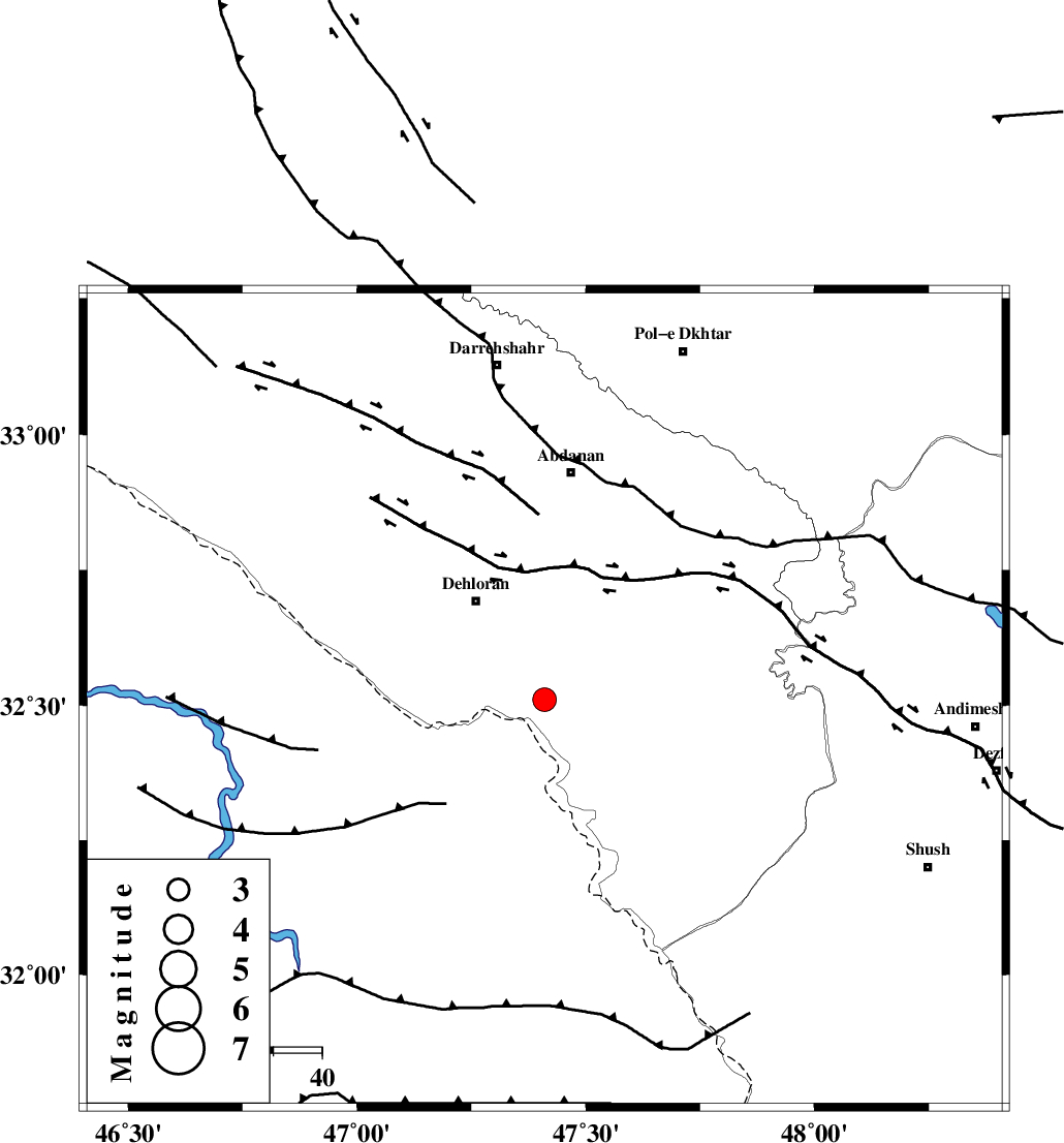
:3.3 |
| Date & Time (UTC) | 2014-08-27 05:33:00.9 |
| Date & Time (Local) | 1393/6/5 10:03:00.9 |
| Location | Lat:32.51 Lon: 47.41 |
| Region | Ilam Province, 24 km South-East of Dehloran |
Nearest Cities |
|
| 6 km of Musian, Ilam Province | |
| 25 km South East of Dehloran, Ilam Province | |
| 46 km South West of Sarabbagh, Ilam Province | |
| 47 km South of Abdanan, Ilam Province | |
| 54 km South East of Bishehzar, Ilam Province | |
| Depth | 14 km |
| Agency | |
Faults within 150 km: |
|
| MFF6 (Length: 144 km) , Distance to epicenter: 19 km | |
| BALARUD_F_Z1 (Length: 87 km) , Distance to epicenter: 51 km | |
| DEZFUL_EMBAYMENT (Length: 228 km) , Distance to epicenter: 71 km | |
| Number of Phases | 7 |
| RMS | 0.2 |
| Number of Stations | 4 |
| Error in Latitude | >2.7 km |
| Error in Longitude | 8.9 km |
| Error in Depth | 9.7 km |
Download waveform in seisan format
to download seisan software Click here
to access information about IIEES stations Click here
Amplitude | ||||||||
| UID | Agency | Station | Component | Amplitude | Period | Arrival Time | Proccessing Time | Signal Clip |
| 93338 | IIEES | SHGR | E | 454.9 | 0.66 | 2014-08-27 05:33:49 | 2014-08-27 10:24:00 | n |
| 93339 | IIEES | SHGR | N | 608.4 | 0.72 | 2014-08-27 05:33:50 | 2014-08-27 10:24:00 | n |
Phase | ||||||||||||
| Agency | Station | Component | Phase Type | Phase Quality | First Motion | Observed Arrival Time | Time Residual | Loc. Flag | Input Weight | Distance | Azimuth | |
| IIEES | SHGR | Z | Pg | E | 2014-08-27 05:33:23 | -0.27 | y | 139 | 108 | |||
| IIEES | SHGR | N | Sg | E | 2014-08-27 05:33:40 | 0.11 | y | 139 | 108 | |||
| IIEES | KHMZ | Z | Pn | E | 2014-08-27 05:33:43 | 0.29 | y | 275 | 60 | |||
| IIEES | ASAO | Z | Pn | E | 2014-08-27 05:33:49 | -0.31 | y | 332 | 46 | |||
| IIEES | ASAO | E | Sg | E | 2014-08-27 05:34:34 | -0.05 | y | 332 | 46 | |||
| IIEES | GHVR | Z | Pn | E | 2014-08-27 05:34:00 | 0.32 | y | 418 | 58 | |||
| IIEES | GHVR | N | Sg | E | 2014-08-27 05:34:57 | -0.05 | y | 418 | 58 | |||