
Magnitude |
:2.5 |
| Date & Time (UTC) | 2014-08-10 16:15:55.9 |
| Date & Time (Local) | 1393/5/19 20:45:55.9 |
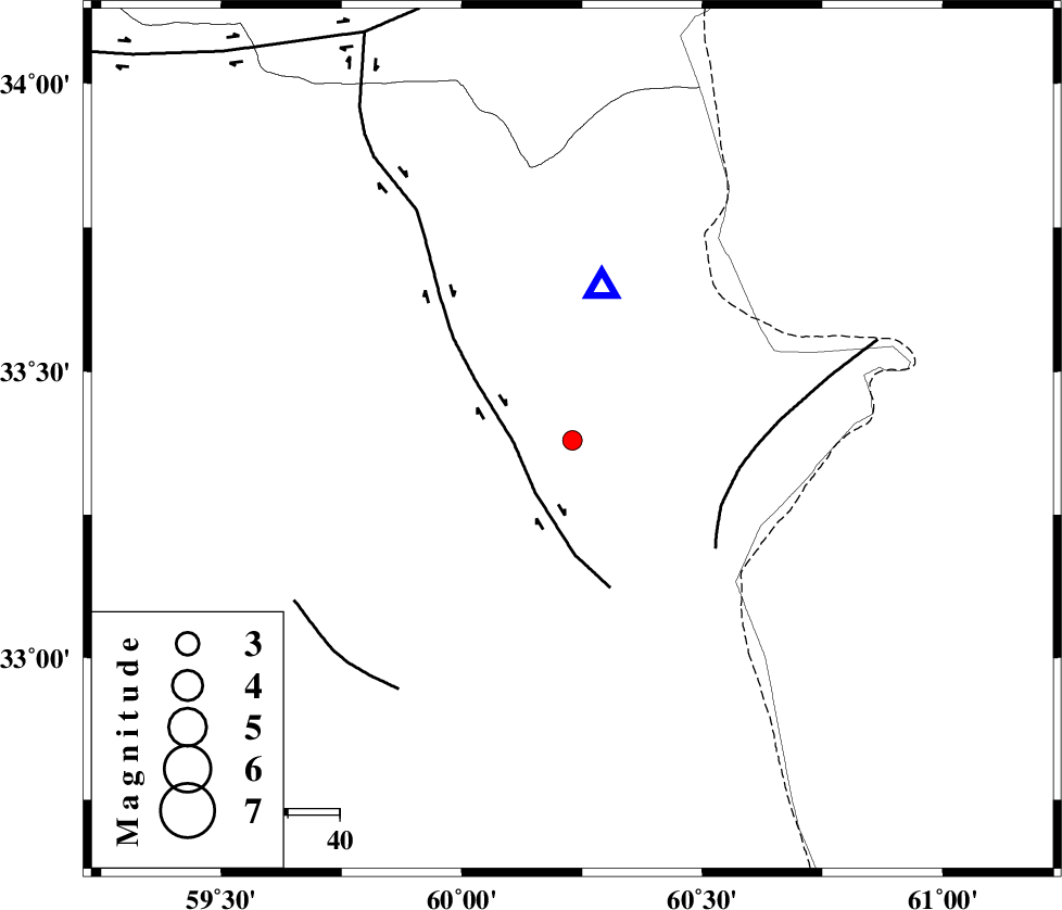
| Location | Lat:33.38 Lon: 60.23 |
| Region | Khorasan(south) Province, 94 km North-East of Sarbisheh |
Nearest Cities |
|
| 30 km South of Shahdokht, Khorasan(south) Province | |
| 38 km South East of Hajiabad, Khorasan(south) Province | |
| 41 km East of Zahan, Khorasan(south) Province | |
| 43 km South East of Abiz, Khorasan(south) Province | |
| 43 km North of Gazik, Khorasan(south) Province | |
| Depth | 16 km |
| Agency | |
Faults within 150 km: |
|
| ABRIZ_F (Length: 114 km) , Distance to epicenter: 11 km | |
| PATARGAN_F (Length: 52 km) , Distance to epicenter: 31 km | |
| NOZAD_F (Length: 27 km) , Distance to epicenter: 59 km | |
| Number of Phases | 5 |
| RMS | 0 |
| Number of Stations | 3 |
| Error in Latitude | >1.8 km |
| Error in Longitude | 5.3 km |
| Error in Depth | 2.6 km |
Download waveform in seisan format
to download seisan software Click here
to access information about IIEES stations Click here
Amplitude | ||||||||
| UID | Agency | Station | Component | Amplitude | Period | Arrival Time | Proccessing Time | Signal Clip |
| 92925 | IIEES | SHRT | N | 636.7 | 0.16 | 2014-08-10 16:16:08 | 2014-08-10 05:36:00 | n |
| 92926 | IIEES | SHRT | E | 695.4 | 0.4 | 2014-08-10 16:16:11 | 2014-08-10 05:36:00 | n |
Phase | ||||||||||||
| Agency | Station | Component | Phase Type | Phase Quality | First Motion | Observed Arrival Time | Time Residual | Loc. Flag | Input Weight | Distance | Azimuth | |
| IIEES | SHRT | Z | Pg | E | 2014-08-10 16:16:01 | -0.05 | y | 29.5 | 10 | |||
| IIEES | SHRT | E | Sg | E | 2014-08-10 16:16:06 | 0.04 | y | 29.5 | 10 | |||
| IIEES | BSRN | Z | Pn | E | 2014-08-10 16:16:26 | 0.02 | y | 189 | 214 | |||
| IIEES | BSRN | E | Sg | E | 2014-08-10 16:16:49 | 0 | y | 189 | 214 | |||
| IIEES | TABS | Z | Pn | E | 2014-08-10 16:16:39 | -0.01 | y | 291 | 277 | |||