
Magnitude |
:2.8 |
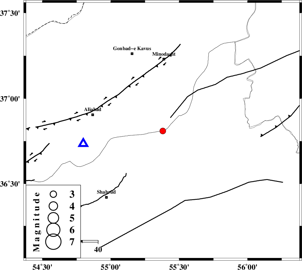
| Date & Time (UTC) | 2014-08-03 11:48:25.5 |
| Date & Time (Local) | 1393/5/12 16:18:25.5 |
| Location | Lat:36.81 Lon: 55.38 |
| Region | Golestan Province, 46 km South of Minodasht |
Nearest Cities |
|
| 16 km South of Farsian, Golestan Province | |
| 17 km North of Kalateh khanj, Semnan Province | |
| 28 km South West of Qale-ye qafeh, Golestan Province | |
| 30 km South West of Qaleh qafeh, Semnan Province | |
| 31 km South East of Ramian, Golestan Province | |
| Depth | 16 km |
| Agency | |
Faults within 150 km: |
|
| ROBATE_QARABIL_F (Length: 168 km) , Distance to epicenter: 10 km | |
| SHAVAR_F (Length: 87 km) , Distance to epicenter: 16 km | |
| KHAZAR_F (Length: 523 km) , Distance to epicenter: 43 km | |
| Number of Phases | 7 |
| RMS | 0.1 |
| Number of Stations | 5 |
| Error in Latitude | >1.4 km |
| Error in Longitude | 2.2 km |
| Error in Depth | 4.2 km |
Download waveform in seisan format
to download seisan software Click here
to access information about IIEES stations Click here
Amplitude | ||||||||
| UID | Agency | Station | Component | Amplitude | Period | Arrival Time | Proccessing Time | Signal Clip |
| 92900 | IIEES | BJRD | N | 80.1 | 0.68 | 2014-08-03 11:49:28 | 2014-08-03 08:46:00 | n |
Phase | ||||||||||||
| Agency | Station | Component | Phase Type | Phase Quality | First Motion | Observed Arrival Time | Time Residual | Loc. Flag | Input Weight | Distance | Azimuth | |
| IIEES | SHRO | E | Pg | E | 2014-08-03 11:48:43 | 0.06 | y | 106 | 147 | |||
| IIEES | SHRO | E | Sg | E | 2014-08-03 11:48:56 | 0.02 | y | 106 | 147 | |||
| IIEES | BJRD | Z | Pn | E | 2014-08-03 11:48:58 | 0.14 | y | 206 | 61 | |||
| IIEES | BJRD | N | Sg | E | 2014-08-03 11:49:23 | -0.08 | y | 206 | 61 | |||
| IIEES | DAMV | Z | Pn | E | 2014-08-03 11:49:14 | 0.02 | y | 333 | 248 | |||
| IIEES | TABS | Z | Pn | E | 2014-08-03 11:49:20 | -0.15 | y | 385 | 155 | |||
| IIEES | CHTH | Z | Pn | E | 2014-08-03 11:49:22 | -0.05 | y | 394 | 257 | |||